A REPORT ON ARCHAEOLOGICAL PHASE 2 MITIGATION OF …
37
1 Archaetnos Culture & Cultural Resource Consultants BK 98 09854/23 A REPORT ON ARCHAEOLOGICAL PHASE 2 MITIGATION OF AN EARLY FARMER SITE TO BE IMPACTED ON BY THE DEVELOPMENT OF THE ZANDSPRUIT ECO ESTATE ON THE FARM HAPPYLAND 241 KT HOEDSPRUIT, LIMPOPO PROVINCE For: ZANDSPRUIT ESTATES P.O.BOX 447 HOEDSPRUIT 1380 REPORT: AE832 Work conducted: July 2008 Date of report: November 2008 WONDERBOOMPOORT 0033 Tel: 083 291 6104/083 459 3091/082 375 3321 Fax: 086 520 0376 Email: [email protected] Members: AC van Vollenhoven BA, BA (Hons), DTO, NDM, MA (Archaeology) [UP], MA (Culture History) [US], DPhil (Archaeology) [UP] AJ Pelser BA (UNISA), BA (Hons) (Archaeology) [WITS], MA (Archaeology) [WITS] FE Teichert BA, BA (Hons) (Archaeology) [UP]
Transcript of A REPORT ON ARCHAEOLOGICAL PHASE 2 MITIGATION OF …
1
Archaetnos Culture & Cultural
Resource Consultants
BK 98 09854/23
A REPORT ON ARCHAEOLOGICAL PHASE 2 MITIGATION OF AN
EARLY FARMER SITE TO BE IMPACTED ON BY THE DEVELOPMENT
OF THE ZANDSPRUIT ECO ESTATE ON THE FARM HAPPYLAND 241 KT
HOEDSPRUIT, LIMPOPO PROVINCE
For:
ZANDSPRUIT ESTATES
P.O.BOX 447
HOEDSPRUIT
1380
REPORT: AE832
Work conducted: July 2008 Date of report: November 2008
WONDERBOOMPOORT
0033
Tel: 083 291 6104/083 459 3091/082 375 3321
Fax: 086 520 0376
Email: [email protected]
Members: AC van Vollenhoven BA, BA (Hons), DTO, NDM, MA (Archaeology) [UP], MA (Culture
History) [US], DPhil (Archaeology) [UP]
AJ Pelser BA (UNISA), BA (Hons) (Archaeology) [WITS], MA (Archaeology) [WITS]
FE Teichert BA, BA (Hons) (Archaeology) [UP]
2
Archaetnos cc was requested by Zandspruit Eco-Estates to carry out the 2nd
Phase
archaeological mitigation of an Early Farmer site located on the farm Happyland 241
KT near Hoedspruit. This work was the result of recommendations put forward in a
Phase 1 Heritage Impact Assessment conducted by Archaeo-Info Northern Province
(AINP) during 2007. Based on the findings reported in their document, it was
recommended that the development can continue on condition that mitigation
measures are implemented. These measures included archaeological excavations and
the mapping and drawing of the site and excavations. SAHRA supported these
recommendations in their Review Comment in March 2008. Initial identification of
the site as belonging to the Eiland/Letaba facies of the Iron Age was based on scatters
of decorated pottery found on the site.
After a permit was obtained from SAHRA, archaeological investigations at the site
commenced during July 2008 for a two week period. Four excavations were
conducted on selected areas on the site, while mapping and drawing was also
conducted. A more detailed survey of the site and area was also undertaken,
identifying and recording more features and scatters of cultural material. A large
amount of cultural material, including pottery, faunal remains and shell was recovered
during this work. The remains of at least three humans were also uncovered in the
process. The largest portion of the pottery (decorated) sample indicated that the site
belongs in the main to the Doornkop facies of the Early Iron Age, although some
Mzonjani facies pottery was also recovered.
We believe that the work conducted, and the data retrieved through it, during July
2008 was adequate enough to enable us to make the necessary deductions and
reconstructions. Therefore it is recommended that the development can continue,
although certain conditions are put forward in the final conclusions and
recommendations.
SUMMARY
3
CONTENTS
SUMMARY
CONTENTS
INTRODUCTION
AIMS
LEGAL REQUIREMENTS
METHODOLOGY
DESCRIPTION OF THE AREA & SITE
DISCUSSIONS
Excavation 1
Excavation 2
Excavation 3
Excavation 4
Cultural Material
Ceramics (Pottery)
Ceramics (other)
Faunal Remains & Shell
Bone tools
Shell artifacts & other utilized shell
Stone objects and stone beads
Miscellaneous artifacts
Human Remains
CONCLUSIONS AND RECOMMENDATIONS
REFERENCES
PROJECT TEAM
APPENDIX 1 – SITE LOCATION AND DISTRIBUTION OF SITE FEATURES
APPENDIX 2 – MAPPING & DRAWING
APPENDIX 3 – EXPERT REPORTS
4
A REPORT ON ARCHAEOLOGICAL PHASE 2 MITIGATION OF AN EARLY
FARMER SITE TO BE IMPACTED ON BY THE DEVELOPMENT OF THE
ZANDSPRUIT ECO ESTATE ON THE FARM HAPPYLAND 241 KT HOEDSPRUIT,
LIMPOPO PROVINCE
INTRODUCTION
Archaetnos cc was requested by Zandspruit Eco-Estates to carry out the 2nd
Phase
archaeological mitigation of an Early Farmer site located on the farm Happyland 241 KT near
Hoedspruit. This work was the result of recommendations put forward in a Phase 1 Heritage
Impact Assessment conducted by Archaeo-Info Northern Province (AINP) during 2007.
Based on the findings reported in their document, it was recommended that the development
can continue on condition that mitigation measures are implemented. These measures
included archaeological excavations and the mapping and drawing of the site and
excavations. SAHRA supported these recommendations in their Review Comment in March
2008. Initial identification of the site as an Eiland/Letaba Industry Early Iron Age site was
based on scatters of decorated pottery found on the site.
After a permit was obtained from SAHRA, archaeological investigations at the site
commenced during July 2008 for a two week period. Four excavations were conducted on
selected areas on the site, while mapping and drawing was also conducted. A more detailed
survey of the site and area was also undertaken, identifying and recording more features and
scatters of cultural material. A large amount of cultural material, including pottery, faunal
remains and shell was recovered during this work. The remains of three humans were also
uncovered in the process.
AIMS
The aims of the archaeological investigation of Site ZEE 01 were the following:
(a) to determine the depth and extent of the archaeological deposit
(b) to determine the furthest extent of the occupied area through the surveying of surface
deposits and features
(c) to determine possible cultural affiliation, occupational time-frame, settlement
organization and domestic economy
(d) the excavations of features and the documentation of cultural material and features
(e) the proper curation of the material in a local institution. In this case the Lydenburg
Museum was identified and will be responsible for the curation of the archaeological
sample
We were informed by the client about the extent of the area that will be affected by the
proposed development. The work was confined to this area.
5
LEGISLATIVE REQUIREMENTS
Aspects concerning the conservation of cultural resources are mainly dealt with in two acts.
These are the South African Heritage Resources Act (Act 25 of 1999) and the Environmental
Conservation Act (Act 73 of 1989).
South African Heritage Resources Act
Archaeology, palaeontology and meteorites
Section 35(4) of this act states that no person may, without a permit issued by the responsible
heritage resources authority:
(a) destroy, damage, excavate, alter, deface or otherwise disturb any
archaeological or palaeontological site or any meteorite;
(b) destroy, damage, excavate, remove from its original position, collect or own
any archaeological or palaeontological material or object or any meteorite;
(c) trade in, sell for private gain, export or attempt to export from the Republic
any category of archaeological or palaeontological material or object, or any
meteorite; or
(d) bring onto or use at an archaeological or palaeontological site any excavation
equipment or any equipment which assists in the detection or recovery of
metals or archaeological and palaeontological material or objects, or use such
equipment for the recovery of meteorites.
(e) alter or demolish any structure or part of a structure which is older than 60
years as protected.
The above mentioned may only be disturbed or moved by an archaeologist, after receiving a
permit from the South African Heritage Resources Agency.
The National Environmental Management Act
This act states that a survey and evaluation of cultural resources must be done in areas where
development projects, that will change the face of the environment, will be undertaken. The
impact of the development on these resources should be determined and proposals for the
mitigation thereof are made.
METHODOLOGY
Documentation
The documentation comprised the following:
Archaeological Excavations
The archaeological excavations comprised four excavation squares in predetermined areas on
the site. Combined, approximately 65 square meters of the site was excavated.
6
Photographic - Photo’s of all excavations and features were taken, while individual objects
were also photographed for record purposes.
GPS Data - A GPS reading for the site, as well as individual features and excavations, was
taken in order to locate it on a map of the area.
Mapping & Drawing
The fieldwork also included physical mapping of the excavations and features with a
theodolite, as well as the producing of detailed excavation drawings where deemed necessary.
The site and larger area was also surveyed, and all surface features, surface scatters of
cultural material and other indications of occupation was GPS’ed and located on a Google
Image of the site.
Analysis & Documentation/Curation of cultural material
This normally includes the cleaning and sorting of all material recovered during the
excavations, as well as the expert analysis of ceramics, faunal remains and other material
cultural remains. The final curation of the material will be handled by a recognized cultural
institution, in this case the Lydenburg Museum in Lydenburg.
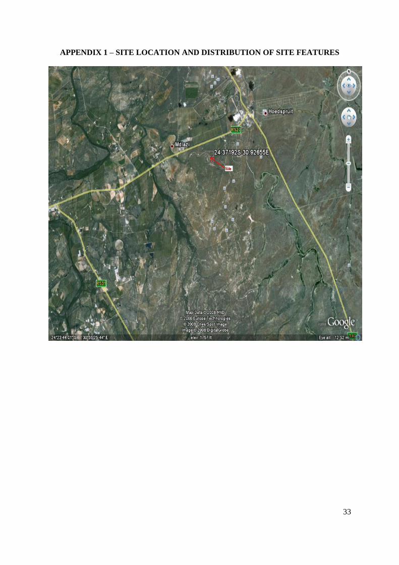
DESCRIPTION OF THE AREA AND SITE
The proposed Eco-Estate development site is located on the farm Happyland 241 KT, in the
Mopani District Municipality of the Limpopo Province. The closest town, Hoedspruit, is
situated approximately 1km from the site, while the site is located on the eastern side of the
R527 (See Appendix I). The establishment of a residential, commercial and retail
development with associated infrastructure, to be referred to as the Zandspruit Estates, is
proposed.
The development area encompasses around 948 ha. Its southern boundary is demarcated by
the Sandspruit River. The whole farm is situated on an alluvial plain with sandy soil
predominant. The topography of the area is flat, sloping gently down towards the river on the
southern side.
Site ZEE001 is located on the eastern side of an existing landing strip along the middle of the
runway (this landing strip will also be upgraded as part of the whole development). However,
after more careful surveying of the area it is clear that the archaeological site is located on
both sides of the landing strip and along the horseshoe bend of the river, covering a far more
substantial area than initially thought. The site is poorly defined on the surface and only the
occurrence of ashy concentrations as well as numerous pottery scatters and upper and lower
grinders indicate the presence of the site.
7
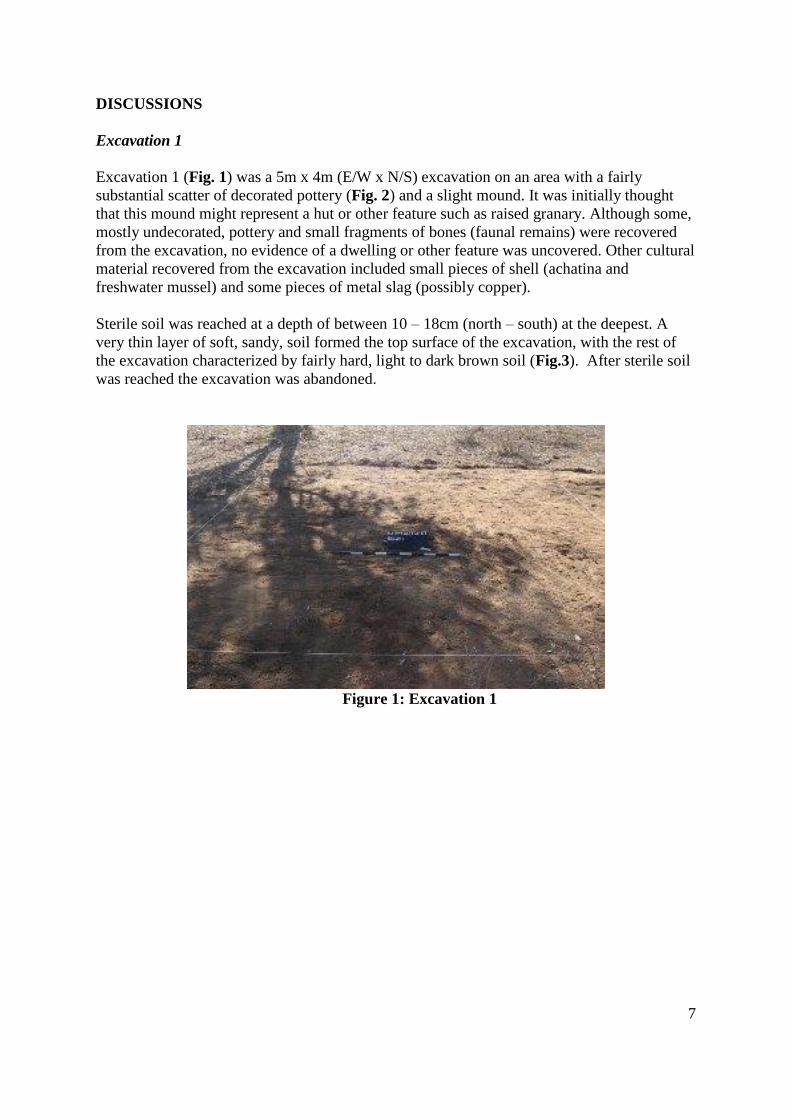
DISCUSSIONS
Excavation 1
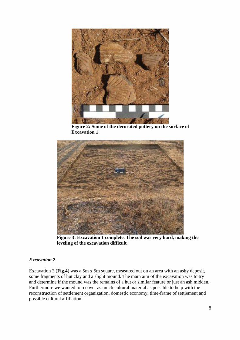
Excavation 1 (Fig. 1) was a 5m x 4m (E/W x N/S) excavation on an area with a fairly
substantial scatter of decorated pottery (Fig. 2) and a slight mound. It was initially thought
that this mound might represent a hut or other feature such as raised granary. Although some,
mostly undecorated, pottery and small fragments of bones (faunal remains) were recovered
from the excavation, no evidence of a dwelling or other feature was uncovered. Other cultural
material recovered from the excavation included small pieces of shell (achatina and
freshwater mussel) and some pieces of metal slag (possibly copper).
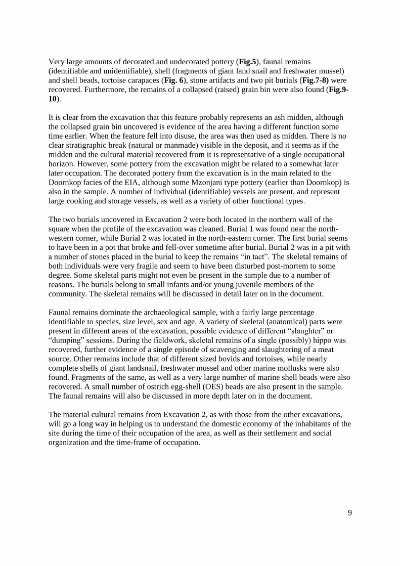
Sterile soil was reached at a depth of between 10 – 18cm (north – south) at the deepest. A
very thin layer of soft, sandy, soil formed the top surface of the excavation, with the rest of
the excavation characterized by fairly hard, light to dark brown soil (Fig.3). After sterile soil
was reached the excavation was abandoned.
Figure 1: Excavation 1
8
Figure 2: Some of the decorated pottery on the surface of
Excavation 1
Figure 3: Excavation 1 complete. The soil was very hard, making the
leveling of the excavation difficult
Excavation 2
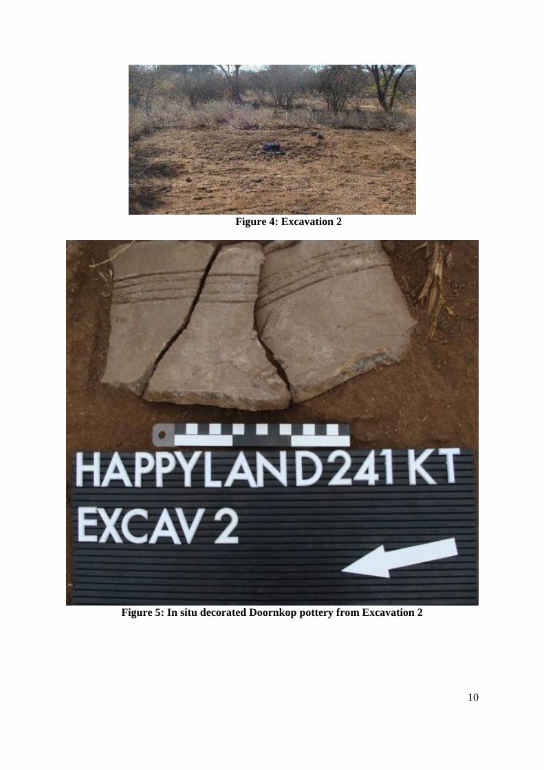
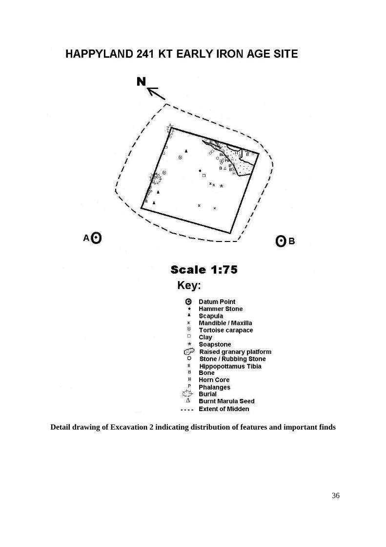
Excavation 2 (Fig.4) was a 5m x 5m square, measured out on an area with an ashy deposit,
some fragments of hut clay and a slight mound. The main aim of the excavation was to try
and determine if the mound was the remains of a hut or similar feature or just an ash midden.
Furthermore we wanted to recover as much cultural material as possible to help with the
reconstruction of settlement organization, domestic economy, time-frame of settlement and
possible cultural affiliation.
9
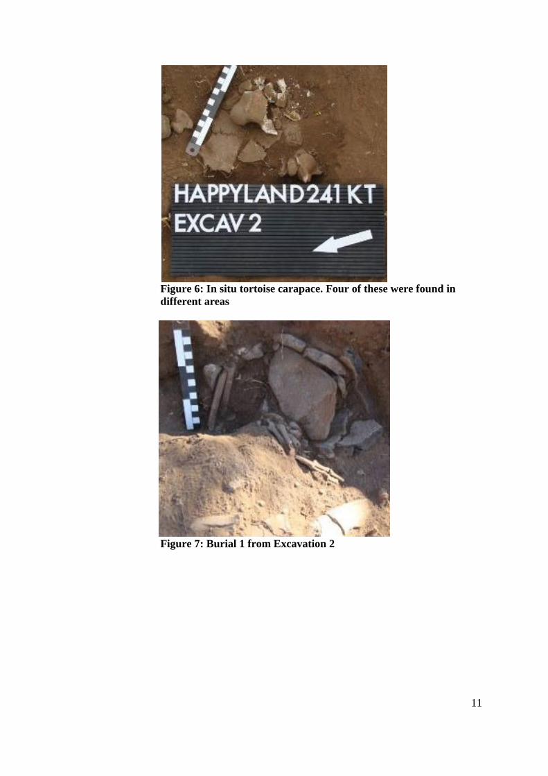
Very large amounts of decorated and undecorated pottery (Fig.5), faunal remains
(identifiable and unidentifiable), shell (fragments of giant land snail and freshwater mussel)
and shell beads, tortoise carapaces (Fig. 6), stone artifacts and two pit burials (Fig.7-8) were
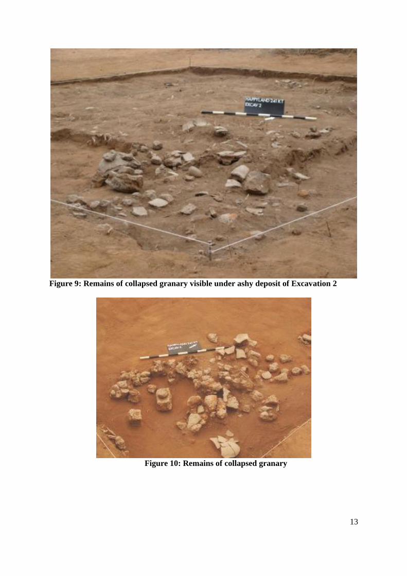
recovered. Furthermore, the remains of a collapsed (raised) grain bin were also found (Fig.9-
10).
It is clear from the excavation that this feature probably represents an ash midden, although
the collapsed grain bin uncovered is evidence of the area having a different function some
time earlier. When the feature fell into disuse, the area was then used as midden. There is no
clear stratigraphic break (natural or manmade) visible in the deposit, and it seems as if the
midden and the cultural material recovered from it is representative of a single occupational
horizon. However, some pottery from the excavation might be related to a somewhat later
later occupation. The decorated pottery from the excavation is in the main related to the
Doornkop facies of the EIA, although some Mzonjani type pottery (earlier than Doornkop) is
also in the sample. A number of individual (identifiable) vessels are present, and represent
large cooking and storage vessels, as well as a variety of other functional types.
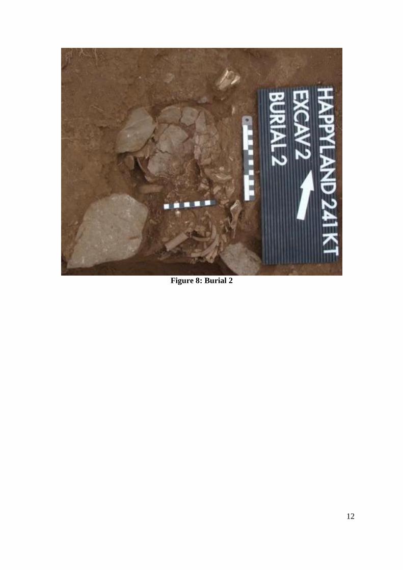
The two burials uncovered in Excavation 2 were both located in the northern wall of the
square when the profile of the excavation was cleaned. Burial 1 was found near the north-
western corner, while Burial 2 was located in the north-eastern corner. The first burial seems
to have been in a pot that broke and fell-over sometime after burial. Burial 2 was in a pit with
a number of stones placed in the burial to keep the remains “in tact”. The skeletal remains of
both individuals were very fragile and seem to have been disturbed post-mortem to some
degree. Some skeletal parts might not even be present in the sample due to a number of
reasons. The burials belong to small infants and/or young juvenile members of the
community. The skeletal remains will be discussed in detail later on in the document.
Faunal remains dominate the archaeological sample, with a fairly large percentage
identifiable to species, size level, sex and age. A variety of skeletal (anatomical) parts were
present in different areas of the excavation, possible evidence of different “slaughter” or
“dumping” sessions. During the fieldwork, skeletal remains of a single (possibly) hippo was
recovered, further evidence of a single episode of scavenging and slaughtering of a meat
source. Other remains include that of different sized bovids and tortoises, while nearly
complete shells of giant landsnail, freshwater mussel and other marine mollusks were also
found. Fragments of the same, as well as a very large number of marine shell beads were also
recovered. A small number of ostrich egg-shell (OES) beads are also present in the sample.
The faunal remains will also be discussed in more depth later on in the document.
The material cultural remains from Excavation 2, as with those from the other excavations,
will go a long way in helping us to understand the domestic economy of the inhabitants of the
site during the time of their occupation of the area, as well as their settlement and social
organization and the time-frame of occupation.
10
Figure 4: Excavation 2
Figure 5: In situ decorated Doornkop pottery from Excavation 2
11
Figure 6: In situ tortoise carapace. Four of these were found in
different areas
Figure 7: Burial 1 from Excavation 2
12
Figure 8: Burial 2
13
Figure 9: Remains of collapsed granary visible under ashy deposit of Excavation 2
Figure 10: Remains of collapsed granary
14
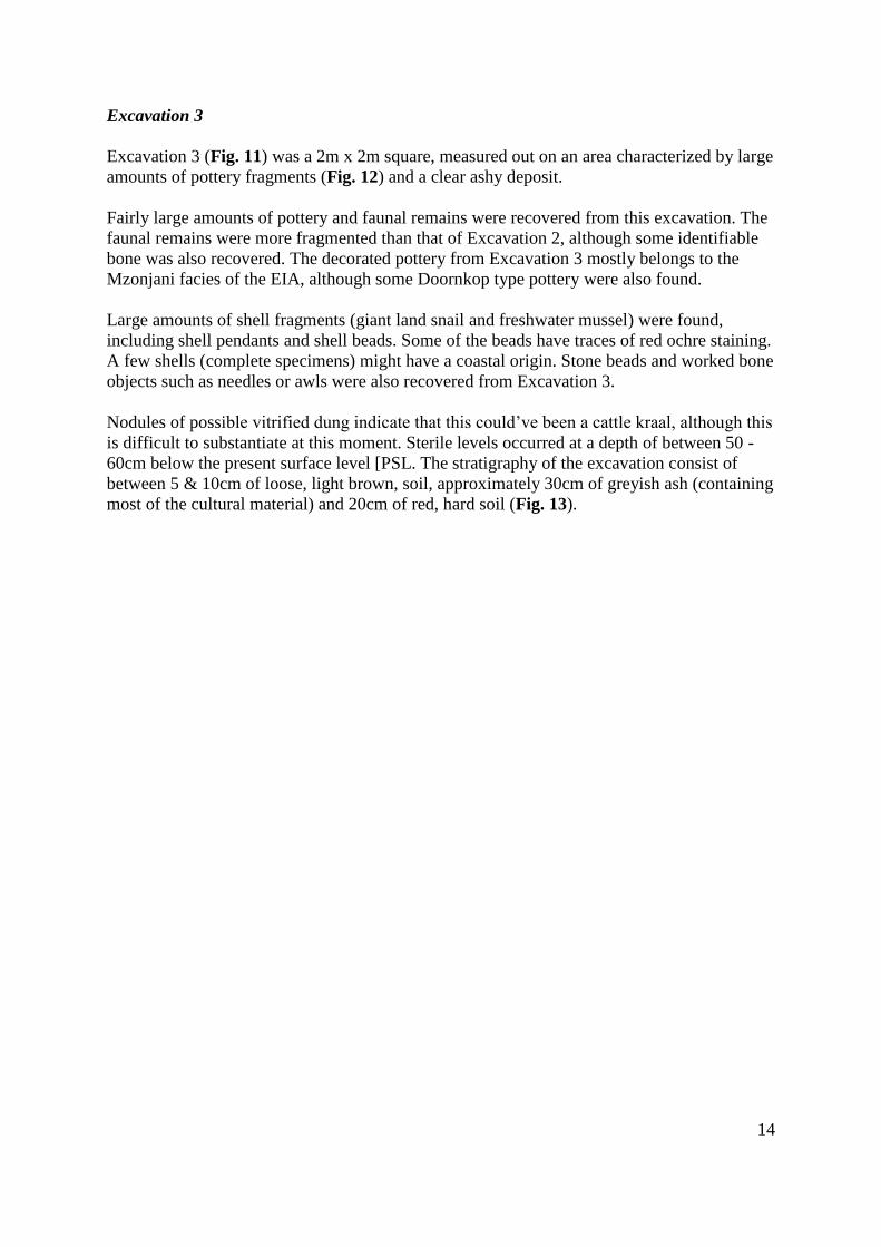
Excavation 3
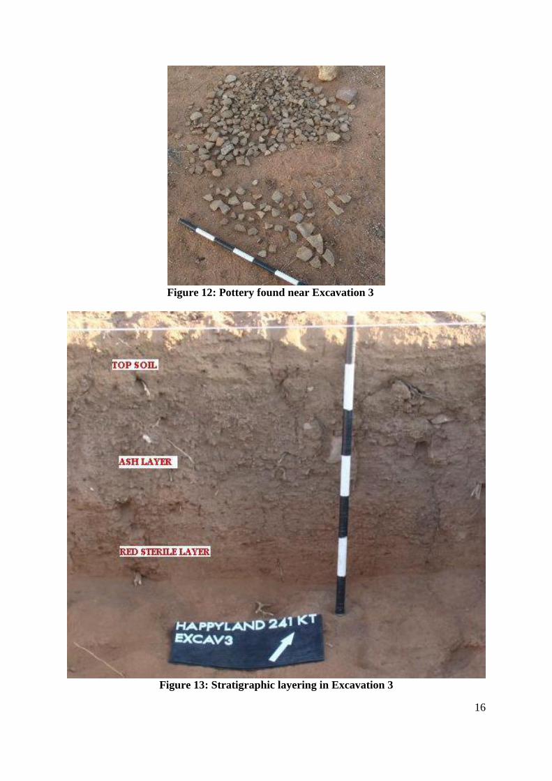
Excavation 3 (Fig. 11) was a 2m x 2m square, measured out on an area characterized by large
amounts of pottery fragments (Fig. 12) and a clear ashy deposit.
Fairly large amounts of pottery and faunal remains were recovered from this excavation. The
faunal remains were more fragmented than that of Excavation 2, although some identifiable
bone was also recovered. The decorated pottery from Excavation 3 mostly belongs to the
Mzonjani facies of the EIA, although some Doornkop type pottery were also found.
Large amounts of shell fragments (giant land snail and freshwater mussel) were found,
including shell pendants and shell beads. Some of the beads have traces of red ochre staining.
A few shells (complete specimens) might have a coastal origin. Stone beads and worked bone
objects such as needles or awls were also recovered from Excavation 3.
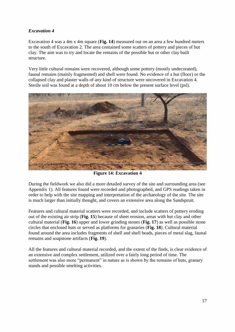
Nodules of possible vitrified dung indicate that this could’ve been a cattle kraal, although this
is difficult to substantiate at this moment. Sterile levels occurred at a depth of between 50 -
60cm below the present surface level [PSL. The stratigraphy of the excavation consist of
between 5 & 10cm of loose, light brown, soil, approximately 30cm of greyish ash (containing
most of the cultural material) and 20cm of red, hard soil (Fig. 13).
15
Figure 11: Excavation 3
16
Figure 12: Pottery found near Excavation 3
Figure 13: Stratigraphic layering in Excavation 3
17
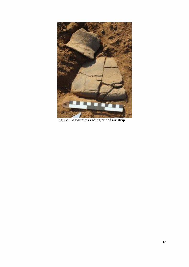
Excavation 4
Excavation 4 was a 4m x 4m square (Fig. 14) measured out on an area a few hundred meters
to the south of Excavation 2. The area contained some scatters of pottery and pieces of hut
clay. The aim was to try and locate the remains of the possible hut or other clay built
structure.
Very little cultural remains were recovered, although some pottery (mostly undecorated),
faunal remains (mainly fragmented) and shell were found. No evidence of a hut (floor) or the
collapsed clay and plaster walls of any kind of structure were uncovered in Excavation 4.
Sterile soil was found at a depth of about 10 cm below the present surface level (psl).
Figure 14: Excavation 4
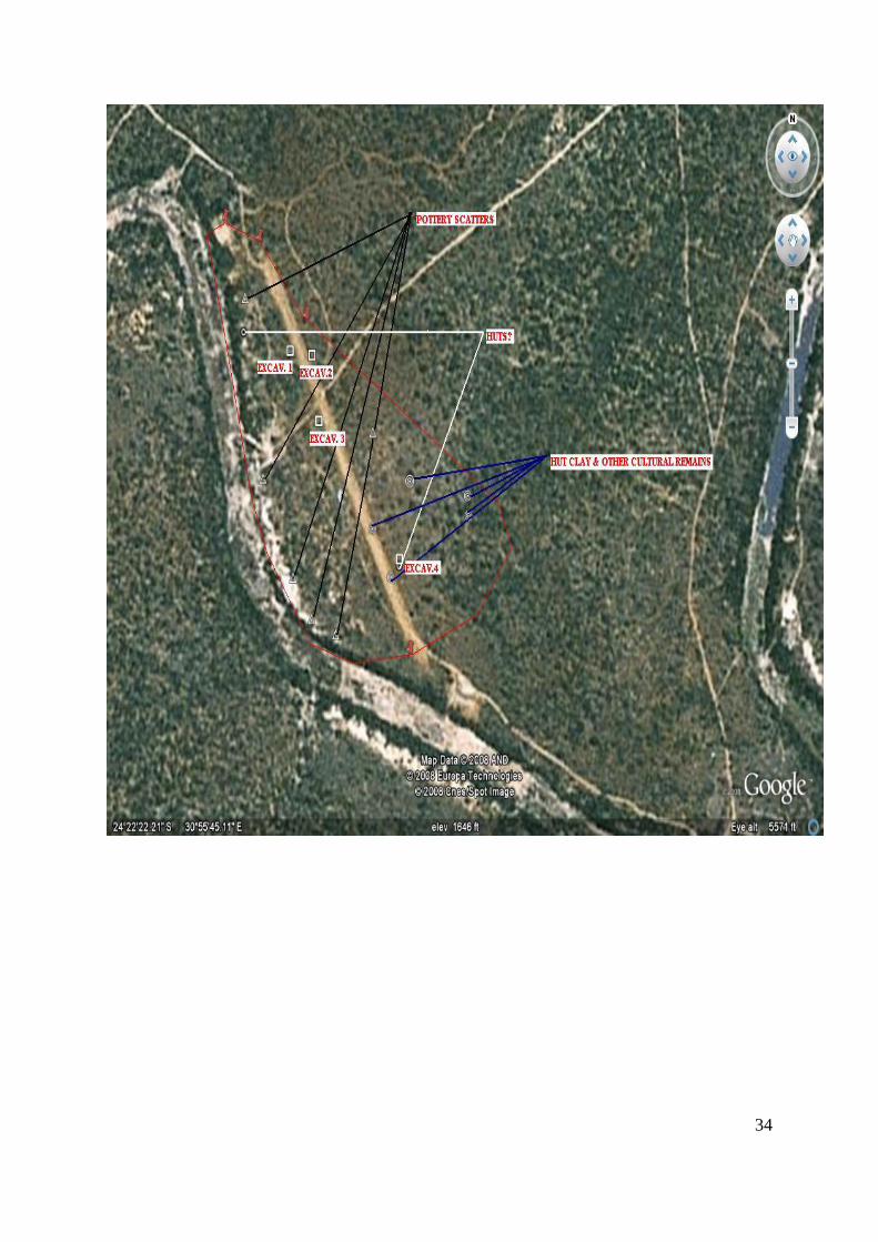
During the fieldwork we also did a more detailed survey of the site and surrounding area (see
Appendix 1). All features found were recorded and photographed, and GPS readings taken in
order to help with the site mapping and interpretation of the archaeology of the site. The site
is much larger than initially thought, and covers an extensive area along the Sandspruit.
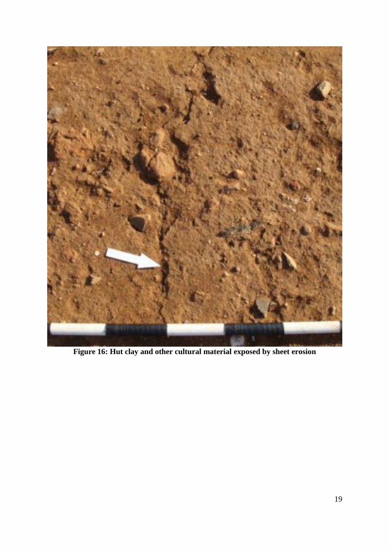
Features and cultural material scatters were recorded, and include scatters of pottery eroding
out of the existing air strip (Fig. 15) because of sheet erosion, areas with hut clay and other
cultural material (Fig. 16) upper and lower grinding stones (Fig. 17) as well as possible stone
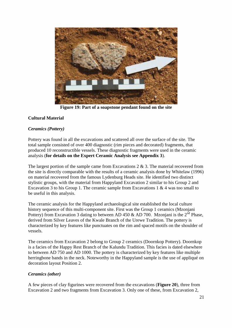
circles that enclosed huts or served as platforms for granaries (Fig. 18). Cultural material
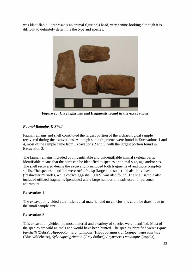
found around the area includes fragments of shell and shell beads, pieces of metal slag, faunal
remains and soapstone artifacts (Fig. 19).
All the features and cultural material recorded, and the extent of the finds, is clear evidence of
an extensive and complex settlement, utilized over a fairly long period of time. The
settlement was also more “permanent” in nature as is shown by the remains of huts, granary
stands and possible smelting activities.
18
Figure 15: Pottery eroding out of air strip
19
Figure 16: Hut clay and other cultural material exposed by sheet erosion
20
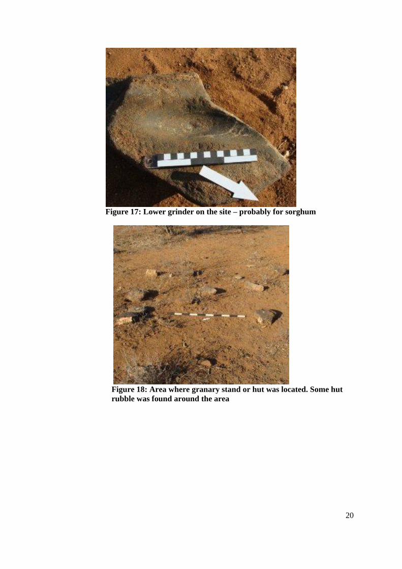
Figure 17: Lower grinder on the site – probably for sorghum
Figure 18: Area where granary stand or hut was located. Some hut
rubble was found around the area
21
Figure 19: Part of a soapstone pendant found on the site
Cultural Material
Ceramics (Pottery)
Pottery was found in all the excavations and scattered all over the surface of the site. The
total sample consisted of over 400 diagnostic (rim pieces and decorated) fragments, that
produced 10 reconstructible vessels. These diagnostic fragments were used in the ceramic
analysis (for details on the Expert Ceramic Analysis see Appendix 3).
The largest portion of the sample came from Excavations 2 & 3. The material recovered from
the site is directly comparable with the results of a ceramic analysis done by Whitelaw (1996)
on material recovered from the famous Lydenburg Heads site. He identified two distinct
stylistic groups, with the material from Happyland Excavation 2 similar to his Group 2 and
Excavation 3 to his Group 1. The ceramic sample from Excavations 1 & 4 was too small to
be useful in this analysis.
The ceramic analysis for the Happyland archaeological site established the local culture
history sequence of this multi-component site. First was the Group 1 ceramics (Mzonjani
Pottery) from Excavation 3 dating to between AD 450 & AD 700. Mzonjani is the 2nd
Phase,
derived from Silver Leaves of the Kwale Branch of the Urewe Tradition. The pottery is
characterized by key features like punctuates on the rim and spaced motifs on the shoulder of
vessels.
The ceramics from Excavation 2 belong to Group 2 ceramics (Doornkop Pottery). Doornkop
is a facies of the Happy Rest Branch of the Kalundu Tradition. This facies is dated elsewhere
to between AD 750 and AD 1000. The pottery is characterized by key features like multiple
herringbone bands in the neck. Noteworthy in the Happyland sample is the use of appliqué on
decoration layout Position 2.
Ceramics (other)
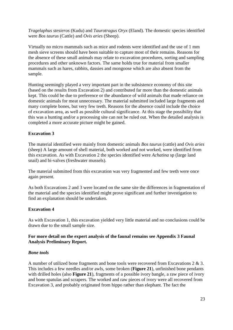
A few pieces of clay figurines were recovered from the excavations (Figure 20), three from
Excavation 2 and two fragments from Excavation 3. Only one of these, from Excavation 2,
22
was identifiable. It represents an animal figurine’s head, very canine-looking although it is
difficult to definitely determine the type and species.
Figure 20: Clay figurines and fragments found in the excavations
Faunal Remains & Shell
Faunal remains and shell constituted the largest portion of the archaeological sample
recovered during the excavations. Although some fragments were found in Excavations 1 and
4, most of the sample came from Excavations 2 and 3, with the largest portion found in
Excavation 2.
The faunal remains included both identifiable and unidentifiable animal skeletal parts.
Identifiable means that the parts can be identified to species or animal size, age and/or sex.
The shell recovered during the excavations included both fragments of and more complete
shells. The species identified were Achatina sp (large land snail) and also bi-valves
(freshwater mussels), while ostrich egg-shell (OES) was also found. The shell sample also
included utilized fragments (pendants) and a large number of beads used for personal
adornment.
Excavation 1
The excavation yielded very little faunal material and no conclusions could be drawn due to
the small sample size.
Excavation 2
This excavation yielded the most material and a variety of species were identified. Most of
the species are wild animals and would have been hunted. The species identified were: Equus
burchelli (Zebra), Hippopotamus amphibious (Hippopotamus), cf Connochaetes taurinus
(Blue wildebeest), Sylvicapra grimmia (Grey duiker), Aeypeceros melampus (impala),
23
Tragelaphus stesieros (Kudu) and Taurotragus Oryx (Eland). The domestic species identified
were Bos taurus (Cattle) and Ovis aries (Sheep).
Virtually no micro mammals such as mice and rodents were identified and the use of 1 mm
mesh sieve screens should have been suitable to capture most of their remains. Reasons for
the absence of these small animals may relate to excavation procedures, sorting and sampling
procedures and other unknown factors. The same holds true for material from smaller
mammals such as hares, rabbits, dassies and mongoose which are also absent from the
sample.
Hunting seemingly played a very important part in the subsistence economy of this site
(based on the results from Excavation 2) and contributed far more than the domestic animals
kept. This could be due to preference or the abundance of wild animals that made reliance on
domestic animals for meat unnecessary. The material submitted included large fragments and
many complete bones, but very few teeth. Reasons for the absence could include the choice
of excavation area, as well as possible cultural significance. At this stage the possibility that
this was a hunting and/or a processing site can not be ruled out. When the detailed analysis is
completed a more accurate picture might be gained.
Excavation 3
The material identified were mainly from domestic animals Bos taurus (cattle) and Ovis aries
(sheep) A large amount of shell material, both worked and not worked, were identified from
this excavation. As with Excavation 2 the species identified were Achatina sp (large land
snail) and bi-valves (freshwater mussels).
The material submitted from this excavation was very fragmented and few teeth were once
again present.
As both Excavations 2 and 3 were located on the same site the differences in fragmentation of
the material and the species identified might prove significant and further investigation to
find an explanation should be undertaken.
Excavation 4
As with Excavation 1, this excavation yielded very little material and no conclusions could be
drawn due to the small sample size.
For more detail on the expert analysis of the faunal remains see Appendix 3 Faunal
Analysis Preliminary Report.
Bone tools
A number of utilized bone fragments and bone tools were recovered from Excavations 2 & 3.
This includes a few needles and/or awls, some broken (Figure 21), unfinished bone pendants
with drilled holes (also Figure 21), fragments of a possible ivory bangle, a raw piece of ivory
and bone spatulas and scrapers. The worked and raw pieces of ivory were all recovered from
Excavation 3, and probably originated from hippo rather than elephant. The fact the
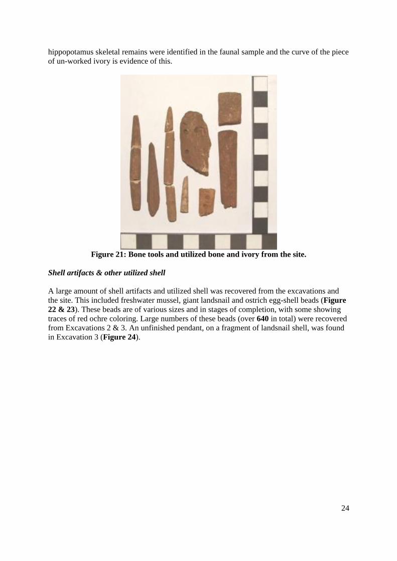
24
hippopotamus skeletal remains were identified in the faunal sample and the curve of the piece
of un-worked ivory is evidence of this.
Figure 21: Bone tools and utilized bone and ivory from the site.
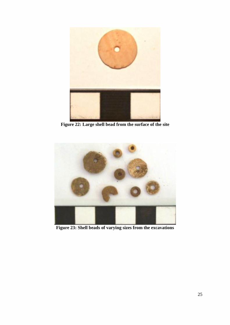
Shell artifacts & other utilized shell
A large amount of shell artifacts and utilized shell was recovered from the excavations and
the site. This included freshwater mussel, giant landsnail and ostrich egg-shell beads (Figure
22 & 23). These beads are of various sizes and in stages of completion, with some showing
traces of red ochre coloring. Large numbers of these beads (over 640 in total) were recovered
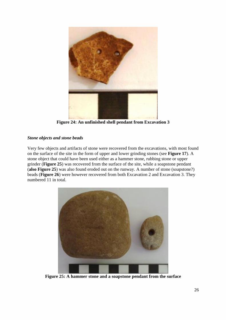
from Excavations 2 & 3. An unfinished pendant, on a fragment of landsnail shell, was found
in Excavation 3 (Figure 24).
25
Figure 22: Large shell bead from the surface of the site
Figure 23: Shell beads of varying sizes from the excavations
26
Figure 24: An unfinished shell pendant from Excavation 3
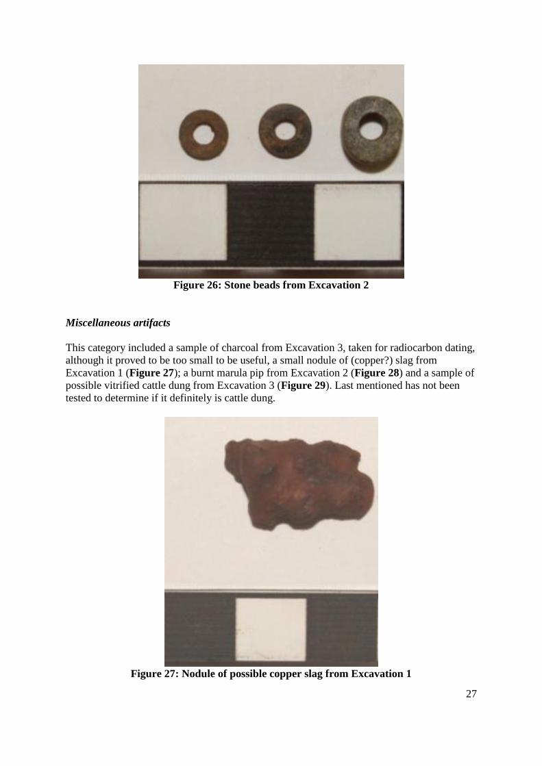
Stone objects and stone beads
Very few objects and artifacts of stone were recovered from the excavations, with most found
on the surface of the site in the form of upper and lower grinding stones (see Figure 17). A
stone object that could have been used either as a hammer stone, rubbing stone or upper
grinder (Figure 25) was recovered from the surface of the site, while a soapstone pendant
(also Figure 25) was also found eroded out on the runway. A number of stone (soapstone?)
beads (Figure 26) were however recovered from both Excavation 2 and Excavation 3. They
numbered 11 in total.
Figure 25: A hammer stone and a soapstone pendant from the surface
27
Figure 26: Stone beads from Excavation 2
Miscellaneous artifacts
This category included a sample of charcoal from Excavation 3, taken for radiocarbon dating,
although it proved to be too small to be useful, a small nodule of (copper?) slag from
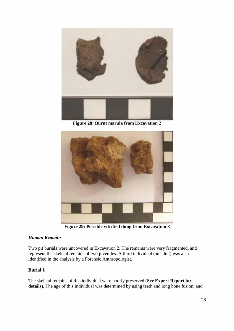
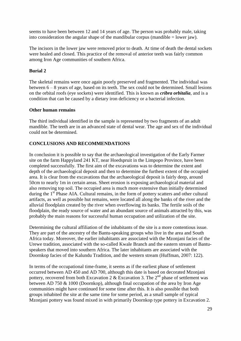
Excavation 1 (Figure 27); a burnt marula pip from Excavation 2 (Figure 28) and a sample of
possible vitrified cattle dung from Excavation 3 (Figure 29). Last mentioned has not been
tested to determine if it definitely is cattle dung.
Figure 27: Nodule of possible copper slag from Excavation 1
28
Figure 28: Burnt marula from Excavation 2
Figure 29: Possible vitrified dung from Excavation 3
Human Remains
Two pit burials were uncovered in Excavation 2. The remains were very fragmented, and
represent the skeletal remains of two juveniles. A third individual (an adult) was also
identified in the analysis by a Forensic Anthropologist.
Burial 1
The skeletal remains of this individual were poorly preserved (See Expert Report for
details). The age of this individual was determined by using teeth and long bone fusion, and
29
seems to have been between 12 and 14 years of age. The person was probably male, taking
into consideration the angular shape of the mandibular corpus (mandible = lower jaw).
The incisors in the lower jaw were removed prior to death. At time of death the dental sockets
were healed and closed. This practice of the removal of anterior teeth was fairly common
among Iron Age communities of southern Africa.
Burial 2
The skeletal remains were once again poorly preserved and fragmented. The individual was
between 6 – 8 years of age, based on its teeth. The sex could not be determined. Small lesions
on the orbital roofs (eye sockets) were identified. This is known as cribra orbitalia, and is a
condition that can be caused by a dietary iron deficiency or a bacterial infection.
Other human remains
The third individual identified in the sample is represented by two fragments of an adult
mandible. The teeth are in an advanced state of dental wear. The age and sex of the individual
could not be determined.
CONCLUSIONS AND RECOMMENDATIONS
In conclusion it is possible to say that the archaeological investigation of the Early Farmer
site on the farm Happyland 241 KT, near Hoedspruit in the Limpopo Province, have been
completed successfully. The first aim of the excavations was to determine the extent and
depth of the archaeological deposit and then to determine the furthest extent of the occupied
area. It is clear from the excavations that the archaeological deposit is fairly deep, around
50cm to nearly 1m in certain areas. Sheet erosion is exposing archaeological material and
also removing top soil. The occupied area is much more extensive than initially determined
during the 1st Phase AIA. Cultural remains, in the form of pottery scatters and other cultural
artifacts, as well as possible hut remains, were located all along the banks of the river and the
alluvial floodplain created by the river when overflowing its banks. The fertile soils of the
floodplain, the ready source of water and an abundant source of animals attracted by this, was
probably the main reasons for successful human occupation and utilization of the site.
Determining the cultural affiliation of the inhabitants of the site is a more contentious issue.
They are part of the ancestry of the Bantu-speaking groups who live in the area and South
Africa today. Moreover, the earlier inhabitants are associated with the Mzonjani facies of the
Urewe tradition, associated with the so-called Kwale Branch and the eastern stream of Bantu-
speakers that moved into southern Africa. The later inhabitants are associated with the
Doornkop facies of the Kalundu Tradition, and the western stream (Huffman, 2007: 122).
In terms of the occupational time-frame, it seems as if the earliest phase of settlement
occurred between AD 450 and AD 700, although this date is based on decorated Mzonjani
pottery, recovered from both Excavation 2 & Excavation 3. The 2nd
phase of settlement was
between AD 750 & 1000 (Doornkop), although final occupation of the area by Iron Age
communities might have continued for some time after this. It is also possible that both
groups inhabited the site at the same time for some period, as a small sample of typical
Mzonjani pottery was found mixed in with primarily Doornkop type pottery in Excavation 2.
30
The Excavation 3 ceramic sample only contained Mzojani pottery, indicating a primary
occupation of the site for at least some period, by this group. The relationship between the
two groups is however at this stage not very clear.
Settlement organization or layout is difficult to reconstruct, as there is barely any surface
features, such as the stone walls associated with the Late Iron Age, visible. A number of areas
with hut clay remains and pottery scatters could indicate possible dwellings, although this is
by no means certain. It seems, based on the evidence recovered from the excavations and
mapping of surface finds that the settlement was located on the fertile alluvial floodplains
created by the Sandspruit in times of flooding. There might have been a number of huts and
granaries scattered about, with one or two decentralized cattle and other livestock enclosures
as part of the settlement. The Central Cattle Pattern, so evident in Later Iron Age stone walled
settlements, is not present. Only with further, more detailed, archaeological excavations could
the settlement organization or layout be reconstructed with more certainty.
Interpreting the domestic economy of the settlement over time also proved problematic, even
though a fairly large amount of cultural material was recovered from the archaeological
excavations. Uncertainty regarding the relationship between the Mzojnai and Doornkop
groups on the site (whether this was contemporaneous or not) also makes this difficult. The
scale on which agriculture (crop growing and utilization) was practiced is not known, but it is
clear that this did form part of the domestic economy of the groups who settled here. Both
upper and lower grinding stones were located over the area, evidence of the production and
use of cereals, more likely crops such as sorghum or millet based on the size of the lower
grinders (see Figure 17). Further evidence for successful agricultural practices, and of
surplus, was the possible collapsed grain bin stand uncovered in Excavation 2.
The domestication of animals (herding) such as cattle (Bos Taurus) and sheep (Ovis aries),
seems to have been practiced, at least during the Mzonjani occupation of the site. The
remains of mainly domestic animals were recovered from Excavation 3. This is of course also
evidence for practices such as the use of cattle for brides (lobola) and status. Hunting, and
also scavenging, played a large role in the domestic economy, especially during the
Doornkop phase of settlement. The remains of mainly non-domestic fauna were recovered
from Excavation 2. A small sample of domestic species (cattle and sheep) was also recovered
from Excavation 2 (probably associated with the small sample of Mzonjani pottery from the
same Excavation.). As hippo is too large and dangerous to hunt, it is more than likely that the
individuals who contributed to the faunal sample from Excavation 2 were scavenged. No
evidence for snaring small animals such as scrub hares was found, with no micro-fauna
skeletal remains recovered from any of the excavations. The remains of at least four tortoises
from Excavation 2 indicate that this was also a source of meat and protein, together with the
freshwater mussel and giant landsnail.
Evidence for other aspects of the domestic economy, such as the production of metal
artifacts, tools and weapons, was very scarce. No metal artifacts or fragments were recovered
from any of the excavations, although tentative evidence for metal working (smelting) was
found. This included a small fragment of possible copper slag from Excavation 1 and some
slag from a single area on the site. It is possible that trade with other groups was practiced,
but this is once again based on very tenuous evidence. The pieces of worked and raw ivory
from Excavation 3 could point in that direction, although no trade beads (glass) was
recovered. All the shell beads, and the ivory, could have been for local consumption only.
31
Finally, it is possible to conclude that the Happyland 241 KT Early Farmer Site was
successfully investigated archaeologically, at least in the section that will be impacted on by
the planned development in the short term. The site is much more significant in terms of its
archaeological, research and scientific value that initially thought. The settlement seems to
have been more extensive and complex as well, and the large scale, long term, residential
development will have a major impact on a site that represents a part of the archaeological
record (Mzonjani and Doornkop) that is not completely understood as yet. Therefore, the
following mitigation measures are recommended:
(a) that, during all phases of the development a “watching brief” be implemented.
This will entail that the Site Manager employed for the development be present
and that all finds, such as dwellings and other settlement features, cultural
material and human remains (pit burials) be reported to qualified archaeologists
to investigate. The subterranean presence of archaeological features and cultural
material should always be kept in mind on sites such as these. The presence of
human remains (pit burials) on this site especially needs to be considered.
(b) that all finds be recorded in detail (photographic, mapped/drawn) and then be
removed and taken to the Lydenburg Museum for curation. The Site Manager
can also carry out some level of recording, taking photographs and measuring
finds. These can then be sent to an archaeologist for identification prior to field
investigation being undertaken.
(c) that, if deemed necessary, extensive archaeological investigations (excavations)
be carried out on significant finds (such as pit burials, huts and other settlement
features including granaries and furnaces), with the necessary permits obtained
from SAHRA. The current permit is valid until 1 July 2009, and will be renewed
every year. It is envisaged that the total development will take place over a
period of approximately 5 – 6 years
(d) As these investigations, as well as the curation of all material, have financial
implications, the costs will have to be covered by the developer
During the fieldwork these measurements were discussed with the client, and they
indicated that they are willing to implement them as such. We believe that these
measurements will ensure that the total site be mitigated satisfactorily and that important
information on the EIA in the area will be preserved for future generations of not only
archaeologists, but also the general public. The development can therefore continue, taking
cognisance of the mitigation measures recommended.
REFERENCES
(1) Site Location and Distribution of Site Features: Images created on Google Earth
(2) Gaigher, S. 2007. Heritage Impact Assessment for the Proposed Eco-Estate on the
farm Happyland, Limpopo Province. Unpublished Report: AINP
32
(3) Gaigher, S & E. Mathoho. 2007. Proposed Second Phase Recommendations for the
Rescue Excavation of an Early Iron Age Site on the Proposed Eco-Estate on the farm
Happyland, Limpopo Province. Unpublished Report: AINP
(4) Huffman, T.N. 2007. Handbook to the Iron Age: The Archaeology of Precolonial
Farming Societies in Southern Africa. Pietermaritzburg: Kwazulu-Natal University Press.
(5) Mosothwane, Moronga N. 2008. Osteological Analysis of human skeletal remains
from Happyland 241 KT. Unpublished Report: Department of Archaeology – University
of the Witwatersrand
(6) Scott, K. 2008. Preliminary Faunal Report on Happyland 241 KT. Unpublished
Report
(7) van der Walt, J. 2008. Ceramic Analysis on Material from the Happyland
Archaeological Site, Hoedspruit, Limpopo Province. Unpublished Report: WITS Heritage
Contracts Unit
PROJECT TEAM
Mr. A.Pelser, Archaeologist (PRINCIPAL INVESTIGATOR) and Project Leader
Dr. A.C. van Vollenhoven (FIELD SUPERVISOR)
Mr. J. van der Walt – Archaeologist: WITS Heritage Contracts Unit – Ceramic Analyis
Me. M. Mosotwane – Forensic Anthropologist: WITS University
Me. K. Scott – Archaeozoologist: Analysis of faunal remains
33
APPENDIX 1 – SITE LOCATION AND DISTRIBUTION OF SITE FEATURES
34
35
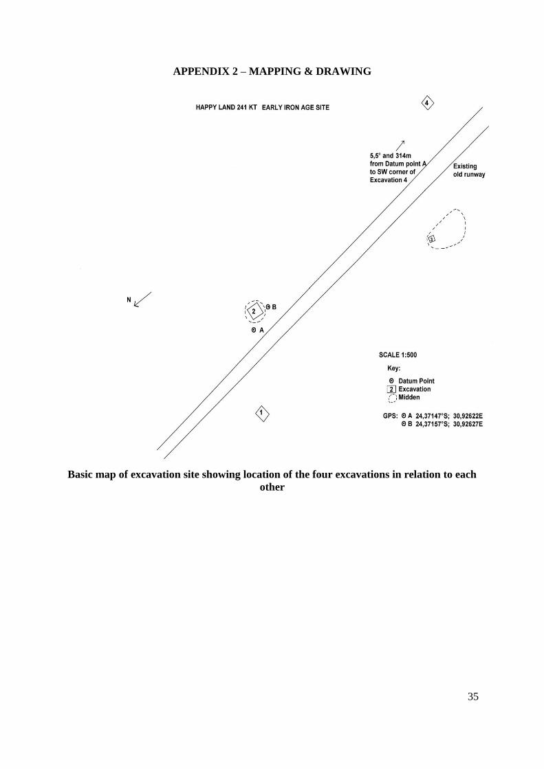
APPENDIX 2 – MAPPING & DRAWING
Basic map of excavation site showing location of the four excavations in relation to each
other
36
Detail drawing of Excavation 2 indicating distribution of features and important finds

37
APPENDIX 3 – EXPERT REPORTS
SEE SEPARATE DOCUMENTS