Tours cyclo 1/9 Fahrradrundwege 85 km La piste des forts ... · deutsch-französischer Radweg, der...
9
Janvier 2008 Janvier 2012 Le Bas-Rhin en roue libre / Mit dem Fahrrad durch das Unterelsass / Cycling through Northern Alsace L'Alsace à vélo 85 km La piste des forts Der Radweg zu den Forts e forts trails 1/9 23 Tours cyclo Fahrradrundwege Circular cycle trails
Transcript of Tours cyclo 1/9 Fahrradrundwege 85 km La piste des forts ... · deutsch-französischer Radweg, der...

Janv
ier
2008
Janv
ier
2012
Le B
as-R
hin
en
ro
ue
lib
re /
Mit
dem
Fah
rrad
du
rch
das
Un
tere
lsas
s /
Cyc
ling
thro
ugh
No
rth
ern
Als
ace
L'A
lsac
e à
vélo
85 km La piste des forts Der Radweg zu den Forts The forts trails
1/9
23
Tours cycloFahrradrundwegeCircular cycle trails
Janv
ier
2008
Janv
ier
2012
Le B
as-R
hin
en
ro
ue
lib
re /
Mit
dem
Fah
rrad
du
rch
das
Un
tere
lsas
s /
Cyc
ling
thro
ugh
No
rth
ern
Als
ace
L'A
lsac
e à
vélo
85 km La piste des forts Der Radweg zu den Forts The forts trails
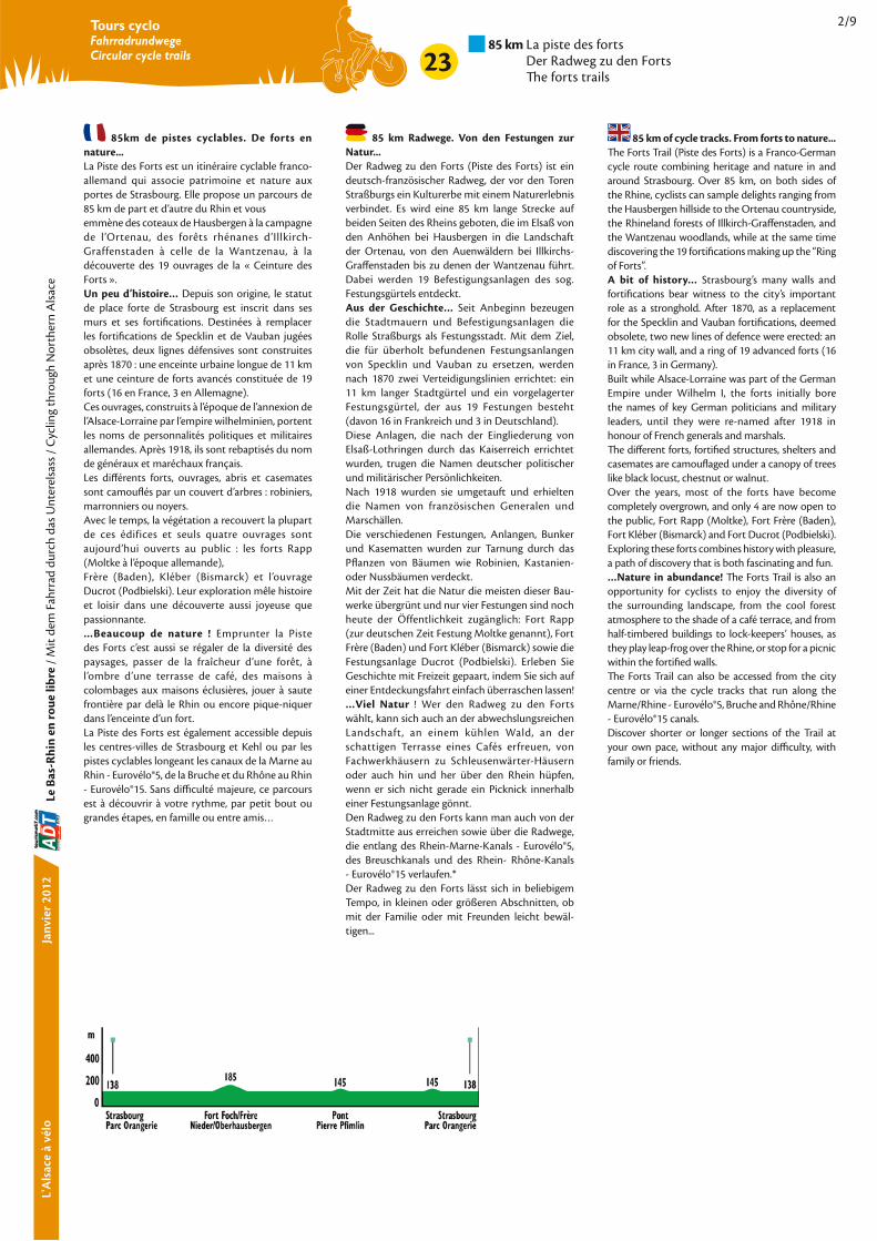
2/9
23
Tours cycloFahrradrundwegeCircular cycle trails
85km de pistes cyclables. De forts en
nature...
La Piste des Forts est un itinéraire cyclable franco-
allemand qui associe patrimoine et nature aux
portes de Strasbourg. Elle propose un parcours de
85 km de part et d’autre du Rhin et vous
emmène des coteaux de Hausbergen à la campagne
de l’Ortenau, des forêts rhénanes d’Illkirch-
Graffenstaden à celle de la Wantzenau, à la
découverte des 19 ouvrages de la « Ceinture des
Forts ».
Un peu d’histoire… Depuis son origine, le statut
de place forte de Strasbourg est inscrit dans ses
murs et ses fortifications. Destinées à remplacer
les fortifications de Specklin et de Vauban jugées
obsolètes, deux lignes défensives sont construites
après 1870 : une enceinte urbaine longue de 11 km
et une ceinture de forts avancés constituée de 19
forts (16 en France, 3 en Allemagne).
Ces ouvrages, construits à l’époque de l’annexion de
l’Alsace-Lorraine par l’empire wilhelminien, portent
les noms de personnalités politiques et militaires
allemandes. Après 1918, ils sont rebaptisés du nom
de généraux et maréchaux français.
Les différents forts, ouvrages, abris et casemates
sont camouflés par un couvert d’arbres : robiniers,
marronniers ou noyers.
Avec le temps, la végétation a recouvert la plupart
de ces édifices et seuls quatre ouvrages sont
aujourd’hui ouverts au public : les forts Rapp
(Moltke à l’époque allemande),
Frère (Baden), Kléber (Bismarck) et l’ouvrage
Ducrot (Podbielski). Leur exploration mêle histoire
et loisir dans une découverte aussi joyeuse que
passionnante.
…Beaucoup de nature ! Emprunter la Piste
des Forts c’est aussi se régaler de la diversité des
paysages, passer de la fraîcheur d’une forêt, à
l’ombre d’une terrasse de café, des maisons à
colombages aux maisons éclusières, jouer à saute
frontière par delà le Rhin ou encore pique-niquer
dans l’enceinte d’un fort.
La Piste des Forts est également accessible depuis
les centres-villes de Strasbourg et Kehl ou par les
pistes cyclables longeant les canaux de la Marne au
Rhin - Eurovélo®5, de la Bruche et du Rhône au Rhin
- Eurovélo®15. Sans difficulté majeure, ce parcours
est à découvrir à votre rythme, par petit bout ou
grandes étapes, en famille ou entre amis…
85 km Radwege. Von den Festungen zur
Natur...
Der Radweg zu den Forts (Piste des Forts) ist ein
deutsch-französischer Radweg, der vor den Toren
Straßburgs ein Kulturerbe mit einem Naturerlebnis
verbindet. Es wird eine 85 km lange Strecke auf
beiden Seiten des Rheins geboten, die im Elsaß von
den Anhöhen bei Hausbergen in die Landschaft
der Ortenau, von den Auenwäldern bei Illkirchs-
Graffenstaden bis zu denen der Wantzenau führt.
Dabei werden 19 Befestigungsanlagen des sog.
Festungsgürtels entdeckt.
Aus der Geschichte… Seit Anbeginn bezeugen
die Stadtmauern und Befestigungsanlagen die
Rolle Straßburgs als Festungsstadt. Mit dem Ziel,
die für überholt befundenen Festungsanlangen
von Specklin und Vauban zu ersetzen, werden
nach 1870 zwei Verteidigungslinien errichtet: ein
11 km langer Stadtgürtel und ein vorgelagerter
Festungsgürtel, der aus 19 Festungen besteht
(davon 16 in Frankreich und 3 in Deutschland).
Diese Anlagen, die nach der Eingliederung von
Elsaß-Lothringen durch das Kaiserreich errichtet
wurden, trugen die Namen deutscher politischer
und militärischer Persönlichkeiten.
Nach 1918 wurden sie umgetauft und erhielten
die Namen von französischen Generalen und
Marschällen.
Die verschiedenen Festungen, Anlangen, Bunker
und Kasematten wurden zur Tarnung durch das
Pflanzen von Bäumen wie Robinien, Kastanien-
oder Nussbäumen verdeckt.
Mit der Zeit hat die Natur die meisten dieser Bau-
werke übergrünt und nur vier Festungen sind noch
heute der Öffentlichkeit zugänglich: Fort Rapp
(zur deutschen Zeit Festung Moltke genannt), Fort
Frère (Baden) und Fort Kléber (Bismarck) sowie die
Festungsanlage Ducrot (Podbielski). Erleben Sie
Geschichte mit Freizeit gepaart, indem Sie sich auf
einer Entdeckungsfahrt einfach überraschen lassen!
…Viel Natur ! Wer den Radweg zu den Forts
wählt, kann sich auch an der abwechslungsreichen
Landschaft, an einem kühlen Wald, an der
schattigen Terrasse eines Cafés erfreuen, von
Fachwerkhäusern zu Schleusenwärter-Häusern
oder auch hin und her über den Rhein hüpfen,
wenn er sich nicht gerade ein Picknick innerhalb
einer Festungsanlage gönnt.
Den Radweg zu den Forts kann man auch von der
Stadtmitte aus erreichen sowie über die Radwege,
die entlang des Rhein-Marne-Kanals - Eurovélo®5,
des Breuschkanals und des Rhein- Rhône-Kanals
- Eurovélo®15 verlaufen.*
Der Radweg zu den Forts lässt sich in beliebigem
Tempo, in kleinen oder größeren Abschnitten, ob
mit der Familie oder mit Freunden leicht bewäl-
tigen...
85 km of cycle tracks. From forts to nature...
The Forts Trail (Piste des Forts) is a Franco-German
cycle route combining heritage and nature in and
around Strasbourg. Over 85 km, on both sides of
the Rhine, cyclists can sample delights ranging from
the Hausbergen hillside to the Ortenau countryside,
the Rhineland forests of Illkirch-Graffenstaden, and
the Wantzenau woodlands, while at the same time
discovering the 19 fortifications making up the “Ring
of Forts”.
A bit of history… Strasbourg’s many walls and
fortifications bear witness to the city’s important
role as a stronghold. After 1870, as a replacement
for the Specklin and Vauban fortifications, deemed
obsolete, two new lines of defence were erected: an
11 km city wall, and a ring of 19 advanced forts (16
in France, 3 in Germany).
Built while Alsace-Lorraine was part of the German
Empire under Wilhelm I, the forts initially bore
the names of key German politicians and military
leaders, until they were re-named after 1918 in
honour of French generals and marshals.
The different forts, fortified structures, shelters and
casemates are camouflaged under a canopy of trees
like black locust, chestnut or walnut.
Over the years, most of the forts have become
completely overgrown, and only 4 are now open to
the public, Fort Rapp (Moltke), Fort Frère (Baden),
Fort Kléber (Bismarck) and Fort Ducrot (Podbielski).
Exploring these forts combines history with pleasure,
a path of discovery that is both fascinating and fun.
…Nature in abundance! The Forts Trail is also an
opportunity for cyclists to enjoy the diversity of
the surrounding landscape, from the cool forest
atmosphere to the shade of a café terrace, and from
half-timbered buildings to lock-keepers’ houses, as
they play leap-frog over the Rhine, or stop for a picnic
within the fortified walls.
The Forts Trail can also be accessed from the city
centre or via the cycle tracks that run along the
Marne/Rhine - Eurovélo®5, Bruche and Rhône/Rhine
- Eurovélo®15 canals.
Discover shorter or longer sections of the Trail at
your own pace, without any major difficulty, with
family or friends.

Janv
ier
2008
Janv
ier
2012
Le B
as-R
hin
en
ro
ue
lib
re /
Mit
dem
Fah
rrad
du
rch
das
Un
tere
lsas
s /
Cyc
ling
thro
ugh
No
rth
ern
Als
ace
L'A
lsac
e à
vélo
85 km La piste des forts Der Radweg zu den Forts The forts trails
3/9
23
Tours cycloFahrradrundwegeCircular cycle trails
LocalitésOrte - Towns
TotalGesamtTotal
PartielTeilabschnittPartial
Le parcours/Der Weg/The route
Strasbourg + tram (Parc de l’orangerie) IC Ep-Be-Bo La Wantzenau IC 9,3 km 9,3 km Ep-Be-Bo Reichstett IC 10,4 km 19,7 km Ep-Be-Bo Souffelweyersheim IC 3 km 22,7 km Ep-Be-Bo Mundolsheim IC 2,7 km 25,4 km Ep-Be-Bo Niederhausbergen (Fort Foch) IC 2,5 km 27,9 km Be Oberhausbergen IC 1,8 km 29,7 km Ep-Be-Bo (Fort Frère)
Wolfisheim IC 5,6 km 35,3 km Ep-Be-Bo Eckbolsheim IC 2,1 km 37,4 km Ep-Be-Bo Lingolsheim + tram IC 1,6 km 39 km Ep-Be-Bo Ostwald tram IC 3 km 42 km Ep-Be-Bo Geispolsheim gare (Musée du Chocolat) IC 3,7 km 45,7 km Ep-Be-Bo Illkirch – Graffenstaden (Fort Uhrich) tram A IC 2,3 km 48 km Ep-Be-Bo Pont Pierre Pflimlin IC 5,4 km 53,4 km Marlen IC 6 km 59,4 km Ep-Be-Bo Sundheim (Fort Kirchbach) IC 4 km 63,4 km Ep-Be-Bo Neumühl (Fort Bose) IC 5 km 68,4 km Ep-Be Auenheim (Fort Blumenthal) IC 5,5 km 73,9 km Be-Bo Kehl (Passerelle des 2 Rives) IC 7 km 80,9 km Ep-Be-Bo Strasbourg + tram (Parc de l’Orangerie) IC 5 km 85,9 km Ep-Be-Bo
Les services par commune/ Serviceangebote der Gemeinden/ Services in each town/village
Camping (*,**,***,****=classement, T=tourisme, L=loisirs, période d’ouverture) / Campingplätze (*,**,***,**** =Einstufung, T=Tourismus, L=Freizeit, Öffnungszeiten) / Campsite (*,**,***,****=classif, T=tourism, L=leisure, opening season)
Bureau de poste / Post / Post office
Baignade / Bademöglichkeit / Bathing
Pharmacie / Apotheke / Pharmacy
Guichet automatique bancaire /Geldautomat / Cash dispenser
Hébergement utilisant les énergies renouvelables / Alsatian accommodation using renewable energy sources / Elsässische Tourismus-Unterkünfte die erneuerbare Energien benützen
Réparation de bicyclettes / Fahrrad-Reparatur / Bicycle repairs
Location de bicyclettes (route, VTC) / Fahrrad-Vermietung / Bicycle hire (town & country bike)
Chambre d’hôtes / Gästezimmer / Bed and breakfast
Hébergement collectif (auberge de jeunesse, gîte d’étape, etc.) / Beherbergungs vereine (Jugendherbergen, Etappenunterkünfte usw.) (lits=Bettenanzahl) / Hostel-type accomodation (youth hostel, hikers' hostels, etc.) (lits=no. of beds)
100
Alimentation / Lebensmittel / Food shop (Ep : épicerie/Lebensmittelgeschäft/grocer's - Be : boulangerie/Bäc-ker/baker's - Bo : boucherie/Metzgerei/butcher's)
Hôtel-restaurant avec garage à bicyclette (H=hôtel, H/
R=hôtel-restaurant, *,**,***,****=class. officiel, ch=nbre de
chambres) / Hotel-Restaurant mit Fahrradgarage (H: Hotel,
H/R: Hotel-Restaurant, *,**,***,****=offizielle Klassifizierung,
ch=Zimmeranzahl / Hotel-restaurant with bicycle shed
(h=hotel, h/r=hotel-restaurant, *,**,***,**** =official classif.,
ch=no. of rooms)
Transport des bagages à l’étape suivante* / Gepäcktransfer zur
nächsten Etappe* / Transportation of luggage to next stop*
Piscine/Schwimmbad/Swimming pool
Piscine couverte/Hallenbad/Indoor swimming pool
*Sur demande préalable / *auf vorige Anfrage / *on prior demand
Petit déjeuner buffet* / Frühstücksbuffet* / Buffet breakfast*
Panier repas pour le déjeuner* / Lunchpaket zum Mitneh-
men* / Take-away dinner*
Outils pour petites réparations/ Werkzeuge für kleine Repara-
turen / Tools for small repairs
Restaurant
Bistrot-café / Bistro-Cafe / Bistro-café
PC Parcours cyclable / Radweg / Cycle track
BC Bande cyclable / Radweg auf der Straße / Cycle lane
IC Itinéraire cyclable local / Fahrrad-Strecke / Local cycle trail
RF Route forestière / Waldweg / Forest road
C Route communale / Gemeindestraße / Local road
D Route départementale / Landstraße / "B" road
N Route nationale / Schnellstraße / "A" road
Office de Tourisme / Verkehrsbüro / Tourist office
� Gare SNCF / Bahnhof / Railway station
Nature de la voirie / Art der Straßen / Types of tracks :
�
�
�
�
�
�
�

Janv
ier
2008
Janv
ier
2012
Le B
as-R
hin
en
ro
ue
lib
re /
Mit
dem
Fah
rrad
du
rch
das
Un
tere
lsas
s /
Cyc
ling
thro
ugh
No
rth
ern
Als
ace
L'A
lsac
e à
vélo
85 km La piste des forts Der Radweg zu den Forts The forts trails
4/9
23
Tours cycloFahrradrundwegeCircular cycle trails
Comment s’y rendreWie erreicht manHow to get there
En train / mit dem Zug / By trainSNCF 36 35 (0,34 € / minute)www.sncf.fr
Ligne/Linie/Line Strasbourg-Lauterbourg
Strasbourg-Molsheim
Strasbourg-Sélestat
DB 0049 (0)180 5 99 66 33(0,14 €/Min. aus dem deutschen Festnetz, Tarif bei Mobilfunk max. 42 ct/Min.)www.bahn.de
Ligne/Linie/Line
En tram / mit der Straßenbahn/ by tram:À partir des 9 arrêts suivants / Von diesen 9 Straßenbahn-Haltestellen aus /
Alouettes
Où se logerUnterkünfte
Where to stay
STRASBOURG (F 67000)
03 90 00 26 26www.cour-corbeau.com
03 90 00 26 26www.lejsbach.com
03 88 15 05 05 www.regent-contades.com
03 88 76 43 43 www.regent-petite-france.com
03 88 15 49 00 www.sofitel-strasbourg.com
03 90 41 18 28
www.villanovarina.com
03 88 32 17 88
www.hotel-europe.com
03 88 32 37 12 www.bestwestern-hotel- defrance.com
03 88 14 39 14 www.bw-monopole.com
03 88 32 00 83www.hotel-strasbourg.com
03 88 32 85 11 www.hotel-rohan.com
03 88 22 12 12 www.hotel-cathedrale.fr
03 90 22 47 00 www.citadines.com
03 88 36 26 61 www.hotel-diana-dauphine.com
03 88 35 79 80 www.dragon.fr
03 88 32 16 22 www.hotel-hannong.com
03 88 32 42 14www.maison-kammerzell.com
03 88 35 20 45 www.royal-lutetia.fr
03 90 22 70 70www.mercure.com
03 88 32 80 80 www.accorhotels.com
03 88 35 10 69 www.hotel-orangerie-strasbourg.com
H/R 38 ch.03 88 29 41 41 www.hotels-arc-en-ciel.com
03 88 37 98 37www.hotel-arts.com
Montagne Verte03 88 29 06 06 www.strasbourg-hotel-alsace.com
H 43 ch.03 88 32 93 93 www.hotel-franciscain.com
03 88 61 38 95 http://perso.orange.fr/hotel.esplanade
03 88 32 66 60 www.etc-hotel.com
03 88 32 71 88 www.grillon.com
03 88 40 32 33www.ibishotel.com
03 88 36 20 01 www.hotel-ill.com
03 88 32 14 54 www.paxhotel.com
03 88 35 22 11 www.hotel-suisse.com
03 88 36 56 95www.hotel3roses-strasbourg.com
03 90 22 43 43 www.hotel-le-victoria.com
03 88 32 14 60 www.hotelpatricia.fr
Chez Claude BAPST06 48 13 14 75http://la-celestine.fr
(266 lits)03 88 45 54 20www.fuaj.org
03 88 15 27 88www.ciarus.com
Chalet des Amis de la Nature (17 lits)03 88 96 90 40www.an67.org
(15/03 -> 31/12)03 88 30 25 46www.aquadis-loisirs.com
LA WANTZENAU (F 67610)
03 88 59 22 22 www.moulin-wantzenau.com
03 88 59 24 80 www.relais-poste.com
REICHSTETT (F 67116)
03 88 20 07 87 www.aigledor.com
SOUFFELWEYERSHEIM (F 67460)
03 88 20 13 38 www.relaisdelasouffel.online.fr
NIEDERHAUSBERGEN
MITTELHAUSBERGEN (F 67206)
03 88 56 18 31 www.autilleul.fr
ECKBOLSHEIM (F 67201)
03 88 77 85 60 www.lescolonnes-strasbourg.com
LINGOLSHEIM (F 67380)
03 88 77 18 18 www.ibishotel.com
03 88 76 11 00 www.kyriadstrasbourg.com
GEISPOLSHEIM (F 67118)
03 08 92 78 80 99www.hotelbb.com
ILLKIRCH-GRAFFENSTADEN (F 67400)
03 88 40 84 84 www.histrasbourg.com
03 88 67 72 00 www.adagio-city.com
chez Annick REIFFSTECK03 88 66 25 64http://chambrehotes.aucanal.pagesperso-orange.fr/
KEHL-MARLEN (D 77694)
Landgasthaus und HotelSchlossergasse 28(0)7854 96990 www.hotelwildermann.de – outils pour petites réparations
Kirchstr. 1(0)7854 96690 www.hotel-oeschger.de
KEHL-SUNDHEIM (D 77694)
Hauptstr. 329(0) 7851 898600 www.hotel-schwanen-kehl.de
KEHL-NEUMÜHL (D 77694)
Elsässer Str. 15(0) 7851 2154 www.pflug-neumuehl.de
Spittelmattweg 18(0)7851 73324
KEHL-AUENHEIM (D 77694)
Waldstr. 28(0)171 9067717 www.gaestehaus-schluessel.de
KEHL (D 77694)
Straßburger Str. 18(0)7851 885650 www.ates-hotel.de
Fabrikstr. 1(0)7851 79030 www.firstaparthotel.de
Hauptstr. 20(0)7851 2735 www.schwanen-kehl.de
Straßburgerstr. 9(0)7851 9947880 www.europa-hotel-kehl.de
Hotel, Hauptstr. 183(0)7851 91040 www.rebstock-kehl.de
Hotel-Gasthaus, Bierkellerstr. 16(0)7851 2273 www.hofreit-kehl.de
Hauptstr. 83(0)7851 955606 www.daslamm.de
Jahnstr. 8(0)7851 958615 www.rosengarten-kehl.de
Hauptstr. 51(0)7851 77580 www.hotel-schwert.com
Schönebergerweg 2(0)174 6064519 www.fontanehouse.sitew.com
Altrheinweg 11(0)7851 2330 www.jugendherberge-kehl.de
Rheindammstr. 1(0)7851 2603www.camping-club.de15.03. 31.10.
Où réparer une bicycletteFahrrad-ReparaturenWhere to get a bicycle fixed
STRASBOURG CENTRE (F 67000)
22, Faubourg de Pierre03 88 21 43 43
5, rue de la Brigade d'AlsaceLorraine03 88 36 22 15
Adresses utiles/Nützliche Adressen/Useful addresses

Janv
ier
2008
Janv
ier
2012
Le B
as-R
hin
en
ro
ue
lib
re /
Mit
dem
Fah
rrad
du
rch
das
Un
tere
lsas
s /
Cyc
ling
thro
ugh
No
rth
ern
Als
ace
L'A
lsac
e à
vélo
85 km La piste des forts Der Radweg zu den Forts The forts trails
5/9
23
Tours cycloFahrradrundwegeCircular cycle trails
56, rue du Faubourg National03 88 22 13 73
33, Avenue des Vosges03 88 36 20 33
6, rue de l’Yser03 88 34 36 55
15, rue Thiergarten03 88 75 01 53
17, rue de la Brigade d'AlsaceLorraine03 88 35 33 81
18, rue Jacques Peirotes03 88 36 18 4177, avenue de la Forêt Noire09 81 37 13 31www.espritcycles.com
24, place des Halles03 88 22 23 98
3, rue de Louvain03 88 61 03 24
7, Avenue d’Alsace03 88 24 13 25
58, rue de Zurich03 88 36 18 18
STRASBOURG OUEST (F 67200)
rue du Cerf Berr03 90 20 47 20
32, rue Charles Péguy03 90 20 45 26
112, route de Schirmeck03 88 78 68 55
STRASBOURG SUD (F 67100)
147, route du Polygone03 88 34 07 55
10, rue de la Ziegelau06 08 28 58 29
STRASBOURG NORD
158, rue Boecklin03 88 31 56 17
LA WANTZENAU (F 67610)
03 88 96 20 37
HOENHEIM (F 67800)
03 88 18 70 47
OBERHAUSBERGEN F 67205)
96a, route de Saverne03 88 56 30 89
OSTWALD (F 67400)
169, rue du Général Leclerc03 88 29 73 15
GEISPOLSHEIM (F 67118)
31, rue des Vosges03 88 66 15 85
1, rue du Fort03 88 55 44 43
ILLKIRCH- GRAFFENSTADEN (F 67400)
03 88 66 19 10
KEHL-MARLEN (D 77964)
Eckartsweiererstr. 10(0)7854 253
KEHL (D 77964)
Hauptstr. 161(0)7851 71231www.fahrrad-rapp.de
Hauptstr. 105(0)7851 957004www.hafenradler.de
Où louer une bicycletteFahrrad-VermietungWhere to rent a bicycle
STRASBOURG CENTRE (F 67000)
03 88 23 56 75
03 88 35 44 65
03 88 35 45 03www.velhop.strasbourg.eu
18, rue Jacques Peirotes03 88 36 18 41www.espritcycles.com
KEHL (D 77964)
Hauptstr. 161(0)7851 71231www.fahrrad-rapp.de
Hauptstr. 105(0)7851 957004www.hafenradler.de
Offices de TourismeVerkehrsämterTourist Offices
STRASBOURG ****Place de la cathédrale - Place de la gare – Place de l’Etoile03 88 52 28 28www.otstrasbourg.fr
KEHLHauptstr. 63 (Marktplatz)(0)7851 88-1555 www.marketing.kehl.de
Que visiterBesichtigungenVisits
STRASBOURG (F 67000)
voir / siehe / see : TOUR CYCLO
Situé au nord-est de Strasbourg, le parc de Pourtalès entoure un joli château rendu célèbre par la Comtesse Mélanie de Pourtalès qui, au siècle dernier, y recevait tout le gotha européen. De nombreuses oeuvres d’art contemporain y sont disséminées.
Der Pourtalès-Park im Nordosten Straßburgs birgt in sei-ner Mitte ein hübsches Schloß, daß berühmt wurde durch die Gräfin Mélanie de Pourtalès, die im letzten Jahrhundert die gesamte europä-ische Hautevolee hier empfing. Hier finden sich zahlreiche zeitgenös-sische Kunstwerke verstreut.
Situated to the north-east of Strasbourg, the Pourtalès Park surrounds an attractive castle made famous by Countess Mélanie de Pourtalès who welcomed all of Europe’s high society there during the last century. Numerous works of contemporary art are also dis-played there.
LA WANTZENAU (F 67610)
Avant d’arriver à la Wantzenau en sortant de la forêt, sur le côté droit de la digue Le gardien de la forêt - Construit de 1887 à 1889, le petit ouvrage intermédiaire se fond dans la forêt humide de la Robertsau. Veilleur sur la lisière, gardien de l’intervalle entre le grand fort Fransecky (fort I) et le Rhin, il doit contrer toute tentative ennemie d’infiltrer la place forte par l’épais sous-bois… Le lieu où il est implanté lui donne son nom : Neu Embert ou Neu-Empert. L’ouvrage est ceint d’un fossé en eau et partage un plan commun avec Werder-Schwarzhoff (Uhrich-Hoche) tapis dans la forêt d’Illkirch, au sud de la place. Il se compose de deux bâtiments d’entrée et d’une petite caserne centrale. Sur le front de tête, côté ennemi, deux traverses abris prennent place dans le rem-part. L’ouvrage abrite une petite garnison de la ligne Maginot en 1940. Fermé à la visite.
Vor Erreichen der Gemeinde La Wantzenau, nach dem Wald auf der rechten Seite des DammsDer Wächter des Waldes - Das klei-ne zwischen 1887 und 1889 erbaute Zwischenwerk, versteckt sich im feuchten Wald der Ruprechtsau. Als Hüter des Waldrandes und Wächter des Feldes zwischen dem großen Fort Fransecky (Fort I) und dem Rhein, soll es jedem
Versuch des Feindes, durch das dichte Unterholz in die Festung einzudringen, entgegentreten… Dem Standort verdankt es seinen Namen: Neu Embert oder Neu Empert. Das Werk ist durch einen Wassergraben umschlossen und zeigt den selben Grundriss wie das Werk Werder-Schwarzhoff (Uhrich-Hoche) im Illkircher Wald, im Süden der Festung. Es besteht aus zwei Eingangsgebäuden und einer kleinen zentralen Kaserne. Auf der Front, Richtung Feind, befinden sich auf dem Wall zwei Hohltraversen. Das Werk beherbergte 1940 eine kleine französische Besatzung der Maginot-Linie. Keine Besichtigung.
Before arriving to the Wantzenau, as the trail comes out of the forest, on the right side of the dam The Guardian of the Forest - Constructed from 1887 to 1889, this small intermediate fortifica-tion nestles in the wetland Forest of Robertsau. A look-out point over the border, guarding the gap between the large Fort Fransecky (Fort 1) and the Rhine, its role was to counter all enemy attempts to infiltrate the fortified area through the thick undergrowth... It was named after its location: Neu Embert or Neu-Empert. The structure is encircled by a water-filled moat and shares a common layout with Werder-Schwarzhoff (Uhrich-Hoche) hidden away in the Forest of Illkirch to the south. It consists of two entrance build-ings and a small central barracks. On the front facade, on the enemy side, two bomb-proof traverses are located in the rampart. The fortification housed a small gar-rison of the Maginot Line in 1940. Not open for visits.
-
area Avant d’arriver à la Wantzenau
sur le côté droit où la piste quitte la digue
Vor Erreichen der Gemeinde La Wantzenau, rechtsseitig wo der Radweg den Damm verlässt
Before arriving to the Wantzenau, on the right at the point where the trail leaves the dam
er
Juni
June
REICHSTETT (F 67116)
Association des Amis du Fort Rapp +33 (0)3 88 20 06 02+33 (0)6 81 57 50 27 [email protected]
Sur la route du nord, le fort Moltke - Situé au sud de la com-mune de Reichstett qui s'étend sur ses glacis, le fort n°II est édifié de 1872 à 1875. Il porte le nom du Generalfeldmarschall Helmut Graf von Moltke (1800-1891), commandant en chef des armées allemandes lors de la guerre contre la France en 1870-1871 puis chef d'état-major de l'armée impériale. Ce fort a pour mission de défendre le canal de la Marne au Rhin ainsi que la route de Hoerdt, seul grand axe praticable entre la forêt de Brumath et les terres humides du Ried nord. Il s'agit d'un fort à fossé sec de taille moyenne armé de 22 canons, comme les forts Roon (fort III) à Mundolsheim et Kronprinz von Sachsen (fort VII) à Holtzheim. C'est après 1918 qu'il prend le nom de Fort Rapp en hommage au général colmarien Jean, comte Rapp (1771-1821) qui a servi sous la Révolution sous l'Empire. Le circuit de visite passe par la caserne, la casemate, la pou-drière, les monte-charges, les sys-tèmes de caponnière, l’infirmerie, la cuisine, la boulangerie…
Auf der Straße nach Norden, das Fort Moltke. Südlich der Gemeinde Reichstett - die sich auf dessen Pufferzone befindet - gelegen, wurde das Fort n°II von 1872 bis 1875 erbaut. Es trägt den Namen des Generalfeldmarshall Helmut Graf von Moltke (1800-1891), Oberbefehlshaber der deutschen Armeen während des deutsch-französichen Krieges von 1870-1871, später dann Generalstabschef der kaiser-lichen Armee. Das Fort dient zur Verteidigung des Rhein-Marne Kanals und der Straße „de Hoerdt", der einzigen begehbaren Achse zwi-schen dem Wald von Brumath und dem Feuchtgelände des nördlichen Rieds. Es handelt sich um ein Fort mit Trockengraben von mittlerer Größe, bestückt mit 22 Kanonen, wie die Forts Roon (Fort III) in Mundolsheim und Kronprinz von Sachsen (Fort VII) in Holtzheim.Nach 1918 erhält es den Namen Fort Rapp in Andenken an den Colmarer General Jean Graf Rapp (1771-1821), der während der Französischen Revolution dem Kaiserreich diente.Die Besichtigung führt durch Kaserne, Kasematten, Munitionslager, Lastenheber, Festungsgräben, Lazarett, Küche und Backstube...
On the Northern Road. Fort Moltke - Located in the south of the commune of Reichstett, which extends over its forward

Janv
ier
2008
Janv
ier
2012
Le B
as-R
hin
en
ro
ue
lib
re /
Mit
dem
Fah
rrad
du
rch
das
Un
tere
lsas
s /
Cyc
ling
thro
ugh
No
rth
ern
Als
ace
L'A
lsac
e à
vélo
85 km La piste des forts Der Radweg zu den Forts The forts trails
6/9
23
Tours cycloFahrradrundwegeCircular cycle trails
slopes, Fort n° II was built from 1872 to 1875. It bore the name of Generalfeldmarschall Helmut Graf von Moltke (1800-1871), Commander-in-Chief of the German armies during the Franco-Prussian War of 1870-1871 and later Chief of Staff of the Imperial Army. The aim of this fort was to defend the Marne-Rhine Canal and the Hoerdt road, the only negotiable main route between the Forest of Brumath and the wetlands of the northern Ried. This was a medium-sized fort with a dry moat, armed with 22 guns, like Fort Roon (Fort III) in Mundolsheim and Fort Kronprinz von Sachsen (Fort VII) in Holtzheim.After 1918, its name was changed to Fort Rapp in honour of General Jean, Count Rapp (1771-1821) who had served during the Revolution and under the Empire.The trail takes you through the barracks, the blockhouse, the gunpowder room, goods lifts, sheltered walkways, medical post, kitchen and bakery …
34, rue Courbée+33 (0)3 88 20 59 90
« Ecorue » de différents types d’habitats traditionnels : maison qui reconstitue dans le détail la vie autour de 1900 (intérieurs, mobilier), grange regroupant du matériel agricole des 19e et 20e siècles et servant de cadre a deux expositions sur la paille et le grain, maison du 17e siècle.
Kleines Freilichtmuseum mit Häusern von damals. Das Haupthaus ist wie in 1900 einge-richtet. In der Scheune befinden sich Landwirtschaftsgeräte aus dem 19. und 20. Jh. Zwei Ausstellungen über Heu und Getreide, sowie ein Haus aus dem 17. Jh.
A “heritage street” with differ-ent types of traditional houses : house with a detailed reconstruc-tion of life around 1900 (interior, furniture), barn displaying agri-cultural equipment from the 19th and 20th century and housing two exhibitions on straw and cereals, 17th century house.
e
Sonntag im Oktober Annual Market : 2nd Sunday of
LE CANAL DE LA MARNE AU RHIN - EUROVÉLO® 5
L’idée de relier la Marne au Rhin, c’est-à-dire les voies navi-gables du bassin de la Seine, à la grande voie rhénane remonte à la fi n du XVIIIe s. Construit de manière concomitante avec la ligne de chemin de fer Paris –
Strasbourg, le Canal de la Marne au Rhin fut mis en service entre Nancy et Strasbourg en 1853.
Ab dem Ende des 18. Jh. gab es zahlreiche Projekte für eine West-Ost-Verbindung, die schließlich zum Bau des Rhein-Marne-Kanal führten. Gebaut zur gleichen Zeit wie die Bahnlinie Paris-Straßburg, wurde der Rhein-Marne- Kanal zwi-schen Nancy und Straßburg 1853 in Betrieb genommen.
The idea of linking the Marne to the Rhine, that is to say linking the navigable waterways of the Seine basin to the great Rhine navigation system dates back to the close of the 18th C. Built at the same period as the Paris-Strasbourg railway line, the Marne-Rhine canal was opened between Nancy and Strasbourg in 1853.
SOUFFELWEYERSHEIM (F 67460)
st er
Sonntag in Oktober st Sunday of
MUNDOLSHEIM (67450)
Les Amis du Fort Ducrot + 33 (0)6 36 99 19 55
Du grès au béton Fort Podbielski - Les hauteurs de Hausbergen s'achèvent ici, au dessus du village de Mundolsheim. Cette côte est un formidable observatoire au nord de Strasbourg. Elle est retenue pour la construction du fort IIIa, le dernier des forts de la ville, édifié de 1879 à 1882. Il complète la ceinture des forts sur une hauteur jusque-là négligée en raison de son exiguïté. Son nom fait référence au général Eugen Anton von Podbielski (1814-1879), membre de l'état-major de von Moltke et à partir de 1872, inspecteur général de l'artillerie. Son implantation sur une crête étroite lui vaut un tracé asymétrique et un plan unique à Strasbourg. Ce fort à fossé sec est de petite taille mais jouit d'une ornementation plus raffinée. En 1913 et 1915, deux casemates pour canons de 90 mm sont éta-blies sur ses flancs.Après 1918, il prend le nom de fort Ducrot en hommage au général Auguste-Alexandre Ducrot (1817-1882), ancien commandant de la 6e division militaire de Strasbourg. Ce dernier s'est distingué à Sedan et à Paris durant la guerre de 1870-1871. Intégré à la Ligne Maginot à la veille de la Seconde Guerre mondiale, le fort sert de poste de commandement à la 103e divison d'infanterie de forteresse chargée
de défendre Strasbourg. A cette fin, ses belles façades sont recou-vertes d'un important masque de béton...
Vom Sandstein zum Beton. Das Fort Podbielski... - Die Höhen von Hausbergen enden hier, über dem Dorf von Mundolsheim. Diese Kuppe ist eine wunderbare Beobachtungsstelle im Norden von Straßburg. Sie wird ausgewählt für den Bau von Fort Illa, das letzte der Forts der Stadt, erbaut von 1879 bis 1882. Es ergänzt den Festungsgürtel auf einer Anhöhe, die bisher wegen ihrer Enge vernachlässigt wurde. Seinen Namen bezieht sich auf den General Eugen Anton Podbielski (1814-1879), Mitglied des Generalstabes von Moltke und ab 1872, General Inspekteur der Artillerie. Seine Lage auf einer engen Kuppe bewirkt einen asym-metrischen Verlauf und einen ein-zigartigen Grundriss in Straßburg. Dieses Fort mit Trockengraben zeigt trotz seiner geringen Größe eine ausgefallene Verzierung. 1913 und 1915 werden zwei Kasematten für 9 cm Kanonen auf dessen Flanken gebaut.Nach 1918 erhält es den Namen Fort Ducrot im Andenken an General Auguste-Alexandre Ducrot (1817-1882), ehemaliger Kommandant der 6. Militär Divison von Straßburg. Dieser hatte sich während des Krieges von 1870-1871 in Sedan und in Paris ausgezeichnet. Kurz vor dem zweiten Weltkrieg in die Maginot-Linie eingegliedert, dient das Fort als Kommandostelle für die 103. Festungsinfanteriedivision, welche die Aufgabe hat, Straßburg zu verteidigen. Aus diesem Grund wird seine schöne Fassade mit einer starken Betonschale übergossen.
From sandstone to concrete Fort Podbielski... - The heights of the Hausbergen come to an end here, above the village of Mundolsheim. This hillside is an excellent observation point over the north of Strasbourg. It was chosen for the construction of the Fort Illa, the last of the city's forts, built from 1879 to 1882.Its name is a reference to Genral Eugen Anton Podbielski (1814-1879), a member of Von Moltke's staff and, from 1872, Inspector Genrel of Artillery. Its construc-tion on a narrow crest gives it an asymmetrical outline and layout, which is unique in Strasbourg. This fort with a dry moat was small, but boasted more sophisticated ornamentation. In 1913 and 1915, two casemates for 90 mm guns were installed on its flanks.After 1918, it took the name of Fort Ducrot in honour of General Auguste-Alexandre Ducrot (1817-1882), former commander of the 6th Military Division of Strasbourg distinguished himself in Sedan and in Paris during the 1870-1871 War. Incorporated into the Maginot Line on the eve of the Second World War, the fort served as
a command post for the 103rd Fortress Infantry Division tasked with defending Strasbourg. For this purpose, its beautiful facades were covered in an imposing clad-ding of concrete...
samedi matin
morninge
nd
NIEDERHAUSBERGEN (F 67207)
la Veste kronprinz - Campé au cœur des hauteurs de Hausbergen, au-dessus du village de Niederhausbergen, le fort n° IV est l'un des plus puissants de la place forte. Construit de 1872 à 1875, il prend le titre de Veste du du prince héritier de Prusse, évoquant ainsi Friedrich-Wilhelm (1831-18888), fils de Guillaume Ier, devenu très brièvement empereur allemand en 1888 sous le nom de Frédéric III. Il s'agit d'un fort à fossé sec de grande taille, armé de 42 pièces d'artillerie, comme le Großherzog von Baden (fort V) à Oberhausbergen et Bismarck (fort VI) à Wolfisheim avec lesquels il constitue le secteur le plus puis-sant de la ceinture des forts, au nord-ouest, sur l'axe probable d'un assaut français. Durant la Première Guerre mondiale, le fort devient un camp pour les prisonniers Serbes. Ils aménagent au sein de la caserne une très belle chapelle orthodoxe dédiée au saint natio-nal serbe St Sava.Après 1918, le fort est rebap-tisé fort Foch, en hommage au Maréchal Ferdinand Foch (1951-1929), commandant en chef des troupes alliées en 1918. Le mardi 17 novembre 1953, vers 11h30 se produit une tragédie : une partie des 200 tonnes de munitions stockées dan le fort explosent et provoquent la mort de 6 ouvriers de l'établissement régional du matériel de l'armée. Le fort est gravement endommagé. Fermé à la visite.
Das Fort des Kronprinzen. Die Feste Kronprinz. - Angesiedelt in der Mitte der Höhen von Hausbergen, oberhalb des Dorfes Niederhausbergen, ist das Fort n°IV eines der mächtigsten der Festung. Erbaut von 1872 bis 1875, erhält es den Titel Veste des Kronprinzen von Preußen, Sohn von Wilhelm I., 99 Tage Kaiser 1888 unter dem Namen Friedrich III. Es handelt sich um ein Fort mit Trockengraben von großem Ausmaß, bewaffnet mit 42 Geschützen, wie die Fort Großherzog von Baden (Fort V)
in Oberhausbergen und Bismarck (Fort VI) in Wolfisheim mit denen er den stärksten Abschnitt des Festungsgürtels im Nordwesten, auf einer möglichen französischen Angriffsachse bildet. Während des ersten Weltkrieges dient das Fort als Gefangenenlager für serbische Soldaten. Diese richten in der Kaserne eine sehr schöne ortho-doxe Kapelle ein, die dem national Heiligen Sava gewidmet ist.Nach 1918 wird das Fort in Fort Foch umgetauft, in Andenken an den Marshall Ferdinand Foch (1851-1929), Oberbefehlshaber der alliierten Truppen 1918. Am 17. November 1953 um 11 Uhr 30 spielt sich hier eine Tragödie ab : ein Teil der 200 Tonnen Munition, die im Fort gelagert sind, explodiert und führt zum Tod von 6 Arbeitern des regionalen Materialwerkes der französischen Armee. Das Fort ist schwer beschädigt. Keine Besichtigung.
The Fort of the Crown Price. The Veste Kronprinz. - Lying at the centre of the heights of Hausbergen, above the village of Niedrehausbergen, Fort n°IV is one of the strongest of the forti-fied area. Constructed from 1872 to 1875, it took the title of Veste from the Crown Prince of Prussia, a reference to Friedrich-Wilhelm (1831-1888), son of William I, who was briefly German Emperor in 1888 under the name of Frederic III. This is a very large fort with a dry moat, armed with 42 artillery pieces, like Fort Großherzog von Baden (Fort V) at Oberhausbergen and Fort Bismarck (Fort VI) at Wolfisheim. Together they con-stitute the strongest sector of the belt of the forts in the northwest, covering the probable route of a French attack. During the First World War, the fort became a camp for Sebian prisoners. Within the barracks, they erected a very beautiful orthodox chapel dedi-cated to the patron saint of Serbia, St. Sava.After 1918, the fort was renamed Fort Foch, in honour of Marshall Ferdinand Foch (1851-1929), Commander in Chief of the allied troops in 1918. A tragedy occured at 11.30 am on Tuesday 17th November 1953 : part of the 200 tons of munitions stored exploded and caused the death of 6 workers from the regional army equipment establishment. The was severely damaged. Not open for visits.
OBERHAUSBERGEN (F 67205)
CSAGS Fort Frère+33 (0)6 98 23 30 14 [email protected]
Le père des forts - Le fort n°V d'Oberhausbergen, construit de 1872 à 1875, jouit d'un statut exceptionnel dans la ceinture des forts de Strasbourg. Il est une

Janv
ier
2008
Janv
ier
2012
Le B
as-R
hin
en
ro
ue
lib
re /
Mit
dem
Fah
rrad
du
rch
das
Un
tere
lsas
s /
Cyc
ling
thro
ugh
No
rth
ern
Als
ace
L'A
lsac
e à
vélo
85 km La piste des forts Der Radweg zu den Forts The forts trails
7/9
23
Tours cycloFahrradrundwegeCircular cycle trails
matrice, le fruit de l'ingénieur Von Biehler qui en conçut les plans, avant d'en étendre les principes aux autres forts de l'Empire. C'est ici qu'a lieu le 28 septembre 1872, l'inauguration officielle de l'en-semble des nouvelles fortifications de Strasbourg ! Aussi, ce grand fort de plus de 900 hommes de garni-son, armé de 42 pièces d'artillerie est-il l'un des pivots de la défense de la ville, avec ses deux puis-sants voisins, la Veste Kronprinz (fort IV) à Niederhausbergen et le fort Bismarck (fort VI) à Wolfisheim. C'est ici au nord-ouest de Strasbourg qu'est attendu l'ennemi, sur la route de Paris... Le fort prend le nom du Grand Duc du Pays de Bade, Frédéric Ier (1826-1907), gendre de l'empereur Guillaume Ier.Au lendemain de l'armistice, le fort est rebaptisé fort du Maréchal Pétain, en hommage au maréchal Philippe Pétain (1856-1951, le «vainqueur de Verdun». Mais en 1945, le fort prend le nom de fort Frère, en souvenir du général Aubert Frère (1881-1944), gou-verneur militaire de Strasbourg en 1940, mort au camp de concen-tration du Struthof en Alsace en 1944.Le circuit de visite passe (entre autres) par la chapelle, les cours intérieures, la casemate, le magasin à poudre, les systèmes de capon-nière, le monte-charge, le caserne-ment, l’infirmerie et la cuisine.
Der Großherzog von Baden – Der Vater der Forts . Das Fort n°V von Oberhausbergen, erbaut von 1872 bis 1875, besitzt eine beson-dere Bedeutung im Straßburger Festungsgürtel. Es bildet die Matrize, das Ergebnis der Arbeiten des Ingenieurs von Biehler der dessen Grundriss ausgearbeitet hat, bevor er dessen Prinzipien auf die anderen Forts des Reiches ausgestreckt hat. Hier findet am 28. September 1872 die offizielle Einweihung aller neuen Befestigungen von Straßburg statt ! Auch ist dieses Fort mit seiner über 900 Mann starken Kriegsbesatzung und bewaffnet mit 42 Geschützen, einer der Hauptstützen zur Verteidigung der Stadt mit seinen zwei Nachbarn, die Feste Kronprinz (Fort IV) in Niederhausbergen und das Fort Bismarck (Fort VI) in Wolfisheim. Es ist hier, im Nordwesten von Straßburg, auf der Straße nach Paris, wo man den Feind erwartet... Das Fort erhält den Namen des Großherzogs von Baden, Friedrich I. (1826-1907), Schwiegersohn von Kaiser Wilhelm I.Nach dem Waffenstillstand, wird das Fort in Fort Marshall Pétain umgetauft in Andenken an Marshall Philippe Pétain (1856-1951), der « Sieger von Verdun ». Aber 1945, erhält das Fort den Namen von Fort Frère, in Andenken an den General Aubert Frère (1881-1944), Militär Gouverneur von Straßburg, der 1944 im KZ Struthof im Elsaß gestorben ist.
Die Besichtigung führt durch Kapelle, Innenhöfe, Kasematte, Pulvermagazin, Grabenwehrsysteme, Aufzüge, Kaserne, Krankenstation und Küche.
Fort Großherzog von Baden – the father of the forts . Constructed from 1872 to 1875, Fort n°V at Oberhausbergen occupies a key position in the Strasbourg belt of forts. It is the fruit of the work of the engineer Hans Alexis von Biehler, who designed this master layout before extending the principles to the Empire's other forts. On 28th September 1872, this was the set-ting for the official inauguration of all the new fortifications of Strasbourg ! In addition, housing a garrison of over 900 men and armed with 42 artillery pieces, this large fort played a pivotal role in the defence of the town, with its two powerful neighbouring forts, the Veste Kronprinz (Fort IV) at Niederhausbergen and Fort Bismarck (Fort VI) at Wolfisheim.This point to the northwest of Strasbourg was where the enemy was expected, along the Paris road... The fort was named after the Grand Duke of Baden, Frederic (1826-1907), son-in-law of Emperor William I.After the Armistice, the fort was renamed the Fort of Marshall Pétain in honour of Marshall Philippe Pétain (1856-1951), the «Hero of Verdun». But in 1945, the fort took the name Fort Frère, in memory of General Aubert Frère (1881-1944), military gov-ernor of Strasbourg in 1940 who perished in the Struthof concen-tration camp in Alsace in 1944.The tour takes you round the chapel, the internal yards, the blockhouse, the powder maga-zine, the ditches systems, the ele-vators, the barracks, the sickroom and the kitchen.
WOLFISHEIM (F 67202)
Association des Amis du Fort Kléber (AAFK)[email protected]
Sur la route de Paris, le fort Fürst Bismarck. - Gardien de la route de Saverne, le fort n°VI, construit de 1872 à 1875, est implanté au nord ouest du village de Wolfisheim. Il prend le nom du chancelier Otto von Bismarck (1815-1898), instigateur de la guerre de 1870-1871 et artisan de l’unité allemande. Il s’agit d’un fort à fossé sec de grande taille armé de 42 pièces d'artillerie, comme
la Veste Kronprinz (fort IV) à Niederhausbergen et le fort Großherzog von Baden (fort V), ses canons battent également le canal de la Bruche. Après la Première Guerre mondiale, le fort est rebaptisé fort Kléber, en hom-mage au général strasbourgeois Jean-Baptiste Kléber (1753-1800) qui s’est illustré lors des guerres de la Révolution, notamment en Vendée et en Egypte où il meurt assassiné. Dans le fort sont installés un parcours sportif, une mini ferme avec une mare et une aire de jeux pour enfants.
Auf der Straße nach Paris. Das Fort Fürst Bismarck. - Als Wächter der Straße nach Zabern liegt das Fort n°VI, erbaut von 1872 bis 1875, im Nordwesten des Dorfes Wolfisheim. Es trägt den Namen des Kanzlers Otto von Bismarck (1815-1898), der Anstifter des Krieges von 1870-1871 und Schöpfer der deutschen Einheit. Es handelt sich um ein Fort mit Trockengraben von großem Maße, bewaffnet mit 42 Geschützen, wie die Veste Kronprinz (Fort IV) in Niederhausbergen und das Fort Großherzog von Baden (Fort V). Seine Kanonen decken ebenfalls den Breuschkanal. Nach dem ersten Weltkrieg, wird das Fort in Fort Kléber umgetauft, in Andenken an den Straßburger General Jean-Baptiste Kléber (1753-1800), der sich während der Kriege der franzö-sischen Revolution, unter anderem in der Vendée und in Ägypten, wo er ermordet wird, auszeichnete. Im Fort sind ein Trimm-dich-Pfad, ein Mini Bauernhof mit Teich und ein Kinderspielplatz eingerichtet.
On the Paris road. Fort Fürst Bismarck. - Guarding the Saverne road, Fort n° VI, constructed from 1872 to 1875, lies to the north-west of the village of Wolfisheim. It took the name of Chancellor Otto von Bismarck (1815-1898), instigator of the 1870-1871 Franco-Prussian War and architect of German unification. This is a large fort with a dry moat and armed with 42 artillery pieces, just like the Veste Kronprinz (Fort IV) at Niederhausbergen and Fort Großherzog von Baden (Fort V). Its guns also cover the Bruche Canal. After the First World War, the fort was renamed Fort Kléber in honour of the Strasbourg gener-al Jean-Baptiste Kléber (1753-1800) who distinguished himself during the Revolutionary Wars, most notably at Vendée and in Egypt, where he was assassinated.In the fort are installed a wellness path, a mini farm with a pond and a children playground.
er ou 2e
st or 2nd
of June
LE CANAL DE LA BRUCHE
Canal Il fut construit en 1681 par
Vauban pour acheminer les maté-riaux qui ont servi à l'érection des fortifications de Strasbourg de 1682 à 1687. Pierres de grès issues des carrières royales de Soultz-les-Bains et de Wolxheim, chaux et briques y furent transportées au fil de ses 19,7 km et de ses onze écluses dès 1682. Jusqu'à 950 bateaux furent recensés sur le canal en 1782 et il fut utilisé jusqu'en 1938.
19,7 Km lang , der Bruchekanal zählt elf Schleusen und wurde in 1681 von Vauban gebaut , um Baumaterial für die Straßburger Festungen von 1682 bis 1687 heranzuschaffen. Sandstein aus den königlichen Steinbrüchenvon Soultz-les-Bains und Wolxheim, Kalk und Ziegel wurden darauf ab 1682 transportiert. Bis zu 950 Schiffe wurden 1782 auf dem Kanal gezählt und bis 1938 wurde er genutzt.
Built by Vauban in 1681 to transport the materials to be used for the construction of fortifica-tions in Strasbourg from 1682 to 1687, the Bruche canal is 19.7 km long and accounts eleven locks. Sandstone blocks from the royal quarries of Soultz-les-Bains and Wolxheim, lime and bricks were carried on the canal from 1682. As many as 950 boats were recorded on the canal in 1782 and it was in use until 1938
ECKBOLSHEIM (F 67201)
samedi matin
morninge
nd
st
OSTWALD (F 67540)
Rue de la Nachtweid
+33 (0)3 88 65 40 07www.naturaparc.com
Situé dans une belle forêt de feuillus (chênes, hêtres), le parc compte 2 hectares et propose 12 parcours avec plus de 200 ateliers pour les 3/6 ans, la famille jusqu’aux sportifs expérimentés. Programme multi-activités sur demande (canoë, rallye,…)
Der Park liegt in einem schönen Laubwald (Eichen und Buchen). Er erstreckt sich auf 2 Hektar Land mit 12 Strecken und mehr als 200 Stationen für 3- bis 6-jährige Kinder. Die ganze Familie und sogar geübte Sportler haben hier ihren Spaß. Auf Anfrage auch Kanufahrten oder Rallyes.
Located in a beautiful decidu-ous forest (oak, beech), the park covers 2 hectares and offers 12 trails with more than 200 work-shops for 3 to 6 year olds, families and high-level sports enthusiasts. Programme covering several activities on request (canoeing, rallies etc.).
-
-
noon
th e
nd Sunday of
GEISPOLSHEIM (F 67118)
Rue du Pont au Péage Association Les Amis du Chocolat+33 (0)3 88 55 04 90www.musee-du-chocolat.com
Sur 800 m2, trois parcours articulés autour d’une placette s’offrent au visiteur et une projec-tion en amphithéâtre complète l’ensemble de la présentation. La visite du musée, conçue sous forme ludique, permet de décou-vrir : le cacao a travers les âges et les civilisations depuis les origines sud-américaines, la fabuleuse histoire d’une transformation ou comment la fève de cacao devient chocolat, l’ascension de la marque « Marquise de Sévigné » créée en 1898 et ses fabrications chocolatières. La visite se termine par une démonstration artisanale d’un chocolatier professionnel. Possibilité de se restaurer sur place

Janv
ier
2008
Janv
ier
2012
Le B
as-R
hin
en
ro
ue
lib
re /
Mit
dem
Fah
rrad
du
rch
das
Un
tere
lsas
s /
Cyc
ling
thro
ugh
No
rth
ern
Als
ace
L'A
lsac
e à
vélo
85 km La piste des forts Der Radweg zu den Forts The forts trails
8/9
23
Tours cycloFahrradrundwegeCircular cycle trails
sur le thème du cacao. Auf 800 m2 bieten sich dem
Besucher drei Strecken rund um einen zentralen Platz, ergänzt durch eine Vorführung ähnlich einem Amphitheater ergänzt die Darstellung. Beim spielerischen Gang durch das Museum entdeckt der Besucher die Geschichte des Kakaos von Südamerika im Laufe der Jahrhunderte, die aufwendige Verarbeitung der Kakaobohnen in Schokolade, den Eroberungsgang der 1898 entstandenen Marke „Marquise de Sevigne“ und ihre Produktpalette. Den Abschluss bildet die Vorführung der Kunst eines Schokoladenfabrikanten. Vor Ort können Köstlichkeiten aus Schokolade genossen und gekauft werden.
Covering 800 m2, visitors can follow three trails centred around a small square and then watch a film projection in the lecture hall to end the presentation. The museum tour offers entertain-ing activities focussed on : cocoa through the ages and civilisations from its South-American origins, the fabulous story of processing cocoa – or how the cocoa bean turns into chocolate, the rise of the “Marquise de Sévigné” brand set up in 1898 and its chocolate creations. The tour ends with a demonstration by a professional chocolate-maker. Onsite catering is available on the theme of cocoa.
ILLKIRCH-GRAFFENSTADEN (F 67400)
Sur plus de 2 hectares, le parc animalier permet aux promeneurs un contact direct avec une grande variété d’animaux domestiques. Animaux de la ferme et de la basse cour, espèces aquatiques ou d’ori-gines plus lointaines, le parc offre un site privilégié de découvertes et d’observation. Dédié à un public de tout âge, il facilite pour les plus jeunes le contact avec la décou-verte du monde animal.
Auf mehr als 2 Hektar Freizeitgelände, sind verschiedene Tierarten in diesem Park zuhause und viele davon können Sie auf einem Rundweg begegnen und erstaunlich nahe kommen.
route du Fort Uhrich+33 (0)3 90 40 06 70www.golfdufort.com
Nombre de trous par parcours : 9. Practice : 45 tapis. Handicap golf minimum exigé : carte verte. Location de matériel : clubs, cha-riots. Restauration sur le site.
9-Loch Golfplatz: 9. Abschlagplätze: 45. Handicap (min-destens): grüne Karte.Geräteverleih: Schläger, Caddies. Verpflegung vor Ort.
Number of holes per course: 9. Practice areas: 45 mats. Minimum
handicap required: green card. Equipment hire: clubs, trolleys. On-site catering.
Les adversaires du siège de 1870, le fort Werder. - Implanté au sud-est de Graffenstaden, en bordure du canal du Rhône au Rhin, le fort n°IX est construit de 1873 à 1877. Il prend le nom du Lieutenant Général Comte de Werder (1840-1887), comman-dant des troupes qui assiègent Strasbourg en 1870. C’est un grand fort à fossé en eau, de 42 canons, comme les forts Tann de Geispolsheim (fort Lefebvre) et Fransecky (fort Ney) dans la forêt de la Robertsau. Le Fort Werder constitue le pilier du front sud de la place forte. Ses canons battent les abords de l’Ill et du canal du Rhône au Rhin, ainsi que la vaste zone inondable prévue pour immerger en temps de guerre les terres jusqu’aux villages d’Eschau et de Plobsheim. En 1898, une batterie bétonnée pour 3 canons de 105 mm sur affûts à bouclier est érigée sur son flanc gauche. Après la Première Guerre mondiale, le fort est rebaptisé Fort Uhrich, en hommage au général Jean-Alexis Uhrich (1802-1884), défenseur de Strasbourg lors du siège de 1870 et adversaire de von Werder. Le fort est gravement endommagé en novembre 1944, lors de l’incendie du dépôt de carburant que l’armée allemande avait implanté dans ses murs. Aménagements de prome-nades aux abords du fort en cours.
Die Gegner der Belagerung von 1870. Das Fort Werder. - Im Südosten von Graffenstaden liegend, am Ufer des Rhein-Rhone Kanal, ist das Fort n°IX von 1873 bis 1877 erbaut. Es trägt den Namen des Generalleutnant Graf von Werder (1840-1887), Kommandant der Belagerungstruppen von Straßburg 1870. Es ist ein großes Fort mit Wassergraben, bewaffnet mit 42 Geschützen, wie die Forts Tann in Geispolsheim (Fort Lefebvre) und Fort Fransecky (Fort Ney) im Ruprechtsauer Wald. Fort Werder bildet die Hauptstütze der Südfront der Festung. Seine Kanonen decken die Umgebung der Ill und des Rhein Rhone Kanals, sowie die weite Überschwemmungszone, die im Kriegsfall vorgesehen ist, um das Gelände bis zu den Dörfern von Eschau und Plobsheim zu über-fluten. 1898 wird eine betonierte Batterie für drei 10 cm Kanonen in Schirmlafette auf seiner linken Flanke erbaut. Nach dem ersten Weltkrieg, wird das Fort in Fort Uhrich umgetauft, in Andenken an General Jean-Alexis Uhrich (1802-1884), Verteidiger von Straßburg während der Belagerung von Straßburg 1870 und Gegner von Werder. Das Fort wurde im November 1944, während dem Brand des Benzinlagers, das die deutschen Truppen dort eingerich-tet hatten, schwer beschädigt. Pfade um den Fort z.Z. im Bau.
Adversaries in the Siege of
1870. Fort Werder. - Lying to the southeast of Graffenstaden on the banks of the Rhône-Rhine Canal, Fort n° IX was constructed from 1873 to 1877. It took the name of Lieutenant General Count von Werder (1840-1887), commander of the troops who besieged Strasbourg in 1870. It is a large fort with a water-filled moat and 42 guns, like Fort Tann at Geispolsheim (Fort Lefebvre) and Fort Fransecky (Fort Ney) in the Forest of Robertsau. Fort Werder constituted the pillar of the south-ern front of the fortified area. Its guns covered the area surrounding the River Ill and the Rhine Rhone canal, as well as the vast flood-able zone which was earmarked for flooding in times of war, as far as the villages of Eschau and Plobsheim. In 1898, a concreted battery for three 105 mm guns on shielded mountings was erected on its left flank. After the First World War, the fort was renamed Fort Uhrich, in honour of General Jean-Alexis Uhrich (1802-1884), defender of Strasbourg during the Siege of 1870 and adversary of von Werder. The fort was severely damaged in November 1944 by a fire in the fuel depot set up within its walls by the German army. Paths around the fort under construction.
er vendredi et
im Juli st
Saturday in July
-
abends im Juli und August in
-nings in July and August in the
CANAL DU RHÔNE-AU-RHIN - BRANCHE NORD (STRASBOURG - RHINAU) EUROVÉLO® 5 - EUROVÉLO® 15
Construit entre 1804 et 1832, il fut appelé successivement « Canal Napoléon » puis Canal Monsieur ». Avant de se jeter dans le Rhône, le canal relie en fait Strasbourg à la Saône.
Der Kanal wurde zwischen 1804 und 1832 gebaut. Nach und nach wurde er „Canal Napoléon“ und „Canal Monsieur“ genannt. Vor dass er den Rhône erreicht fließt er in seinen Nebenfluss die Saône.
Built from 1804 to1832, it was first called « Canal Napoléon » later « Canal Monsieur ». Before
joining the Rhône, it streams into the river Saône.
SUNDHEIM (D 77964)
Sur la route de Fribourg. Le fort Kirchbach De 1872 à 1880, seuls trois forts constituent la ceinture défensive de la place forte de Strasbourg sur la rive droite du Rhin, contre 11 pour la rive gauche. Implanté au sud de Kehl-Sundheim le fort n°X est construit de 1873 à 1877. Il prend le nom du général prussien Hugo Ewald comte de Kirchbach (1809-1887), commandant le 5e corps d’armée prussien aux batailles de Wissembourg, Woerth, Sedan ainsi qu’au siège de Paris durant la guerre de 1870-1871 contre la France. Il s’agit d’un grand fort à fossé en eau avec caserne sur la gorge (côté Kehl), comme les forts Bose à Neumühl (fort XI) et Blumenthal (fort XII) à Auenheim. Ses canons défendent la route du sud, celle qui conduit à Fribourg en Brisgau, mais doivent aussi contri-buer à interdire un franchissement du Rhin au sud de Kehl. Après la Première Guerre mondiale, le fort est occupé par l’armée française jusqu’en 1930. Mais celle-ci doit évacuer la tête de pont de Kehl avant le 30 juin, conformément au traité de Versailles de 1919. Aussi le fort est complètement détruit, arasé. Il n’en subsiste plus que les fossés… Fermé à la visite.
Auf der Strasse nach Freiburg. Das Fort Kirchbach - Von 1872 bis 1880, bilden nur drei Forts den Festungsgürtel der Festung Straßburg auf dem rechten Ufer des Rheins gegen 11 auf dem linken Ufer. Angesiedelt im Süden von Kehl-Sundheim, wird das Fort n°X von 1873 bis 1877 erbaut. Es trägt den Namen des preußischen Generals Hugo Ewald Graf von Kirchbach (1809-1887), Kommandant des 5. preußischen Armeekorps während den Schlachten von Weißenburg, Wörth, Sedan sowie bei der Belagerung von Paris während dem deutsch-französischen Krieg von 1870-1871. Es handelt sich um ein großes Fort mit Wassergraben und Kehlkaserne (Richtung Kehl) wie die Forts Bose in Neumühl (Fort XI) und Blumenthal (Fort XII) in Auenheim. Seine Kanonen verteidigen die Straße nach Süden, die nach Freiburg im Breisgau führt, aber sie sollen auch einen Rheinübertritt im Süden von Kehl verhindern. Nach dem ersten Weltkrieg, wird das Fort bis 1930 von der französischen Armee besetzt. Laut Versailler Vertrag von 1919, muss aber diese den Kehler Brückenkopf vor dem 30. Juni räu-men. Darum wird das Fort zerstört, geschleift. Nur die Gräben bestehen noch. Keine Besichtigung.
On the Freiburg road. Fort Kirchbach - From 1872 to 1880, only three forts constituted the defensive belt around the fortified area of Strasbourg on the right bank of the Rhine, compared with
11 on the left bank. Located tothe south of Kehl- Sundheim, Fort n° X was constructed between 1873 and 1877. It took the name of the Prussian general Hugo Ewald, Count of Kirchbach (1809-1887), commander of the 5th Corps of the Prussian army at the battles of Wissembourg, Woerth and Sedan as well as the Siege of Paris during the 1870-1871 Franco-Prussian War. This is a large fort with a water-filled moat and a gorge barracks (on the Kehl side), like Fort Bose at Neumühl (Fort XI) and Fort Blumenthal (Fort XII) at Auenheim. Its guns defended the southern road, leading to Freiburg in Brisgau, but they were also intended to prevent any crossings of the Rhine to the south of Kehl. After the First World War, the fort was occupied by the French army until 1930. But the French were obliged to evacuate the Kehl bridgehead before 30th June under the terms of the 1919 Treaty of Versailles. Only its moats now remain… Not open for visits.
-
Sonderlandeplatz Kehl-Sundheim0049(0) 7851 5360www.aero-club-kehl.de
NEUMÜHL (D 77964)
Sur la route d’Offenburg. - Bordant la ligne ferroviaire Kehl-Appenweier qu’il couvre avec la route d’Offenburg, le fort n°XI, est le fort central de la ligne des trois forts qui constituent la ceinture défensive de la place forte de Strasbourg sur la rive droite du Rhin. Construit de 1874 à 1877, il prend le nom du général prussien Julius comte de Bose (1809-1894), commandant le XIe corps d’armée prussien à la bataille de Woerth-Frœschwiller durant la guerre de 1870-1871 contre la France. Il s’agit d’un grand fort à fossé en eau avec caserne de gorge, comme les forts Kirchbach à Sündheim (fort X) et Blumenthal (fort XII) à Auenheim. En 1930, lorsque les troupes françaises occupant la tête de pont de Kehl se préparent à son évacuation conformément au traité de Versailles de 1919, le fort est totalement arasé et les fossés sont comblés. Il n’en reste rien et seules les photographies aériennes permettent encore de localiser son site. Fermé à la visite.
Am Rande der Bahnlinie Kehl- Auf der Straße nach Offenburg. Das Fort Bose. Appenweier, die sich mit der Straße nach Offenburg deckt, liegt das Fort n°XI in der Mitte der drei Forts, die den Festungsgürtel der Festung Straßburg auf der rechten Rheinseite bilden. Erbaut von 1874 bis 1877, erhält es den Namen des preußischen Generals Julius Graf von Bose (1809-1894), Kommandant des XI. Armeekorps in der Schlacht von Wörth-Fröschweiler während des Krieges gegen Frankreich von 1870-1871. Es

Janv
ier
2008
Janv
ier
2012
Le B
as-R
hin
en
ro
ue
lib
re /
Mit
dem
Fah
rrad
du
rch
das
Un
tere
lsas
s /
Cyc
ling
thro
ugh
No
rth
ern
Als
ace
L'A
lsac
e à
vélo
85 km La piste des forts Der Radweg zu den Forts The forts trails
9/9
23
Tours cycloFahrradrundwegeCircular cycle trails
handelt sich um ein großes Fort mit Wassergräben und Kehlkaserne, wie die Forts Kirchbach in Sundheim (Fort X) und Blumenthal (Fort XII) in Auenheim. Als die franzö-sischen Truppen 1930 noch den Brückenkopf von Kehl besetzen und dessen Räumung vorbereiten, wird das Fort laut Versailler Vertrag von 1919 vollkommen geschleift und die Gräben eingeebnet. Es bleibt von ihm nichts übrig und nur noch Luftaufnahmen ermöglichen es, seinen Standort zu orten. Keine Besichtigung.
On the Offenburg Road. - Bordering the Kehl-Appenweier railway line, which it covered together with the Offenburg road, Fort n° XI was the central fort in the three-fort line constituting the defensive belt of the fortifica-tions of Strasbourg on the right bank of the Rhine. Constructed from 1874 to 1877, it took the name of the Prussian general Julius Count von Bose (1809-1894), commander of the 11th Corps of the Prussian army at the Battle of Woerth-Frœschwiller during the 1870-1871 Franco-Prussian War. This is a large fort with a water-filled moat and a gorge barracks, like Fort Kirchbach at Sundheim (Fort X) and Fort Blumenthal (Fort XII) at Auenheim. In 1930, when the French troops occupying the Kehl bridgehead were preparing to evacuate under the terms of the 1919 Treaty of Versailles, the fort was completely razed to the ground and the moats filled in. Nothing now remains of it, and the site's location can be identified only in aerial photographs. Not open for visits.
Birkenhof 1(0)7851 77497www.golfgelaende.de
Nombre de trous par par-cours : 9. Handicap golf minimum exigé : PlatzreifeNombre de trous par parcours : 6. Handicap golf minimum exigé : pour tout le mondePractice : 12 tapis.Location de matériel : clubs, chariots. Restauration sur le site. Aire de jeux et mini-ferme pour les enfants
9-Loch Golfplatz, Handicap: Platzreife6-Loch Golfplatz für JedermannAbschlagplätze: 12 Geräteverleih: Schläger, Caddies. Verpflegung vor Ort.Spielplatz und Streichelzoo Kinder.
Number of holes per course: 9. Minimum handicap required: PlatzreifeNumber of holes per course: 6. Minimum handicap required: for everyonePractice areas: 12 mats.Equipment hire: clubs, trolleys. On-site catering.Playground and petting zoo for children.
AUENHEIM (D 77964)
Défendre la route de Karlsruhe. Das Fort Blumenthal. - Pivot nord de la ligne des trois forts qui constituent la ceinture défensive de la Place forte de Strasbourg sur la rive droite du Rhin, le fort n°XII est construit de 1873 à 1877. Situé à l’est du village d’Auenheim, ses canons défendent la route de Karlsruhe et doivent interdire un franchissement du Rhin au nord de Kehl. Ce fort prend le nom du général prussien Leonhard comte de Blumenthal (1810-1900), chef d’état major des armées du Kronprinz lors la guerre de 1870-1871 contre la France. Il s’agit d’un grand fort à fossé en eau avec caserne sur la gorge (côté Kehl), comme les forts Kirchbach à Sundheim (fort X) et Bose à Neumühl (fort XI). Conformément au traité de Versailles de 1919, les troupes françaises occupant la tête de pont de Kehl se préparent à son évacuation avant le 30 juin 1930. Mais avant cela il faut détruire les fortifications ! Aussi le fort est tota-lement arasé et seuls subsistent les fossés. Fermé à la visite.
Die Straße nach Karlsruhe ver-teidigen. - Nördliche Stütze der Linie der drei Forts, die den Festungsgürtel der Festung Straßburg auf dem rechten Ufer des Rheins bilden, ist das von 1873 bis 1877 erbaute Fort n°XIII. Östlich vom Dorf Auenheim verteidigen seine Kanonen die Straße nach Karlsruhe und sollen einen Rheinübertritt im Norden von Kehl verhindern. Dieses Fort erhält den Namen des Preußischen Generals Leonhard Graf von Blumenthal (1810-1900), Stabschef der Armeen des Kronprinzen während des deutsch-französischen Krieges von 1870-1871. Es han-delt sich um ein großes Fort mit Wassergraben und einer Kehlkaserne (Richtung Kehl), wie die Forts Kirchbach in Sundheim (Fort X) und Bose in Neumühl (Fort XI). Gemäß dem Versailler Vertrag, müssen die französischen Truppen, die den Brückenkopf von Kehl beset-zen, diesen vor dem 30. Juni 1930 räumen. Aber vorher muss man die Befestigungen zerstören! Daher wird das Fort vollkommen abgerissen und nur die Gräben bleiben erhal-ten. Keine Besichtigung.
Defending the Karlsruhe Road. - The northern pivot of the three forts constituting the defensive belt of the fortifica-tions of Strasbourg on the right bank of the Rhine, Fort n° XII was constructed from 1873 to 1877. Located to the east of the village of Auenheim, its guns defended the Karlsruhe road and were intended to prevent any crossing of the Rhine to the north of Kehl. This fort took the name of the Prussian general Leonhard, Count von Blumenthal (1810-1900), Chief-of-Staff of the Crown Prince’s armies during the 1870-1871 Franco-Prussian War. This is a large fort with a water-filled moat and a
gorge barracks (on the Kehl side), like Fort Kirchbach at Sundheim (Fort X) and Fort Bose at Neumühl (Fort XI). Under the terms of the 1919 Treaty of Versailles, the French troops occupying the Kehl bridgehead were preparing to evacuate before 30th June 1930. But before that, it was necessary to destroy the fortifications! So the fort was completely razed to the ground, and only the moats now remain. Not open for visits.
KEHL (D 77964)
mardi matin et vendredi matin
Ostern
-
-
-ret every Saturday evening from end of July till beginning of
er
er
Oktober st
Friedhofstraße 50049 (0)7851 78783
Le musée créé en 1956 est situé dans l'ancienne école du village de Kehl. Des expositions temporaires montrent l'histoire de la ville de Kehl. L'exposition permanente comporte des pièces préhisto-riques et protohistoriques avec une collection d'éboulis et des mammifères de l'époque glaciaire du fossé du Rhin supérieur. Dans la partie protohistorique des outils de pierre à briquet, des haches en pierre, des pièces d'or de l'époque de La Tène ou du grès romaine (Terra igillata) et des offrandes funéraires franconiennes-aléma-niques sont exposées. Egalement des pièces du moyen-âge dont des épées et des récipients pour
boire sont à découvrir. Ouvert sur rendez-vous.
Das Museum wurde 1956 gegründet und ist in der ehemaligen Schule von Dorf Kehl unterge-bracht. In Sonderausstellungen wird die Kehler Stadtgeschichte gezeigt. Die ständige Ausstellung besteht aus Exponaten zur Ur- und Frühgeschichte mit einer Sammlung von eiszeitlichen Geröllen und Säugetierresten aus dem Oberrheingraben. In der frühgeschichtlichen Abteilung sind Feuersteinwerkzeuge, Steinbeile, Goldmünzen aus der Latènezeit, römische Terra sigillata und frän-kisch-alemannische Grabbeigaben zu sehen. Daran schließen sich mittelalterliche Zeugnisse, darunter Schwerter und Trinkgefäße, an. Öffnung nach Vereinbarung.
The museum was founded in 1956 and is situated in the former schoolhouse of the village of Kehl. A special exhibition shows the history of the city of Kehl. The per-manent display shows prehistorical and early historical exhibits like a collection of Ice Age scree and mammals from the upper Rhine valley. The area of the prehistory shows flint tools, short-handled axes made of stone, gold coins from the La Tène age, roman Terra sigillata and Franconian-Alemannic burial objects. Further you will find pieces out of the middle-age like swords and drinking-vessels. Open on demand.
KEHL-STRASBOURG
Situé de part et d’autre du Rhin, ce jardin est plus que le symbole d’une parfaite amitié entre la France et l’Allemagne. Ce vaste jardin sans frontière accueille, au rythme des saisons, des expositions végétales et des animations culturelles : concerts, danse, cirque... Une passerelle aux lignes audacieuses relie les deux rives du Rhin.
Dieser Garten auf beiden Seiten des Rheins ist das Symbol einer vollkommenen Freundschaft zwischen Frankreich und Deutschland. In dem weitläu-figen Park ohne Grenze sind - je nach Jahreszeit - verschiedenste Pflanzen-/Gartenausstellungen und Kulturveranstaltungen zu bewun-dern: Konzerte, Tanz, Zirkus... Die beiden Rheinufer sind verbunden durch eine nach kühnen Plänen erbaute Brücke.
Spanning the River Rhine, this garden symbolises the perfect friendship between France and Germany. Throughout the year, this huge, cross-border garden is home to plant exhibitions and cultural events including concerts, dancing and circus performances, etc. A boldly styled footbridge links both banks of the Rhine.
STRASBOURG
Park Le plus ancien parc de la ville
est le rendez-vous favori des amoureux, des joggers et des pro-meneurs du dimanche. Les enfants adorent ses aires de jeu, son circuit de voitures anciennes, sa mini-ferme et son zoo (gratuit).C’est ici que la cigogne menacée un temps de disparition a été réin-troduite avec succès. Plus de 800 cigogneaux ont vu le jour depuis 1971. Le bel oiseau symbole de l’Al-sace peut y être admiré en toutes saisons. Le lac, orné d’une grande cascade romantique, permet de se livrer aux joies du canotage.Le Pavillon Joséphine accueille des expositions et des événements temporaires. Le Buerehiesel, jolie maison à colombages, abrite un restaurant gastronomique. Le Bowling et sa terrasse complètent cette offre de loisirs.
Der älteste Park der Stadt ist der bevorzugte Treffpunkt von Liebespärchen, Joggern und sonntäglichen Spaziergängern. Die Kinder lieben seine Spielplätze, seine Oldtimer-Bahn, seinen Tierpark und Mini-Streichelzoo (gratis).Hier wurde auch der Storch, der geraume Zeit vom Aussterben bedroht war, wieder hei-misch gemacht. Mehr als 800 Storchenküken haben im Orangerie-Park seit 1971 das Licht der Welt erblickt. Dieser schöne Vogel, das Sinnbild des Elsass, kann hier zu allen Jahreszeiten bewundert werden. Der See mit seinem roman-tischen Wasserfall lädt zu vergnüg-lichen Ruderausflügen ein.Im Joséphine-Pavillon werden Sonderausstellungen und Events organisiert. Das Buerehiesel, ein schönes Fachwerkhaus, beherbergt ein Feinschmecker-Restaurant. Die Bowling-Bahn und die herrliche Terrasse runden das Freizeitangebot ab.
As the town’s oldest park, the Orangerie is the favourite destina-tion for young lovers, joggers and Sunday strollers. Children simply love its play areas, its vintage chil-dren car track, its miniature farm and its zoo (free of charge).It was here that the stork, (once threatened with extinction), was successfully reintroduced. More than 800 young storks have been born since 1971. This beautiful bird which is also the symbol of Alsace can today be admired whatever the time of year. The lake with its romantic waterfall provides a won-derful opportunity to enjoy some excellent boating.The "Pavillon Joséphine" (Joséphine Lodge) hosts numerous exhibitions and temporary events. The Buerehiesel, an attractive timber framed house, is home to a gourmet restaurant. The bowling centre and its terrace further add to the range of leisure facilities.