Pressetermin Es ist an der Zeit - bau.uni-siegen.de · Prof. Dr.-Ing. Müller-Jarosch 1 30. April...
19
30. April 2001 Prof. Dr.-Ing. Müller-Jarosch 1 Pressetermin Pressetermin Freitag, den 18.05.2001 Freitag, den 18.05.2001 Universität Siegen Universität Siegen FB10 Bauingenieurwesen FB10 Bauingenieurwesen „Fachgebiet Praktische „Fachgebiet Praktische Geodäsie Geodäsie “ “ • • Interdisziplinarität Interdisziplinarität • • Internationalität Internationalität • • neue und alternative Technologien neue und alternative Technologien 30. April 2001 Prof. Dr.-Ing. Müller-Jarosch 2 Es ist an der Zeit ... Es ist an der Zeit ... 1995 September 1998 1996 1997 1999 2000 2001 Italien heute 1. Antrag EU-Projekt 25.04.2001 2. Antrag EU-Projekt WHIST/ GIST Geod. Kolloquium: GPS und moderne Totalstationen IS Vom Geometer zum Geoinformatiker 1. Diplomarbeit mit GIS-Thema: SPANS und Fernerkundung + WPF GPS+GIS 2D → 3D 3D → 4D FM, terrestrische Photogrammetrie 2D/3D 30. April 2001 Prof. Dr.-Ing. Müller-Jarosch 3 (potentielle) EU-Partner ... (potentielle) EU-Partner ... WHIST/ GIST WHIST/ GIST Walking Walking through history through history / Giro / Giro nella storia nella storia IST 2001 IST 2001 3.1.2/ 3.1.3 3.1.2/ 3.1.3 • • Koordinator Koordinator : : GMD Forschungszentrum Informationstechnik GmbH GMD Forschungszentrum Informationstechnik GmbH IPSI Institute IPSI Institute for Integrated Publication and for Integrated Publication and Information Systems Information Systems Darmstadt Darmstadt • • Deutschland Deutschland • • Österreich Österreich • • Frankreich Frankreich • • Italien Italien Virtual reality - reconstruction - time metaphor Motivation? 30. April 2001 Prof. Dr.-Ing. Müller-Jarosch 4 Daten sammeln neue + alternativ e Technologien Daten analysieren Attribute Raum D a t e n d a r s t e l l e n 2 d 3 d 4 d Zweck je Disziplin Daten? Neu? Alternativ? 4D?
Transcript of Pressetermin Es ist an der Zeit - bau.uni-siegen.de · Prof. Dr.-Ing. Müller-Jarosch 1 30. April...
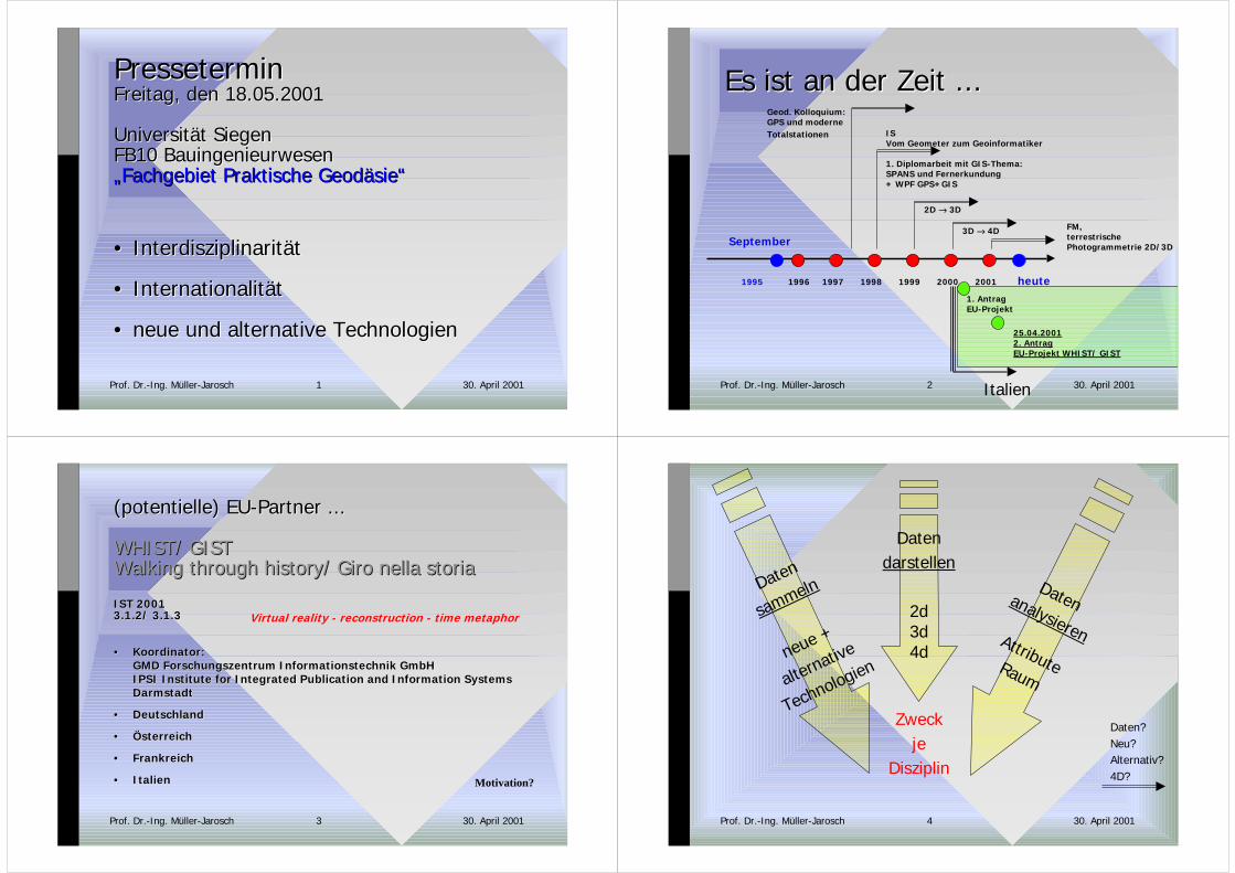
30. April 2001Prof. Dr.-Ing. Müller-Jarosch 1
PresseterminPresseterminFreitag, den 18.05.2001Freitag, den 18.05.2001
Universität SiegenUniversität SiegenFB10 BauingenieurwesenFB10 Bauingenieurwesen„Fachgebiet Praktische „Fachgebiet Praktische GeodäsieGeodäsie““
•• InterdisziplinaritätInterdisziplinarität
•• InternationalitätInternationalität
•• neue und alternative Technologienneue und alternative Technologien
30. April 2001Prof. Dr.-Ing. Müller-Jarosch 2
Es ist an der Zeit ...Es ist an der Zeit ...
1995
September
19981996 1997 1999 2000 2001
Italien
heute1. AntragEU-Projekt
25.04.20012. AntragEU-Projekt WHIST/ GIST
Geod. Kolloquium:GPS und moderneTotalstationen IS
Vom Geometer zum Geoinformatiker
1. Diplomarbeit mit GIS-Thema:SPANS und Fernerkundung+ WPF GPS+GIS
2D → 3D
3D → 4D FM,terrestrische Photogrammetrie 2D/3D
30. April 2001Prof. Dr.-Ing. Müller-Jarosch 3
(potentielle) EU-Partner ...(potentielle) EU-Partner ...
WHIST/ GISTWHIST/ GISTWalking Walking through historythrough history/ Giro / Giro nella storianella storia
IST 2001IST 20013.1.2/ 3.1.33.1.2/ 3.1.3
•• KoordinatorKoordinator::GMD Forschungszentrum Informationstechnik GmbHGMD Forschungszentrum Informationstechnik GmbHIPSI Institute IPSI Institute for Integrated Publication and for Integrated Publication and Information SystemsInformation SystemsDarmstadtDarmstadt
•• DeutschlandDeutschland
•• ÖsterreichÖsterreich
•• FrankreichFrankreich
•• ItalienItalien
Virtual reality - reconstruction - time metaphor
Motivation?
30. April 2001Prof. Dr.-Ing. Müller-Jarosch 4
Daten
sammeln
neue +
alternative
Technologien
DatenanalysierenAttributeRaum
Datendarstellen
2d3d4d
Zweckje
Disziplin
Daten?Neu?Alternativ?4D?

30. April 2001Prof. Dr.-Ing. Müller-Jarosch 5
Daten
sammeln
Totalstationen
GPS-Empfänger
Bilder!
Fernerkundung
und
terrestrische
Photogrammetrie
DatenanalysierenIS
Grafik+Datenbank
Datendarstellen
2d3d4d
Zweckje
Disziplinrealistisch?
30. April 2001Prof. Dr.-Ing. Müller-Jarosch 6
Motivation der Motivation der aktuellenaktuellen Austellungsveranstalter Austellungsveranstalterund Kooperationspartnerund Kooperationspartner
OTTO DER GROSSEOTTO DER GROSSEVOLTERRA UND EUROPAVOLTERRA UND EUROPA
Kulturhistorische AusstellungKulturhistorische Ausstellung2. September bis 5. November 20012. September bis 5. November 2001Volterra Volterra - - ToskanaToskana
•• Schirmherrschaft: Schirmherrschaft: Commune di VolterraCommune di Volterra
•• Veranstalter: Villa Veranstalter: Villa Palagione Palagione - - Centro InterculturaleCentro Interculturale
•• in Zusammenarbeit:in Zusammenarbeit:- kulturhistorisches Museum Magdeburg- kulturhistorisches Museum Magdeburg- Kloster - Kloster Seon Seon - Kultur-u. Bildungszentrum des Bezirks Bayern- Kultur-u. Bildungszentrum des Bezirks Bayern- - Laboratorio Universitario Europeo VolterraLaboratorio Universitario Europeo Volterra- Universitäten - Universitäten PisaPisa, , SiegenSiegen und Weimar. und Weimar.
30. April 2001Prof. Dr.-Ing. Müller-Jarosch 7
Viel griffiger:Viel griffiger:ein Bild der Situation!ein Bild der Situation!
30. April 2001Prof. Dr.-Ing. Müller-Jarosch 8
Toscana
30. April 2001Prof. Dr.-Ing. Müller-Jarosch 9
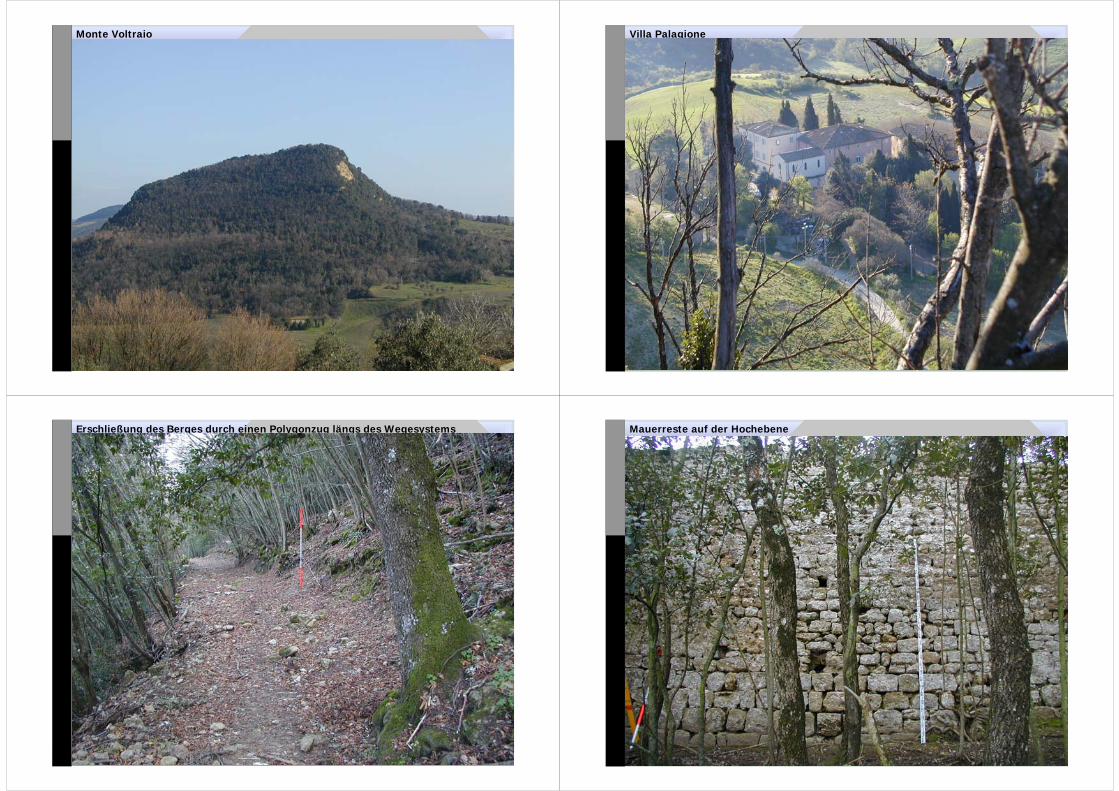
Monte Voltraio
30. April 2001Prof. Dr.-Ing. Müller-Jarosch 10
Villa Palagione
30. April 2001Prof. Dr.-Ing. Müller-Jarosch 11
Erschließung des Berges durch einen Polygonzug längs des Wegesystems
30. April 2001Prof. Dr.-Ing. Müller-Jarosch 12
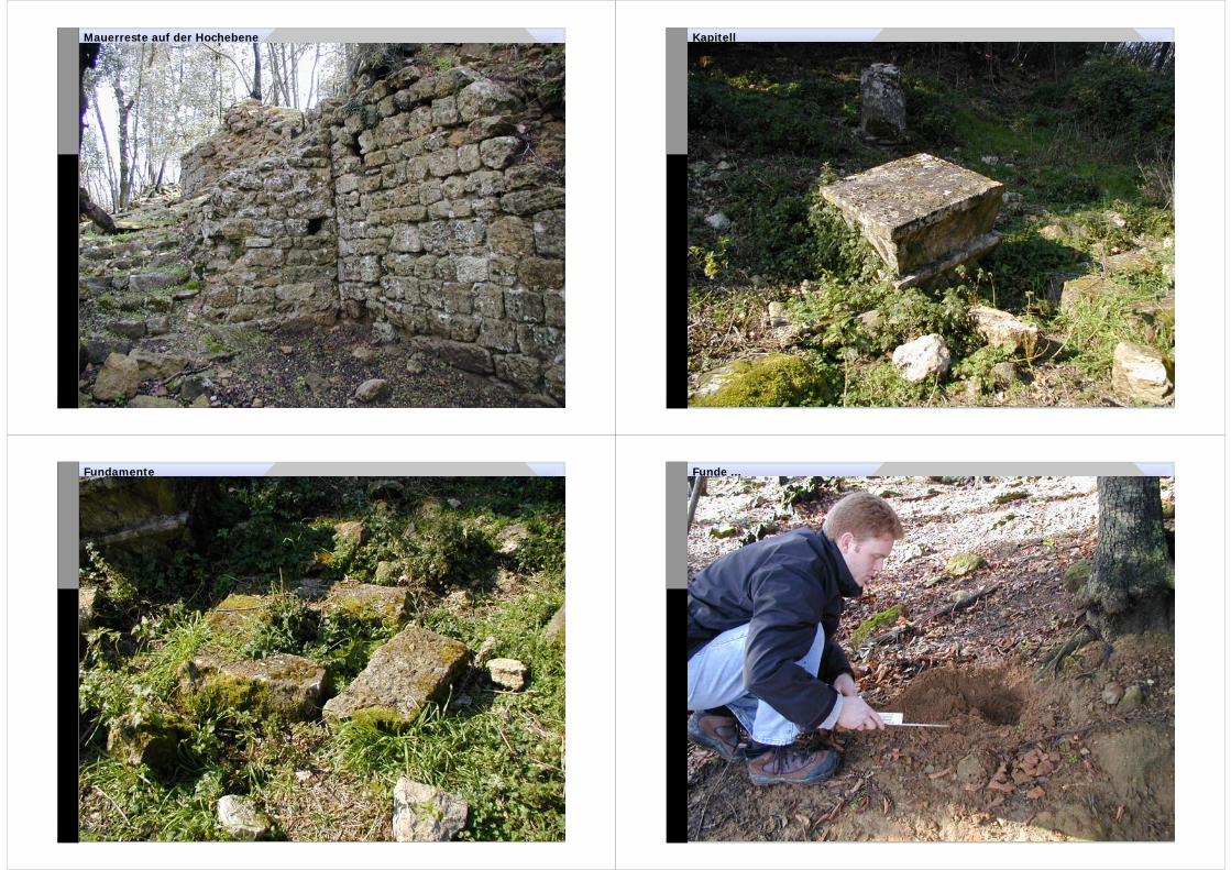
Mauerreste auf der Hochebene
30. April 2001Prof. Dr.-Ing. Müller-Jarosch 13
Mauerreste auf der Hochebene
30. April 2001Prof. Dr.-Ing. Müller-Jarosch 14
Kapitell
30. April 2001Prof. Dr.-Ing. Müller-Jarosch 15
Fundamente
30. April 2001Prof. Dr.-Ing. Müller-Jarosch 16
Funde ...

30. April 2001Prof. Dr.-Ing. Müller-Jarosch 17
Funde ...
30. April 2001Prof. Dr.-Ing. Müller-Jarosch 18
Zusammentreffen der Disziplinen ...
To To Visualize HistoryVisualize History......
ProfProf. Dr.-. Dr.-IngIng. Monika Müller-. Monika Müller-JaroschJaroschUniversität-GH SiegenUniversität-GH Siegen
30. April 2001University of Pisa
30. April 2001Prof. Dr.-Ing. Müller-Jarosch 20
Historical Historical Information SystemInformation SystemKnowKnow--howhow and Applicationand Application
•• Basics Basics ... an ... an idea idea in in mindmind!!
•• The The Instrument ... IS ... GIS - SIS - HISInstrument ... IS ... GIS - SIS - HIS
•• How How to to UseUse??
•• Motivation to Motivation to do itdo it!!
30. April 2001Prof. Dr.-Ing. Müller-Jarosch 21
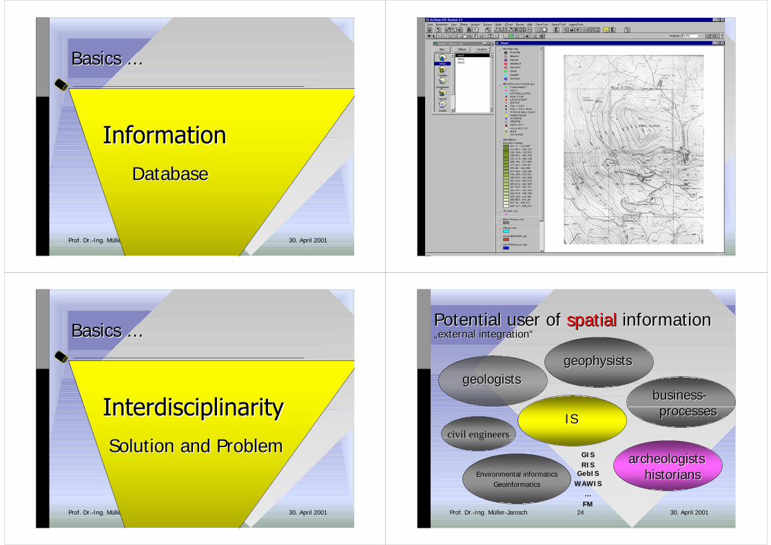
Basics Basics ......
Database Database
30. April 2001Prof. Dr.-Ing. Müller-Jarosch 22
30. April 2001Prof. Dr.-Ing. Müller-Jarosch 23
Basics Basics ......
Solution and Solution and ProblemProblem
30. April 2001Prof. Dr.-Ing. Müller-Jarosch 24
Environmental informaticsGeoinformatics
civil engineers
Potential Potential user ofuser of spatialspatial informationinformation„„external integrationexternal integration““
ISIS
geologistsgeologistsgeophysistsgeophysists
GISRIS
GebISWAWIS
...FM
businessbusiness-- processesprocesses
archeologistsarcheologistshistorianshistorians
30. April 2001Prof. Dr.-Ing. Müller-Jarosch 25 30. April 2001Prof. Dr.-Ing. Müller-Jarosch 26
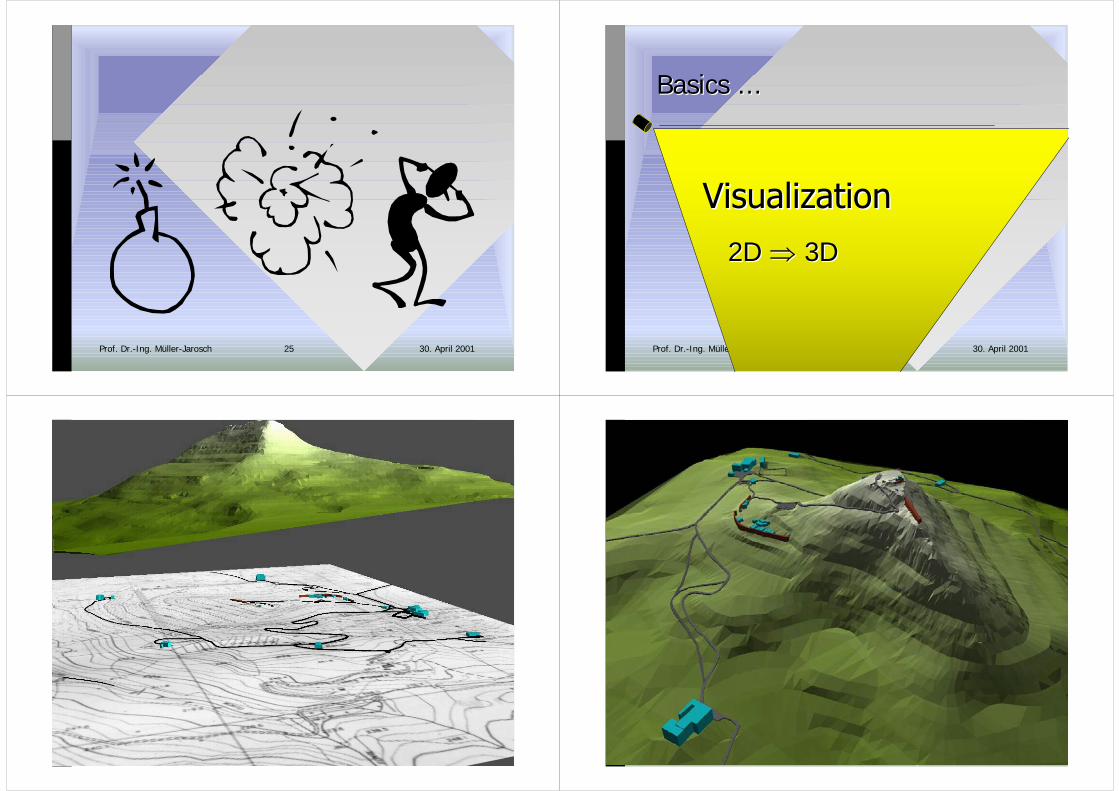
Basics Basics ......
2D 2D �� 3D 3D
30. April 2001Prof. Dr.-Ing. Müller-Jarosch 27 30. April 2001Prof. Dr.-Ing. Müller-Jarosch 28
30. April 2001Prof. Dr.-Ing. Müller-Jarosch 29 30. April 2001Prof. Dr.-Ing. Müller-Jarosch 30
30. April 2001Prof. Dr.-Ing. Müller-Jarosch 31
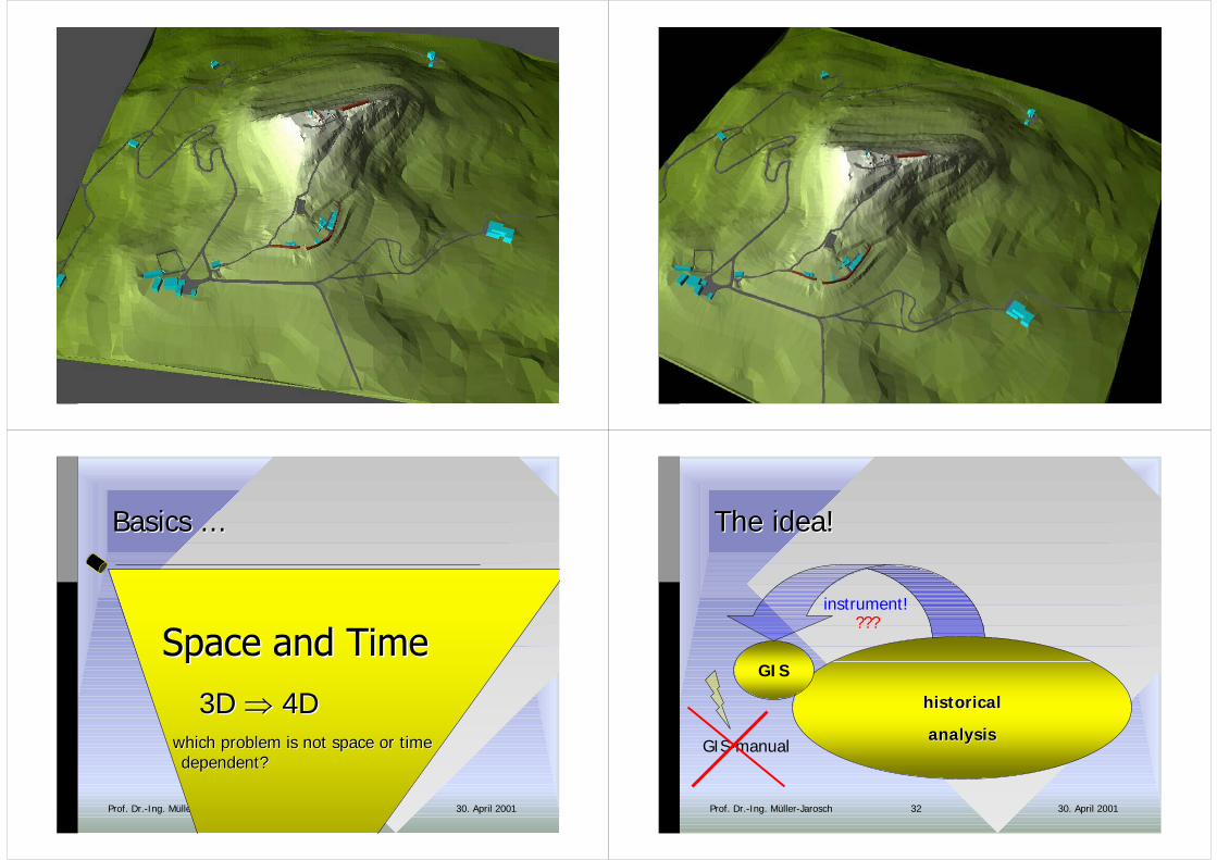
BasicsBasics ... ...
3D 3D �� 4D 4D which problem is which problem is not not space or timespace or time
dependentdependent??
30. April 2001Prof. Dr.-Ing. Müller-Jarosch 32
instrument!
The ideaThe idea!!
historicalhistorical
analysisanalysis
GIS
GIS-manual
???
30. April 2001Prof. Dr.-Ing. Müller-Jarosch 33
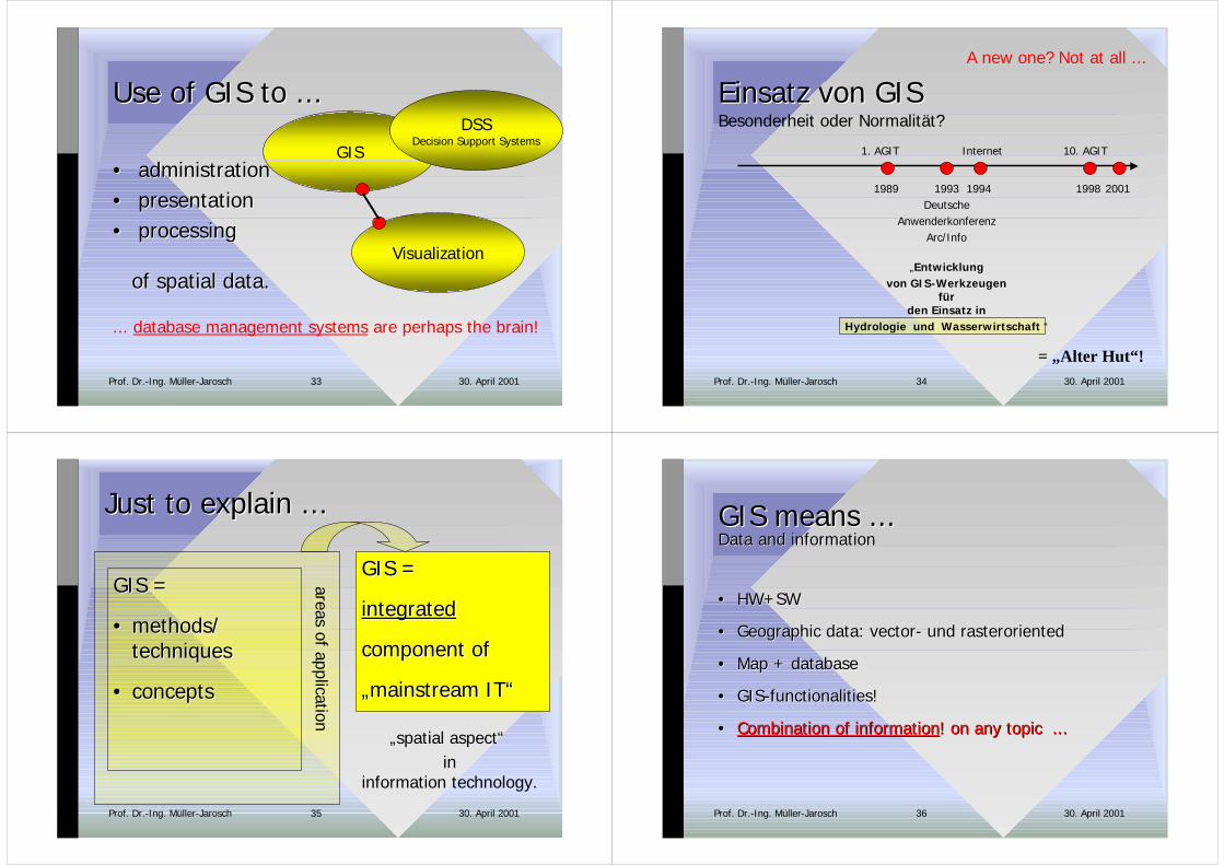
Use ofUse of GIS to ... GIS to ...
•• administrationadministration•• presentation presentation•• processing processing
ofof spatialspatial datadata..Visualization
GIS
DSSDecision Support Systems
... database management systems are perhaps the brain!
30. April 2001Prof. Dr.-Ing. Müller-Jarosch 34
Einsatz von GISEinsatz von GIS
2001
= „Alter Hut“!
Besonderheit oder Normalität?
1998
10. AGIT
1989
1. AGIT
1993Deutsche
AnwenderkonferenzArc/Info
„Entwicklungvon GIS-Werkzeugen
fürden Einsatz in
Hydrologie und Wasserwirtschaft “
1994
Internet
A new one? Not at all ...
30. April 2001Prof. Dr.-Ing. Müller-Jarosch 35
Just to Just to explain explain ......
GIS =GIS =
•• methodsmethods//techniquestechniques
•• conceptsconcepts
areas of application
GIS =GIS =
integratedintegrated
component ofcomponent of
„„mainstream mainstream IT“IT“
„spatial aspect“ in
information technology.
30. April 2001Prof. Dr.-Ing. Müller-Jarosch 36
GIS GIS means means ......DataData andand informationinformation
•• HW+SWHW+SW
•• Geographic dataGeographic data: : vectorvector- und - und rasterorientedrasteroriented
•• MapMap + + databasedatabase
•• GIS-GIS-functionalitiesfunctionalities!!
•• CombinationCombination ofof informationinformation! ! on any topic on any topic ......

30. April 2001Prof. Dr.-Ing. Müller-Jarosch 37
GIS-GIS-functionalitiesfunctionalities::Analysis of spatial dataAnalysis of spatial data
•• analysisanalysis ofof attributesattributes((sort of tilessort of tiles, , measures of stonesmeasures of stones, , sort of mortarsort of mortar...)...)databasesdatabases
•• analysisanalysis accordingaccording to to topologictopologic criteriacriteria... ... distancesdistances - - neighbourhoodneighbourhood - - bufferbuffer
as a model of reality!
30. April 2001Prof. Dr.-Ing. Müller-Jarosch 38
SpatialSpatial AnalysisAnalysisFunctionalitiesFunctionalities ofof a GIS a GIS
Features near other features: orders ...• Buffer• Disolve• Merge• Intersect• Union• Spatial Join
Horizontal dimension: computation of distances
Vertical dimension: analysis of the relation between different themes, such as topography, vegetation etc.
classificationclassificationclassificationattribute � criterium �
classes of objects
30. April 2001Prof. Dr.-Ing. Müller-Jarosch 39
KnowKnow--HowHow•• Coordinate systemsCoordinate systems
•• Map projectionsMap projections
•• GeoreferencingGeoreferencing
Use it!
30. April 2001Prof. Dr.-Ing. Müller-Jarosch 40
How How to to useuse??
Historical Historical Information SystemInformation System
30. April 2001Prof. Dr.-Ing. Müller-Jarosch 41
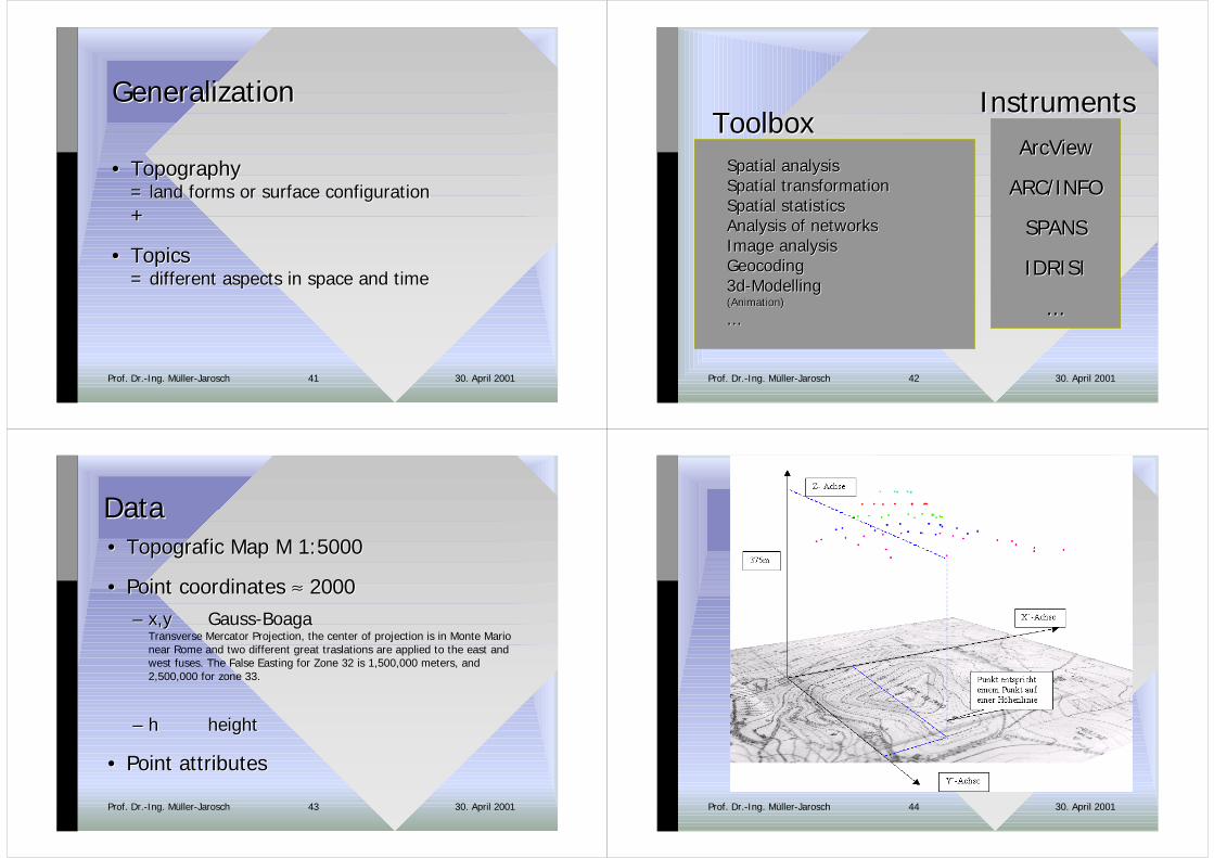
GeneralizationGeneralization
•• TopographyTopography= = land forms or surface configurationland forms or surface configuration++
•• TopicsTopics= different = different aspects aspects in in space and timespace and time
30. April 2001Prof. Dr.-Ing. Müller-Jarosch 42
InstrumentsInstrumentsArcViewArcView
ARC/INFOARC/INFO
SPANSSPANS
IDRISIIDRISI
......
ToolboxToolboxSpatialSpatial analysisanalysisSpatialSpatial transformationtransformationSpatialSpatial statisticsstatisticsAnalysisAnalysis ofof networksnetworksImage Image analysisanalysisGeocodingGeocoding3d-3d-ModellingModelling(Animation)(Animation)
......
30. April 2001Prof. Dr.-Ing. Müller-Jarosch 43
DataData•• Topografic Map Topografic Map M 1:5000M 1:5000
•• Point coordinates Point coordinates ≈≈ 2000 2000–– x,yx,y GaussGauss--BoagaBoaga
Transverse Mercator Projection, the center of projection is in Monte Marionear Rome and two different great traslations are applied to the east andwest fuses. The False Easting for Zone 32 is 1,500,000 meters, and2,500,000 for zone 33.
–– hh heightheight
•• Point attributesPoint attributes
30. April 2001Prof. Dr.-Ing. Müller-Jarosch 44
30. April 2001Prof. Dr.-Ing. Müller-Jarosch 45
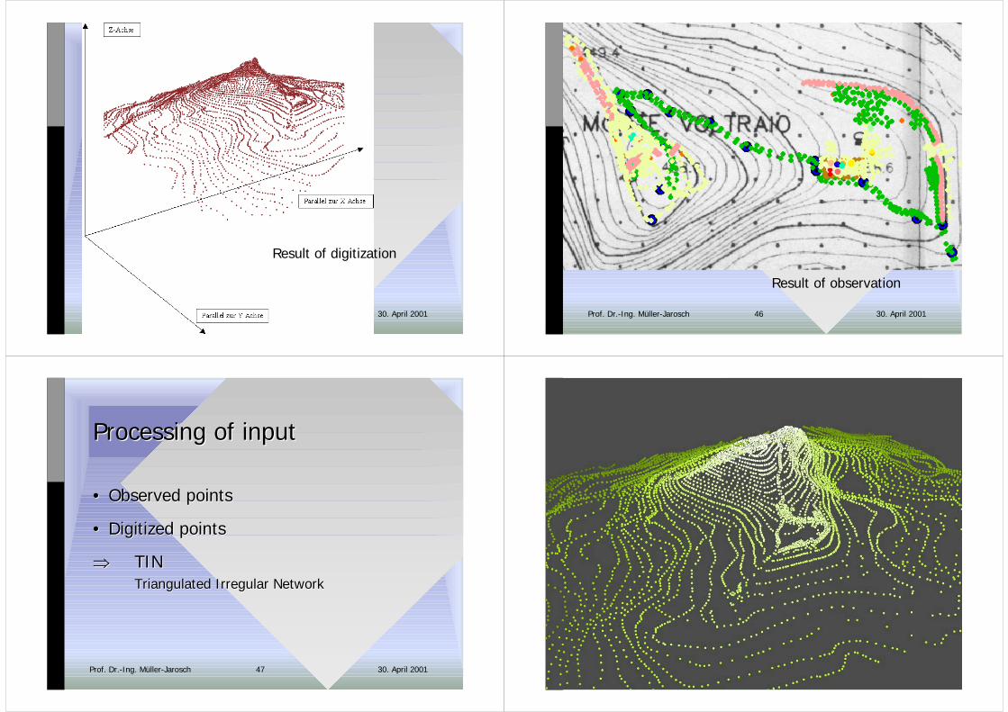
Result of digitization
30. April 2001Prof. Dr.-Ing. Müller-Jarosch 46
Result of observation
30. April 2001Prof. Dr.-Ing. Müller-Jarosch 47
ProcessingProcessing ofof inputinput
•• Observed pointsObserved points
•• Digitized pointsDigitized points
�� TINTINTriangulated Irregular Triangulated Irregular NetworkNetwork
30. April 2001Prof. Dr.-Ing. Müller-Jarosch 48
30. April 2001Prof. Dr.-Ing. Müller-Jarosch 49 30. April 2001Prof. Dr.-Ing. Müller-Jarosch 50
30. April 2001Prof. Dr.-Ing. Müller-Jarosch 51
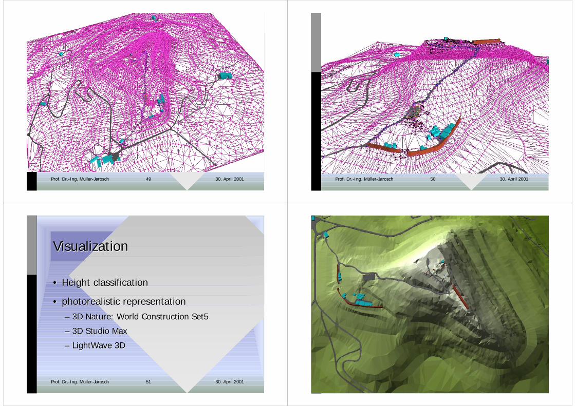
VisualizationVisualization
•• Height classificationHeight classification
•• photorealistic representationphotorealistic representation–– 3D 3D NatureNature: : World Construction World Construction Set5Set5
–– 3D Studio Max3D Studio Max
–– LightWaveLightWave 3D 3D
30. April 2001Prof. Dr.-Ing. Müller-Jarosch 52
30. April 2001Prof. Dr.-Ing. Müller-Jarosch 53 30. April 2001Prof. Dr.-Ing. Müller-Jarosch 54
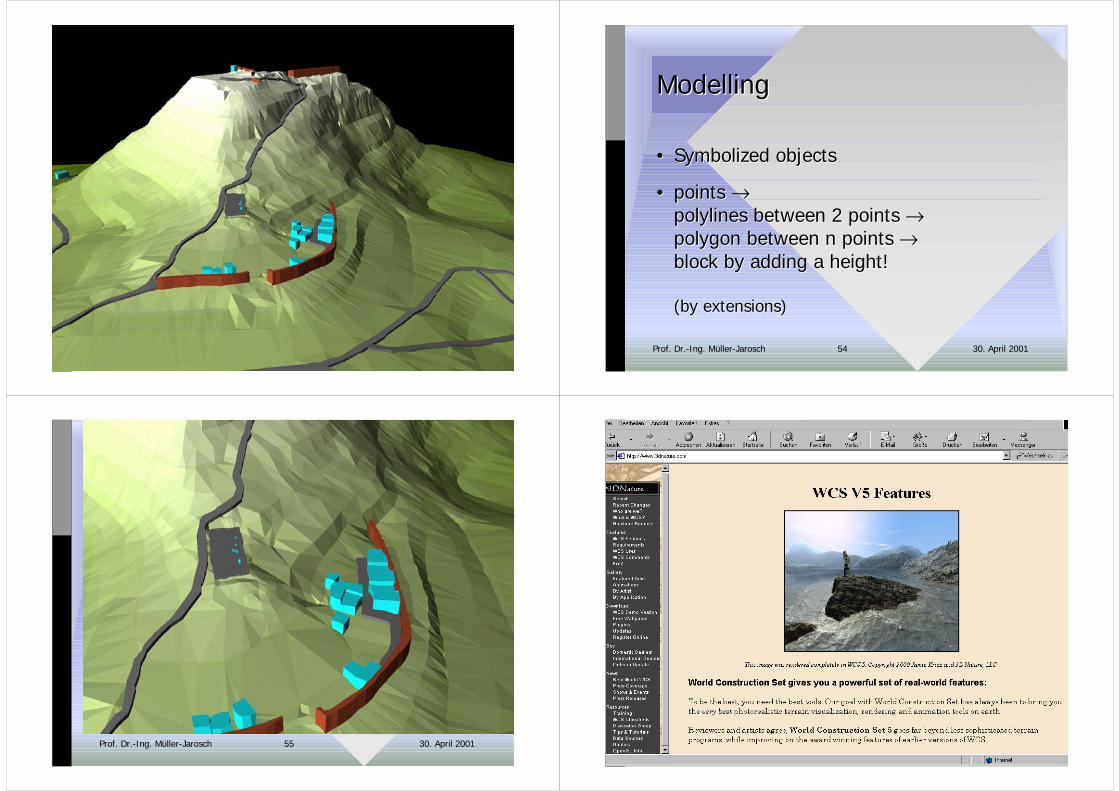
ModellingModelling
•• Symbolized objectsSymbolized objects
•• points points →→polylines between polylines between 2 2 pointspoints →→polygon between polygon between n n pointspoints →→block by adding block by adding a a heightheight!!
((by extensionsby extensions))
30. April 2001Prof. Dr.-Ing. Müller-Jarosch 55
InformationInformation
30. April 2001Prof. Dr.-Ing. Müller-Jarosch 56
30. April 2001Prof. Dr.-Ing. Müller-Jarosch 57 30. April 2001Prof. Dr.-Ing. Müller-Jarosch 58
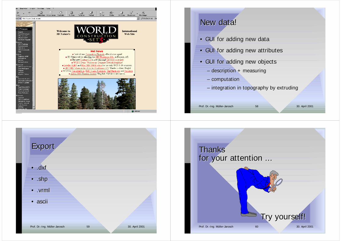
New New datadata!!
•• GUI GUI for adding new datafor adding new data
•• GUI GUI for adding new attributesfor adding new attributes
•• GUI GUI for adding new objectsfor adding new objects–– descriptiondescription + + measuring measuring
–– computationcomputation
–– integration integration in in topography by extrudingtopography by extruding
30. April 2001Prof. Dr.-Ing. Müller-Jarosch 59
ExportExport
•• ..dxfdxf
•• ..shpshp
•• ..vrmlvrml
•• asciiascii
30. April 2001Prof. Dr.-Ing. Müller-Jarosch 60
ThanksThanksforfor youryour attention attention ......
Try yourselfTry yourself!!
30. April 2001Prof. Dr.-Ing. Müller-Jarosch 61
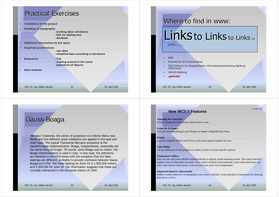
Practical ExercisesPractical Exercises•• Installation Installation of the projectof the project
•• Handling of topographyHandling of topography::-- existing data existing data++attributesattributes- GUI- GUI for adding new for adding new - - databasedatabase
•• Additional information by hot spotsAdditional information by hot spots
•• Graphical presentationGraphical presentation: : - - raw dataraw data- - classified data accordingclassified data according to to attributesattributes
•• EvaluationEvaluation:: - TIN- TIN-- walking around walking around in in the scenethe scene-- placement of objects placement of objects
•• Data AnalysisData Analysis
30. April 2001Prof. Dr.-Ing. Müller-Jarosch 62
to Links to Links toto
Links Links to Links ...to Links ...
•• ESRIESRI
•• Arbeitskreis GIS (Deutschland)Arbeitskreis GIS (Deutschland)
•• ZGIS Zentrum für Geographische Informationsverarbeitung SalzburgZGIS Zentrum für Geographische Informationsverarbeitung Salzburg(Österreich)(Österreich)
•• UNIGIS SalzburgUNIGIS Salzburg
•• „„geofindergeofinder““
Where Where to find in to find in wwwwww::
30. April 2001Prof. Dr.-Ing. Müller-Jarosch 63
GaussGauss--BoagaBoaga
• Mercator Trasverse, the center of projection is in Monte Mario nearRome and two different great traslations are applied to the east andwest fuses. The typical Transverse Mercator projection is theGauss/Krueger implementation. Boaga, independently, essentially didthe same thing as Kruger. Of course, since Boaga was an Italian, theBoaga implementation is used in Italy. In any case, the defintionsare identical to the UTM zones with the exception that the falseeastings are different, probably to prevent confusion between Gauss-Boaga and UTM. The False Easting for Zone 32 is 1,500,000 meters,and 2,500,000 for zone 33. Our information suggests that these arenormally referenced to the European Datum of 1950.
30. April 2001Prof. Dr.-Ing. Müller-Jarosch 64
New WCS 5 Features
Amazing New InterfaceWorld Construction Set is now much easier to use.
Scene-At-A-GlanceLets you see everything in your Project in simple collapsible list views.
MatrixLets you organize Editors and Views in the most logical manner for you.
Task ModesLet you hide parts of the program to make it easier to tweak specific options.
Component GalleryLets you use and reuse editable building blocks to quickly create amazing scenes. The visual interfacemakes it easy to find what you need. Your choice of Skies, Environments, Lakes and much more areonly a few mouse clicks away. You can even save your own Components!
Improved OpenGL InteractivityMakes it easier than ever to manipulate your scenes. Quickly create and place Components by drawingdirectly in a View.
1 von 13
30. April 2001Prof. Dr.-Ing. Müller-Jarosch 65
New Import WizardThe new Import Wizard makes importing a wide variety of data easier than ever. And now you candirectly import even more types of DEM and vector data, including SDTS, GTOPO30 and much more.
Improved Texture EngineNew interactive multi-band color gradient control makes it easier to make amazingly complex textureswhile using fewer actual components.
Extended Texture ApplicationsYou can now control many more aspects of the program with the powerful Texture Engine. This opensthe door to a whole new range of subtlety and nuance for the highest level of realism ever achieved in aprofessional, GIS-based terrain rendering package.
Better Terrain RenderingImproved antialiasing gives you better looking terrain without multi-pass antialiasing. You can still domulti-pass antialiasing if you choose.
12 New Instant Diagnostic PreviewsSee new visualizations of various rendering buffers showing Component areas, distances, relativeelevation, slope, reflection, illumination and more.
Improved 3D Object RenderingEnhanced antialisasing lets you render better looking 3D Objects faster. 3D Objects no longer have to beassociated with a visible terrain polygon in order to render.
2 von 13
30. April 2001Prof. Dr.-Ing. Müller-Jarosch 66
Improved Image Object RenderingBetter 3D-shading and dynamic range for foliage images make them even more believable. FoliageEffects no longer have to be associated with a visible terrain polygon in order to render.
Multiple CamerasRender multiple angles. Set up special cameras to monitor parts of your scene. Choose from a variety ofCamera types.
Flexible EcosystemsPlace a forest, plant a flowerbed, or clear the trees from building site. Great for parks, golf courses, andlandscaping. A single Ecosystem can now have multiple Materials, which can each have their ownoverstory, understory and ground overlay texturing for enhanced realism.
New Ecosystem Support for 3D TreesNow add 3D trees and other 3D Objects to your Ecosystems.
New Multiple EnvironmentsCreate entire collections of Ecosystems that you can restrict to specific areas. Fantastic control overfoliage even across different climate zones.
New Multiple Ground EffectsCover the terrain with realistic rock and ground textures independently of Ecosystems. MultipleMaterials include textures and Strata.
3 von 13
30. April 2001Prof. Dr.-Ing. Müller-Jarosch 67
Improved Foliage EffectsPlace individual Scaled Image foliage or 3D trees alone or in rows. Perfect for orchards, crops,landscaping, telephone poles, fence posts and road signs. Now supports 3D Objects.
New Multiple AtmospheresSimulate dust, smog, haze and fog that reacts to shadows and lights. Atmospheres let you createdramatic sunbeams and crepuscular ray effects.
Improved ShadowsEasily create better shadows from 3D Objects, clouds, foliage and terrain.
Multiple LightsSplash light where you need it to add interest and mood. Lights can be attached to Celestial Objects likethe sun and moon, cast shadows and affect the sky and atmosphere. Choose from a variety of light types.
True GIS Georeferenced RenderingAccurate latitude and longitude coordinates let you render real places where they belong on the planet.Use WCS alone or with other GIS software to visualize real places as they were, as they are now or asthey could be in the future.
Real Planet ModelTrue spherical terrain for accurate visualization of low level fly-overs and large-scale planet shots. Whenyou do fly-over animations the terrain will come up over the horizon like it should. When you moveyour camera up you'll see the curve of the horizon. Remember, the Earth is not flat!
4 von 13
30. April 2001Prof. Dr.-Ing. Müller-Jarosch 68
Unlimited Terrain RenderingWhy limit yourself? Render anything from close-up scenes to the entire planet. Whole Earth data,suitable for rendering the Earth from space, is included with the program.
Render Engine capability for additional workstationsWhen it comes time to render you can now use all the computing power at hand to speed up the process.When you run WCS without its hardware key it turns into a rendering engine! Render on separatemachines or across a network.
Animated Image ObjectsUse still images or animations for foliage, characters or other objects. Built-in luminance keying andchroma-keying. Choose from several kinds of shading for flat or 3Dimensional looks.
Image Sequencing and DissolvesUse the sequencing controls to edit complete movies within an Image Object. Slow motion, fast motionand dissolves are all at your command.
Image Color and Band ControlAlter color and contrast of Image Objects. Rearrange GIS color bands. Great for satellite datavisualization or foliage color control.
Extensive Image Object Tree LibraryHigh quality trees worthy of rendering close-up. New trees are included and you can create your owncustom trees. Any kind of tree is possible; you can even make forests of non-tree objects. Use an imagesequence and you can have animated trees!
5 von 13
30. April 2001Prof. Dr.-Ing. Müller-Jarosch 69
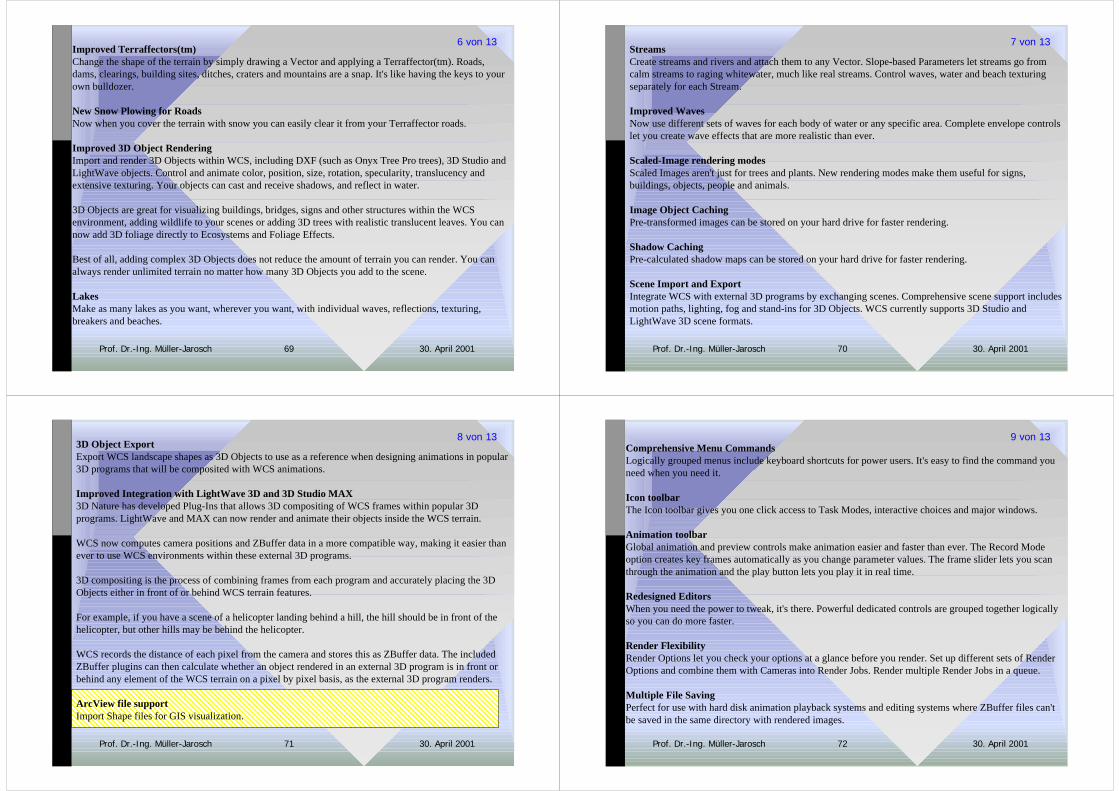
Improved Terraffectors(tm)Change the shape of the terrain by simply drawing a Vector and applying a Terraffector(tm). Roads,dams, clearings, building sites, ditches, craters and mountains are a snap. It's like having the keys to yourown bulldozer.
New Snow Plowing for RoadsNow when you cover the terrain with snow you can easily clear it from your Terraffector roads.
Improved 3D Object RenderingImport and render 3D Objects within WCS, including DXF (such as Onyx Tree Pro trees), 3D Studio andLightWave objects. Control and animate color, position, size, rotation, specularity, translucency andextensive texturing. Your objects can cast and receive shadows, and reflect in water.
3D Objects are great for visualizing buildings, bridges, signs and other structures within the WCSenvironment, adding wildlife to your scenes or adding 3D trees with realistic translucent leaves. You cannow add 3D foliage directly to Ecosystems and Foliage Effects.
Best of all, adding complex 3D Objects does not reduce the amount of terrain you can render. You canalways render unlimited terrain no matter how many 3D Objects you add to the scene.
LakesMake as many lakes as you want, wherever you want, with individual waves, reflections, texturing,breakers and beaches.
6 von 13
30. April 2001Prof. Dr.-Ing. Müller-Jarosch 70
StreamsCreate streams and rivers and attach them to any Vector. Slope-based Parameters let streams go fromcalm streams to raging whitewater, much like real streams. Control waves, water and beach texturingseparately for each Stream.
Improved WavesNow use different sets of waves for each body of water or any specific area. Complete envelope controlslet you create wave effects that are more realistic than ever.
Scaled-Image rendering modesScaled Images aren't just for trees and plants. New rendering modes make them useful for signs,buildings, objects, people and animals.
Image Object CachingPre-transformed images can be stored on your hard drive for faster rendering.
Shadow CachingPre-calculated shadow maps can be stored on your hard drive for faster rendering.
Scene Import and ExportIntegrate WCS with external 3D programs by exchanging scenes. Comprehensive scene support includesmotion paths, lighting, fog and stand-ins for 3D Objects. WCS currently supports 3D Studio andLightWave 3D scene formats.
7 von 13
30. April 2001Prof. Dr.-Ing. Müller-Jarosch 71
3D Object ExportExport WCS landscape shapes as 3D Objects to use as a reference when designing animations in popular3D programs that will be composited with WCS animations.
Improved Integration with LightWave 3D and 3D Studio MAX3D Nature has developed Plug-Ins that allows 3D compositing of WCS frames within popular 3Dprograms. LightWave and MAX can now render and animate their objects inside the WCS terrain.
WCS now computes camera positions and ZBuffer data in a more compatible way, making it easier thanever to use WCS environments within these external 3D programs.
3D compositing is the process of combining frames from each program and accurately placing the 3DObjects either in front of or behind WCS terrain features.
For example, if you have a scene of a helicopter landing behind a hill, the hill should be in front of thehelicopter, but other hills may be behind the helicopter.
WCS records the distance of each pixel from the camera and stores this as ZBuffer data. The includedZBuffer plugins can then calculate whether an object rendered in an external 3D program is in front orbehind any element of the WCS terrain on a pixel by pixel basis, as the external 3D program renders.
ArcView file supportImport Shape files for GIS visualization.
8 von 13
30. April 2001Prof. Dr.-Ing. Müller-Jarosch 72
Comprehensive Menu CommandsLogically grouped menus include keyboard shortcuts for power users. It's easy to find the command youneed when you need it.
Icon toolbarThe Icon toolbar gives you one click access to Task Modes, interactive choices and major windows.
Animation toolbarGlobal animation and preview controls make animation easier and faster than ever. The Record Modeoption creates key frames automatically as you change parameter values. The frame slider lets you scanthrough the animation and the play button lets you play it in real time.
Redesigned EditorsWhen you need the power to tweak, it's there. Powerful dedicated controls are grouped together logicallyso you can do more faster.
Render FlexibilityRender Options let you check your options at a glance before you render. Set up different sets of RenderOptions and combine them with Cameras into Render Jobs. Render multiple Render Jobs in a queue.
Multiple File SavingPerfect for use with hard disk animation playback systems and editing systems where ZBuffer files can'tbe saved in the same directory with rendered images.
9 von 13
30. April 2001Prof. Dr.-Ing. Müller-Jarosch 73
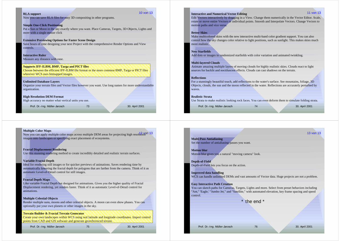
RLA supportNow you can save RLA files for easy 3D compositing in other programs.
Simple One-Click PositioningPut a Sun or Moon in the sky exactly where you want. Place Cameras, Targets, 3D Objects, Lights andmore with a single mouse click
Extensive Previewing Options for Faster Scene DesignSave hours of time designing your next Project with the comprehensive Render Options and Viewcontrols.
Interactive RulerMeasure any distance with ease.
Supports IFF-ILBM, BMP, Targa and PICT filesChoose between the efficient IFF-ILBM file format or the more common BMP, Targa or PICT fileswherever WCS uses bitmapped images.
Unlimited Database LayersOrganize your terrain files and Vector files however you want. Use long names for more understandableorganization.
High Resolution DEM FormatHigh accuracy no matter what vertical units you use.
10 von 13
30. April 2001Prof. Dr.-Ing. Müller-Jarosch 74
Interactive and Numerical Vector EditingEdit Vectors interactively by dragging in a View. Change them numerically in the Vector Editor. Scale,rotate or move entire Vectors or individual points. Smooth and Interpolate Vectors. Change Vectors tomotion paths and vice versa.
Better SkiesMake multicolored skies with the new interactive multi-band color gradient support. You can alsocontrol how the sky changes color relative to light positions, such as sunlight. This makes skies muchmore realistic.
New StarfieldsAdd dots or images in randomized starfields with color variation and animated twinkling.
Multi-layered CloudsAnimate amazing multiple layers of moving clouds for highly realistic skies. Clouds react to lightsources for backlit and noctiluscent effects. Clouds can cast shadows on the terrain.
ReflectionsFor a stunningly beautiful touch, add reflections to the water's surface. See mountains, foliage, 3DObjects, clouds, the sun and the moon reflected in the water. Reflections are accurately perturbed bywaves.
Realistic StrataUse Strata to make realistic looking rock faces. You can even deform them to simulate folding strata.
11 von 13
30. April 2001Prof. Dr.-Ing. Müller-Jarosch 75
Multiple Color MapsNow you can apply multiple color maps across multiple DEM areas for projecting high resolutionimages onto landscapes or specifying exact placement of ecosystems.
Fractal Displacement RenderingUse this stunning rendering method to create incredibly detailed and realistic terrain surfaces.
Variable Fractal DepthIdeal for rendering still images or for quicker previews of animations. Saves rendering time byautomatically lowering the fractal depth for polygons that are farther from the camera. Think of it asautomatic Level-of-Detail control for still images.
Fractal Depth MapsLike variable Fractal Depth but designed for animations. Gives you the higher quality of FractalDisplacement rendering, yet renders faster. Think of it as automatic Level-of-Detail control foranimations.
Multiple Celestial ObjectsRender multiple suns, moons and other celestial objects. A moon can even show phases. You canoptionally put your own planets or other images in the sky.
Terrain Builder & Fractal Terrain GeneratorCreate your own landscapes within WCS using real latitude and longitude coordinates. Import controlpoints from CAD and GIS software and generate georeferenced terrain.
12 von 13
30. April 2001Prof. Dr.-Ing. Müller-Jarosch 76
Multi-Pass AntialiasingSet the number of antialiasing passes you want.
Motion blurMotion blur gives you a natural "moving camera" look.
Depth-of-FieldDepth-of-Field lets you focus on the action.
Improved data handlingWCS can handle unlimited DEMs and vast amounts of Vector data. Huge projects are not a problem.
Easy Interactive Path CreationYou can sketch paths for Cameras, Targets, Lights and more. Select from preset behaviors including"Ant," 'Eagle,' "Jumbo Jet," and "Satellite," with automated elevation, key frame spacing and speedcontrol.
* the end *
13 von 13