Tatort Plattengrenze Renée Heilbronner - ROCK … · Entstehung ... supernova big bang Precambrian...
93
Renée Heilbronner Tatort Plattengrenze 5. Nov. 12. Nov. 19. Nov. 26. Nov.
-
Upload
nguyenkiet -
Category
Documents
-
view
223 -
download
0
Transcript of Tatort Plattengrenze Renée Heilbronner - ROCK … · Entstehung ... supernova big bang Precambrian...
Renée Heilbronner
Tatort Plattengrenze
5. Nov. 12. Nov. 19. Nov. 26. Nov.

was bisher geschah ....
Tatort : Konstruktive Plattengrenze
Mittelozeanischer Rücken produzieren ausschliesslich ozeanische Lithosphäre
Ozeane : < 180 Ma
Kontinente:4.5 Ga
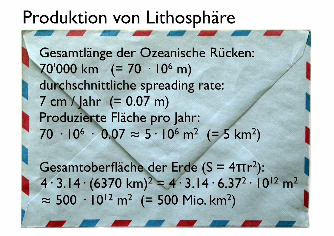
Produktion von Lithosphäre
Gesamtlänge der Ozeanische Rücken:70'000 km (= 70 · 106 m)durchschnittliche spreading rate:7 cm / Jahr (= 0.07 m)Produzierte Fläche pro Jahr:70 · 106 · 0.07 ≈ 5· 106 m2 (= 5 km2)
Gesamtoberfläche der Erde (S = 4πr2):4· 3.14· (6370 km)2 = 4· 3.14· 6.372· 1012 m2
≈ 500 · 1012 m2 (= 500 Mio. km2)

Produktion von Lithosphäre
im Verhältnis: ≈ 10-8
⇒in 108 Jahren (= 10 Ma) wird die Erdoberfläche verdoppelt !!
Da dies nicht geschieht ....muss die Oberfläche wieder vernichtet werden.
5· 106 m2
500 · 1012 m2
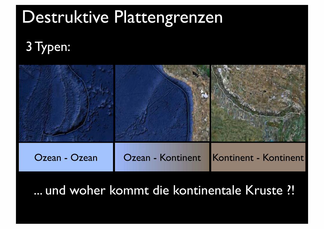
Destruktive Plattengrenzen
Ozean - Kontinent Kontinent - KontinentOzean - Ozean
... und woher kommt die kontinentale Kruste ?!
3 Typen:
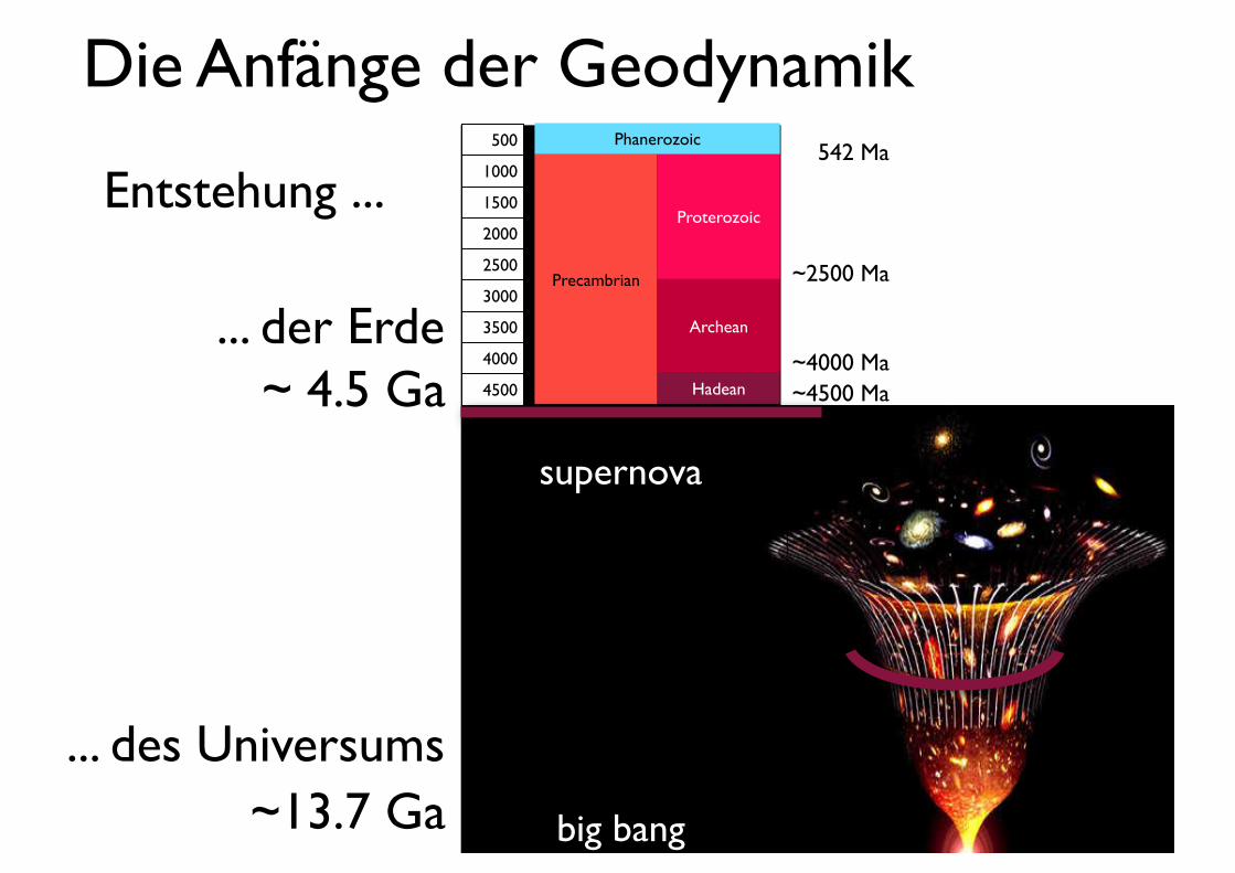
542 Ma
~2500 Ma
~4000 Ma~4500 Ma
Entstehung ...
supernova
big bang
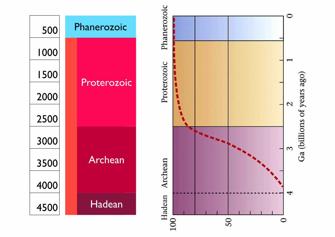
Precambrian
500
1000
1500
2000
2500
3000
3500
4000
4500 Hadean
Archean
Proterozoic
Phanerozoic
~13.7 Ga
~ 4.5 Ga
... des Universums
... der Erde
Die Anfänge der Geodynamik
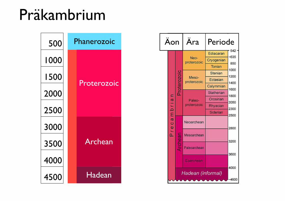
Phanerozoic500
1000
1500
2000
2500
3000
3500
4000
4500 Hadean
Archean
Proterozoic
PeriodeÄon Ära
Präkambrium
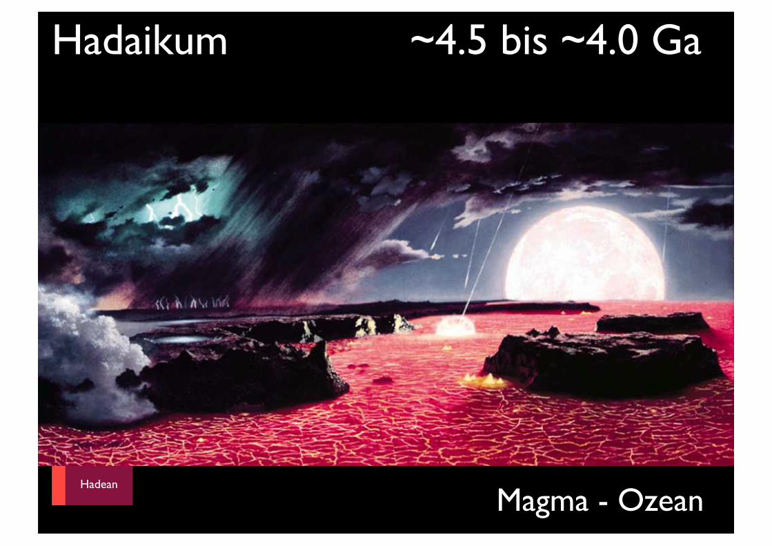
Hadaikum ~4.5 bis ~4.0 Ga
Phanerozoic
Hadean
Archean
Proterozoic
~500
~2500
~4000
Magma - Ozean
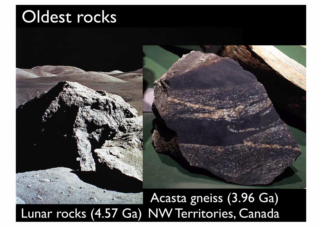
Oldest rocks
Lunar rocks (4.57 Ga) Acasta gneiss (3.96 Ga) NW Territories, Canada
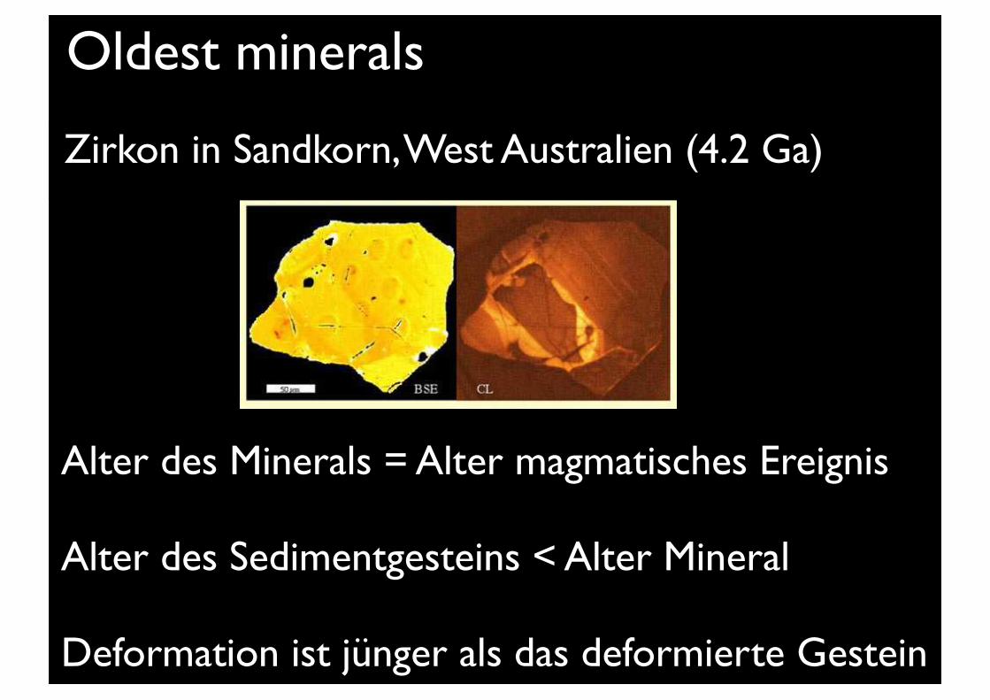
Oldest minerals
Alter des Minerals = Alter magmatisches Ereignis
Alter des Sedimentgesteins < Alter Mineral
Deformation ist jünger als das deformierte Gestein
Zirkon in Sandkorn, West Australien (4.2 Ga)

Phanerozoic
Hadean
Archean
Proterozoic
~500
~2500
~4000
Archaikum: Entwicklung der Kontinente
Hadean
Had
ean
Phanerozoic500
1000
1500
2000
2500
3000
3500
4000
4500 Hadean
Archean
Proterozoic
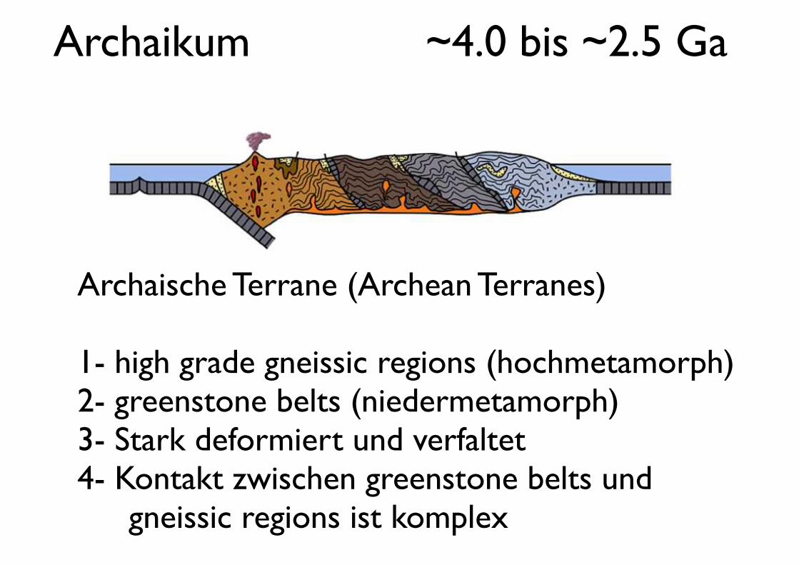
Archaikum ~4.0 bis ~2.5 Ga
Archaische Terrane (Archean Terranes)
1- high grade gneissic regions (hochmetamorph)2- greenstone belts (niedermetamorph)3- Stark deformiert und verfaltet4- Kontakt zwischen greenstone belts und
gneissic regions ist komplex
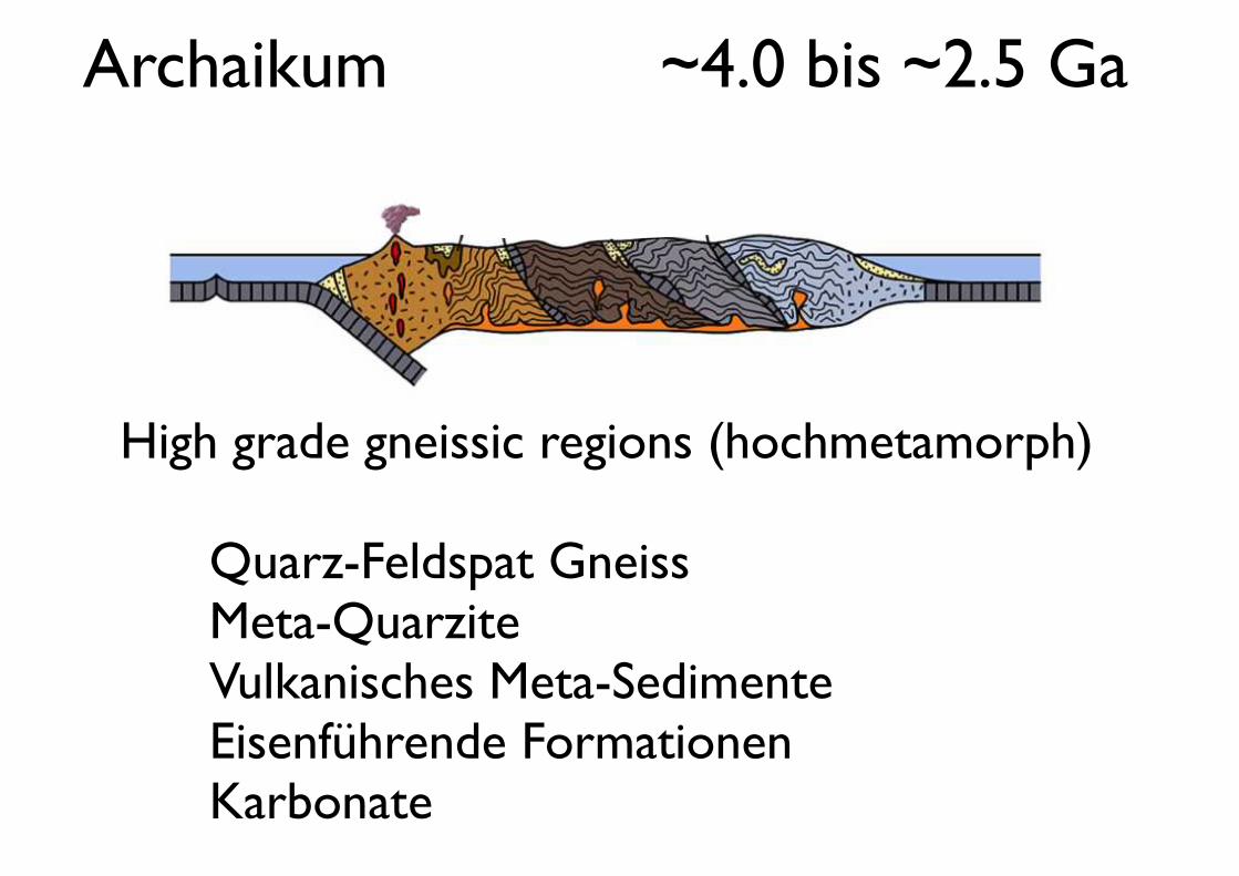
Archaikum ~4.0 bis ~2.5 Ga
High grade gneissic regions (hochmetamorph)
! ! Quarz-Feldspat Gneiss! ! Meta-Quarzite! ! Vulkanisches Meta-Sedimente! ! Eisenführende Formationen! ! Karbonate
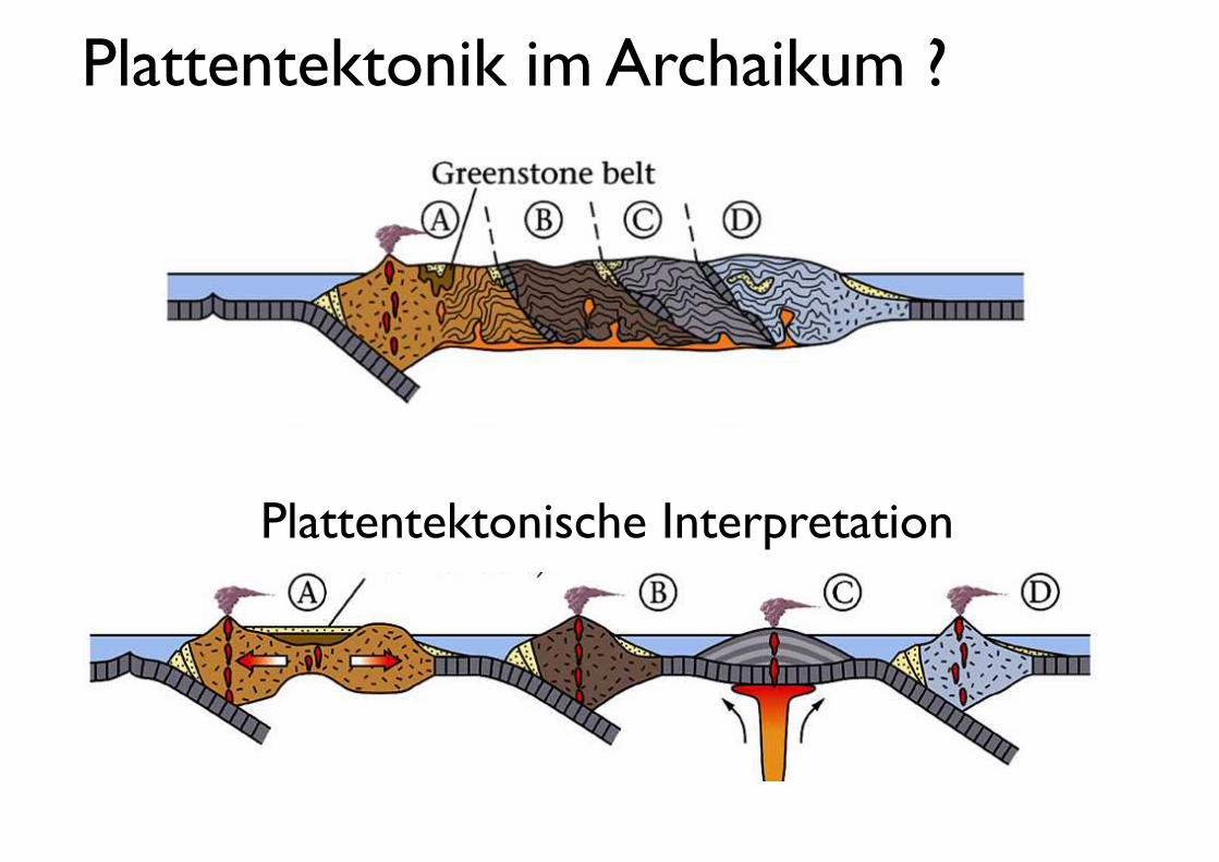
Plattentektonik im Archaikum ?
Plattentektonische Interpretation
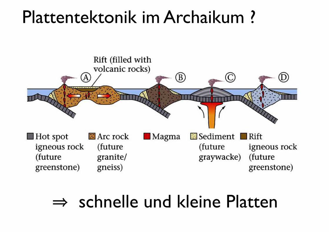
Plattentektonik im Archaikum ?
⇒ schnelle und kleine Platten
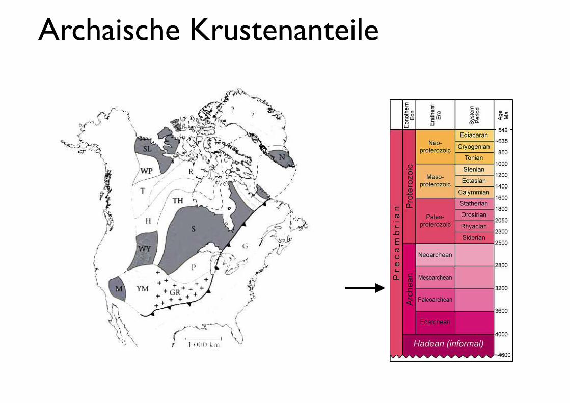
Archaische Krustenanteile
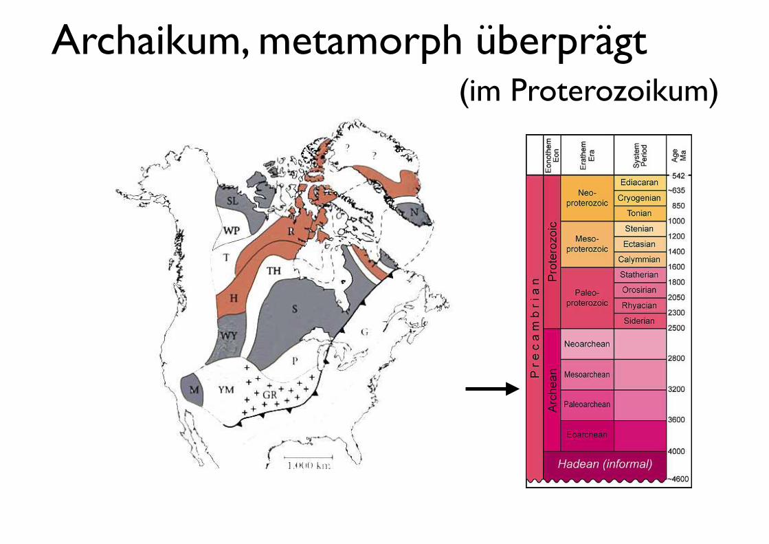
Archaikum, metamorph überprägt(im Proterozoikum)
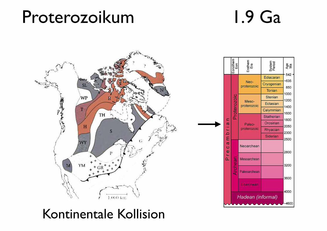
Proterozoikum 1.9 Ga
Kontinentale Kollision
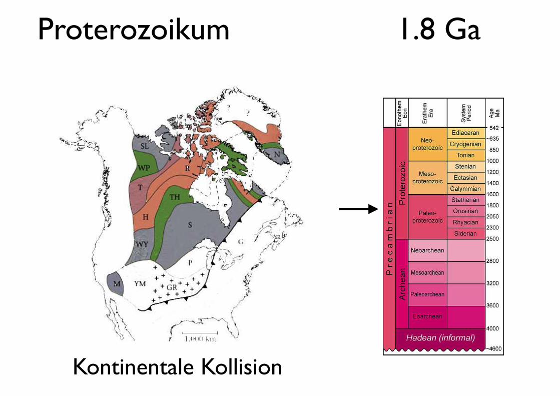
Proterozoikum 1.8 Ga
Kontinentale Kollision
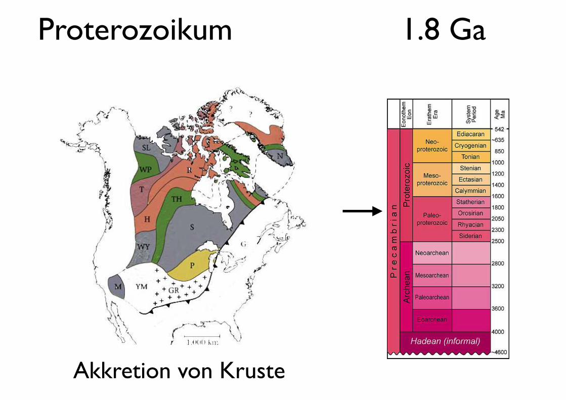
Proterozoikum 1.8 Ga
Akkretion von Kruste
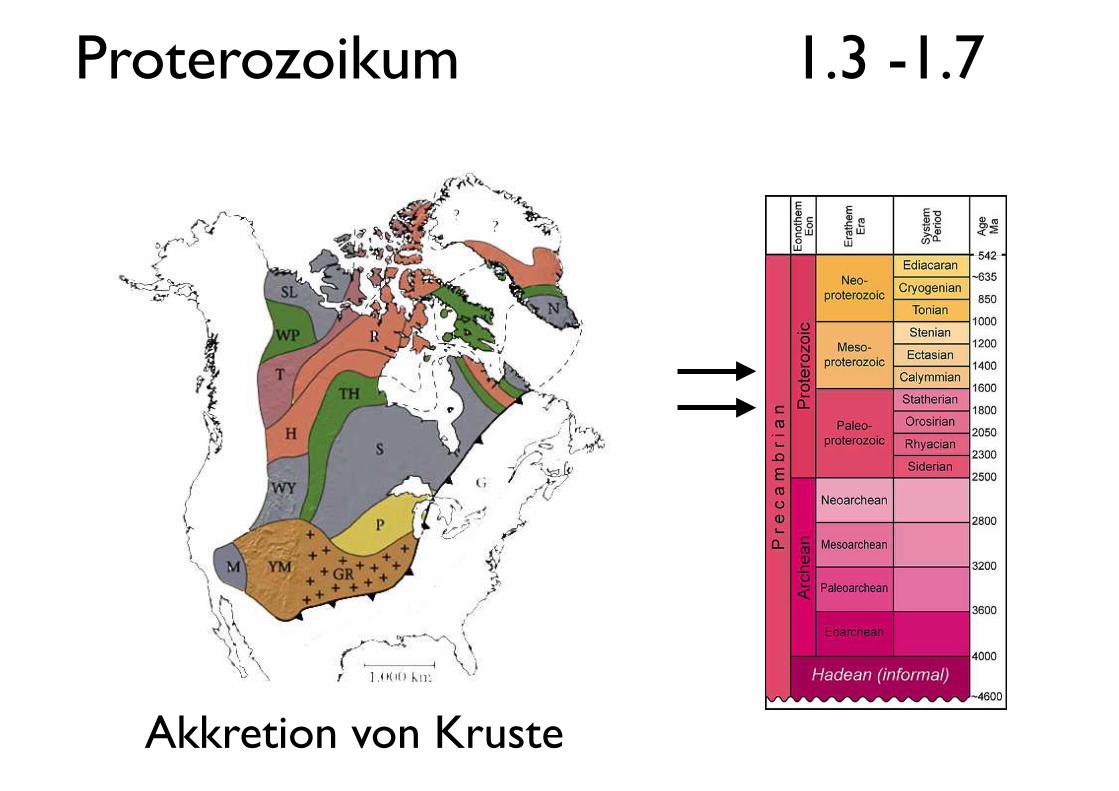
Proterozoikum 1.3 -1.7
Akkretion von Kruste
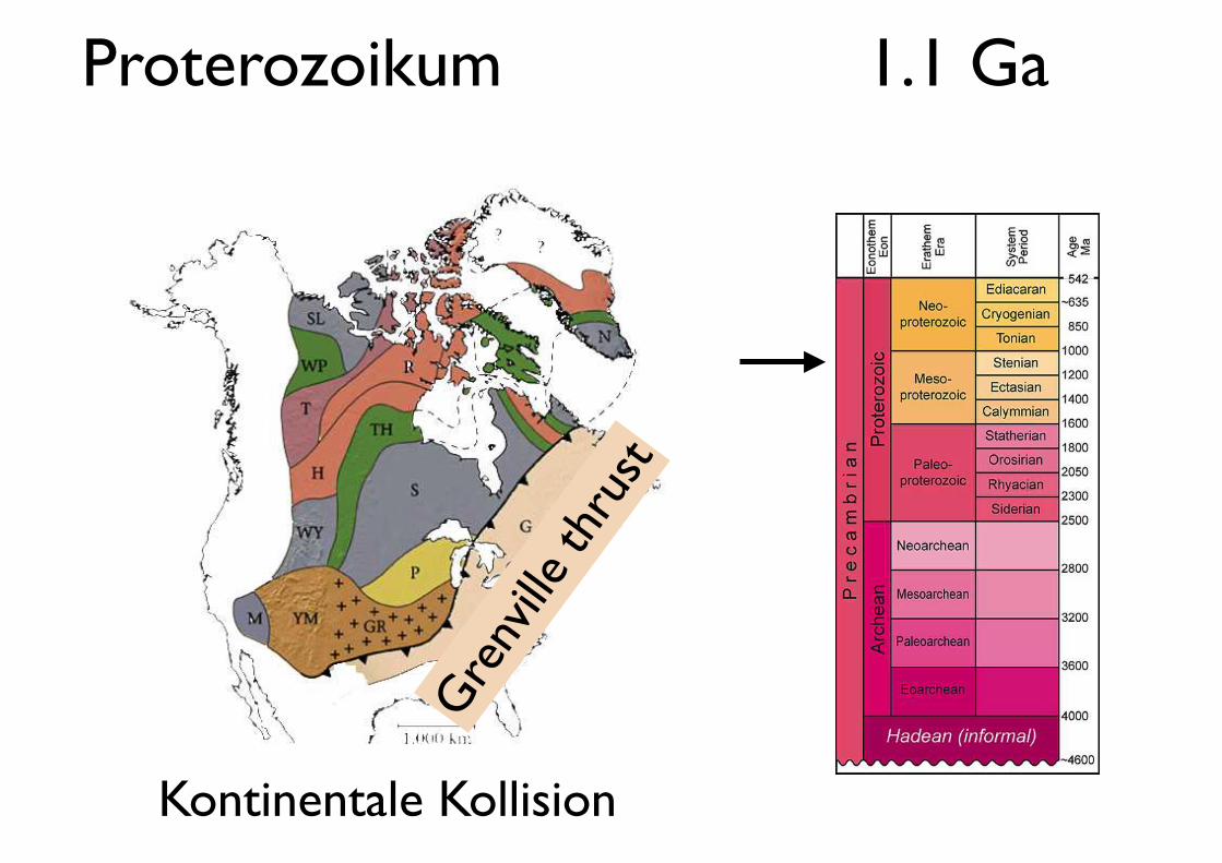
Proterozoikum 1.1 Ga
Gre
nville
thru
st
Kontinentale Kollision
Let's google !
http://earth.google.com
Ungava Bay
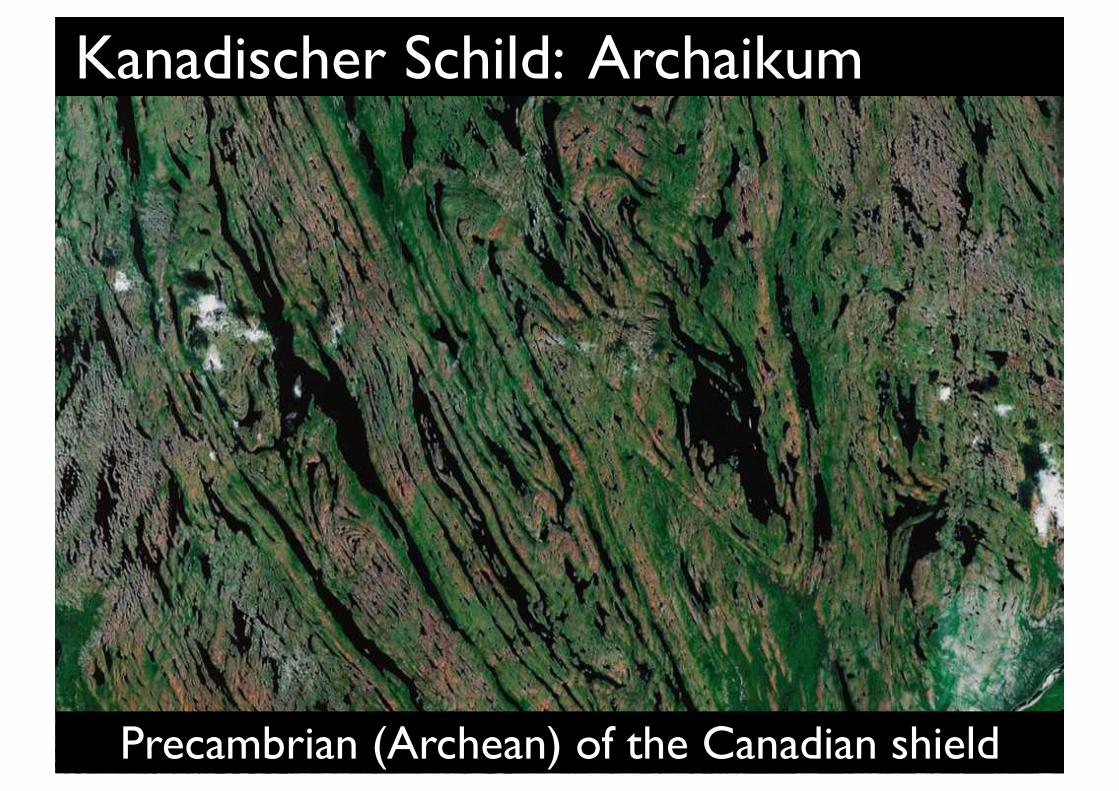
Kanadischer Schild: Archaikum
Precambrian (Archean) of the Canadian shield
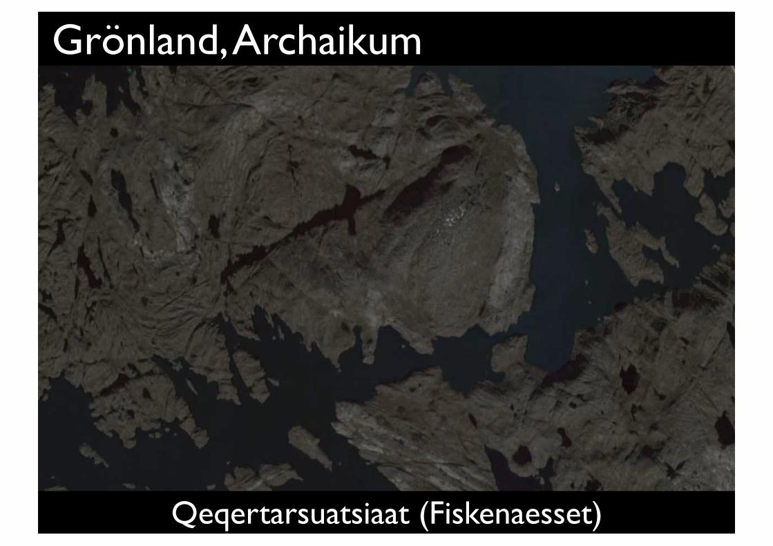
Grönland, Archaikum
Qeqertarsuatsiaat (Fiskenaesset)
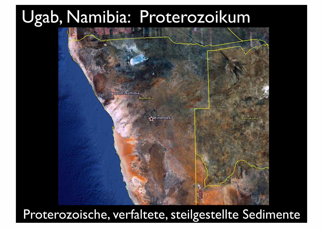
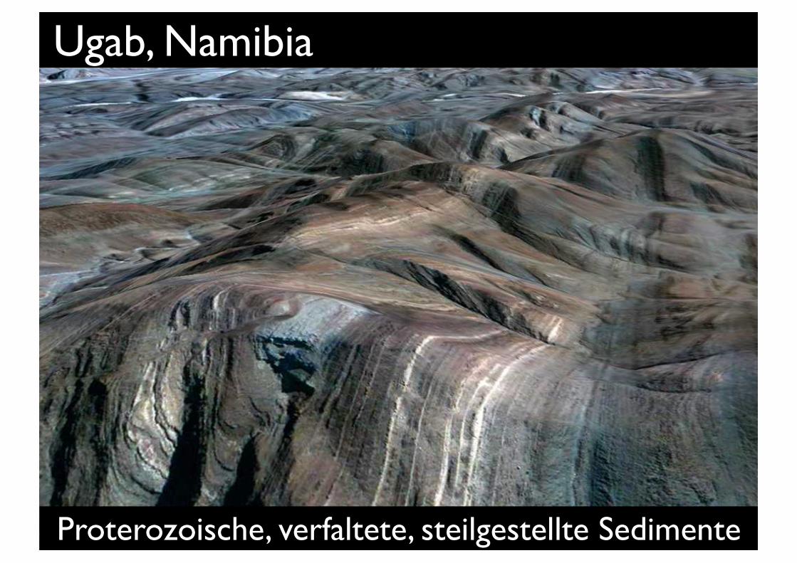
Ugab, Namibia: Proterozoikum
Proterozoische, verfaltete, steilgestellte Sedimente
Ugab, Namibia google Earth
Proterozoische, verfaltete, steilgestellte Sedimente
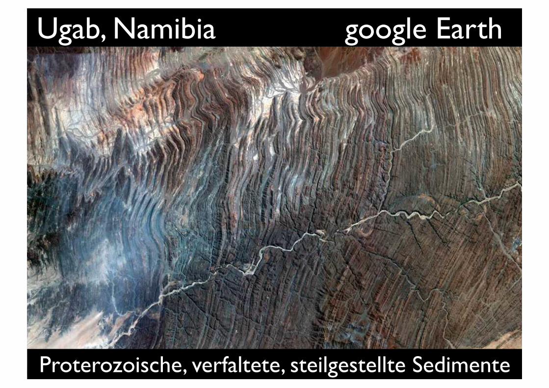
Ugab, Namibia
Proterozoische, verfaltete, steilgestellte Sedimente
Ugab, Namibia
Proterozoische, verfaltete, steilgestellte Sedimente
Ugab, Namibia
Proterozoische, verfaltete, steilgestellte Sedimente
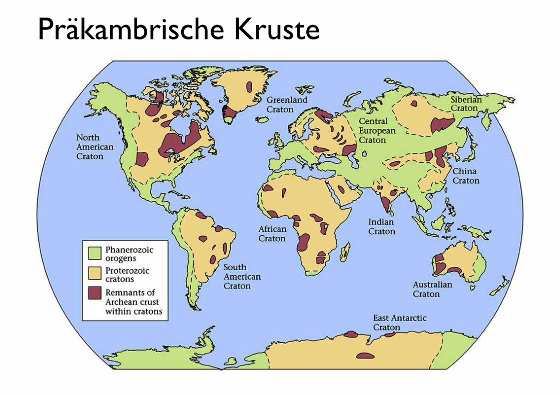
Präkambrische Kruste
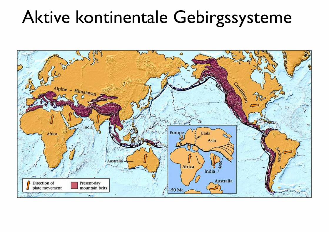
Aktive kontinentale Gebirgssysteme
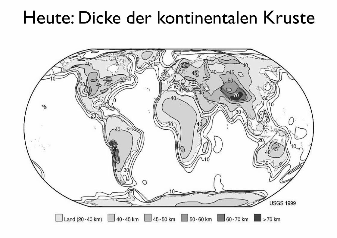
Heute: Dicke der kontinentalen Kruste
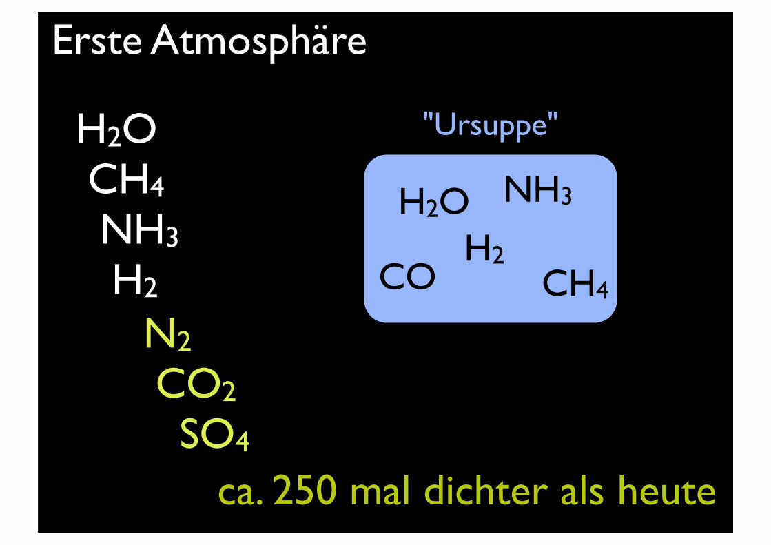
Erste Atmosphäre
H2O CH4
NH3
H2
N2
CO2
SO4
ca. 250 mal dichter als heute
H2OH2
NH3
CH4CO
"Ursuppe"
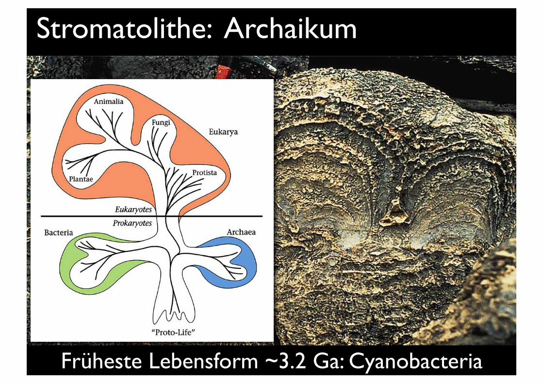
Stromatolithe: Archaikum
Früheste Lebensform ~3.2 Ga: Cyanobacteria
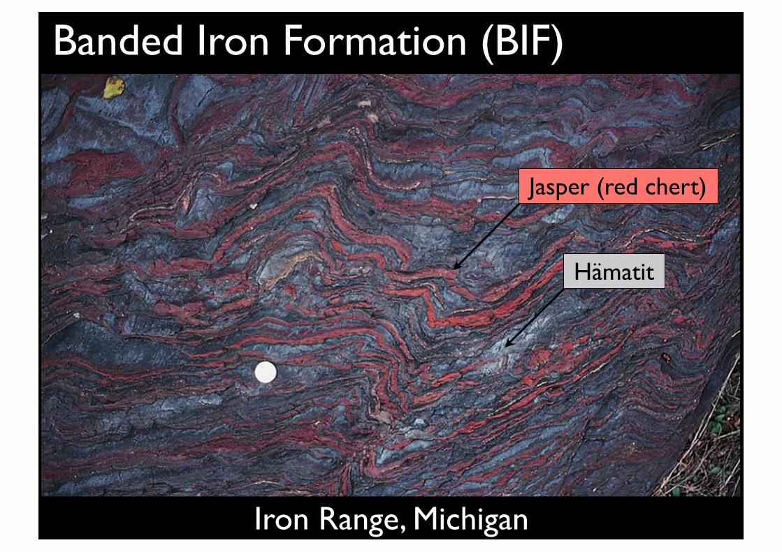
Banded Iron Formation (BIF)
Iron Range, Michigan
Jasper (red chert)
Hämatit
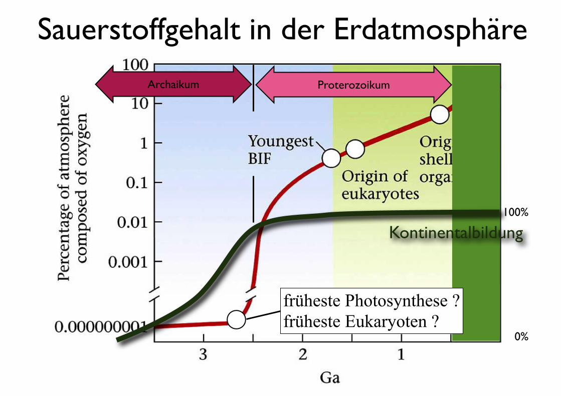
Sauerstoffgehalt in der Erdatmosphäre
früheste Photosynthese ?früheste Eukaryoten ?
ProterozoikumArchaikum
Kontinentalbildung100%
0%
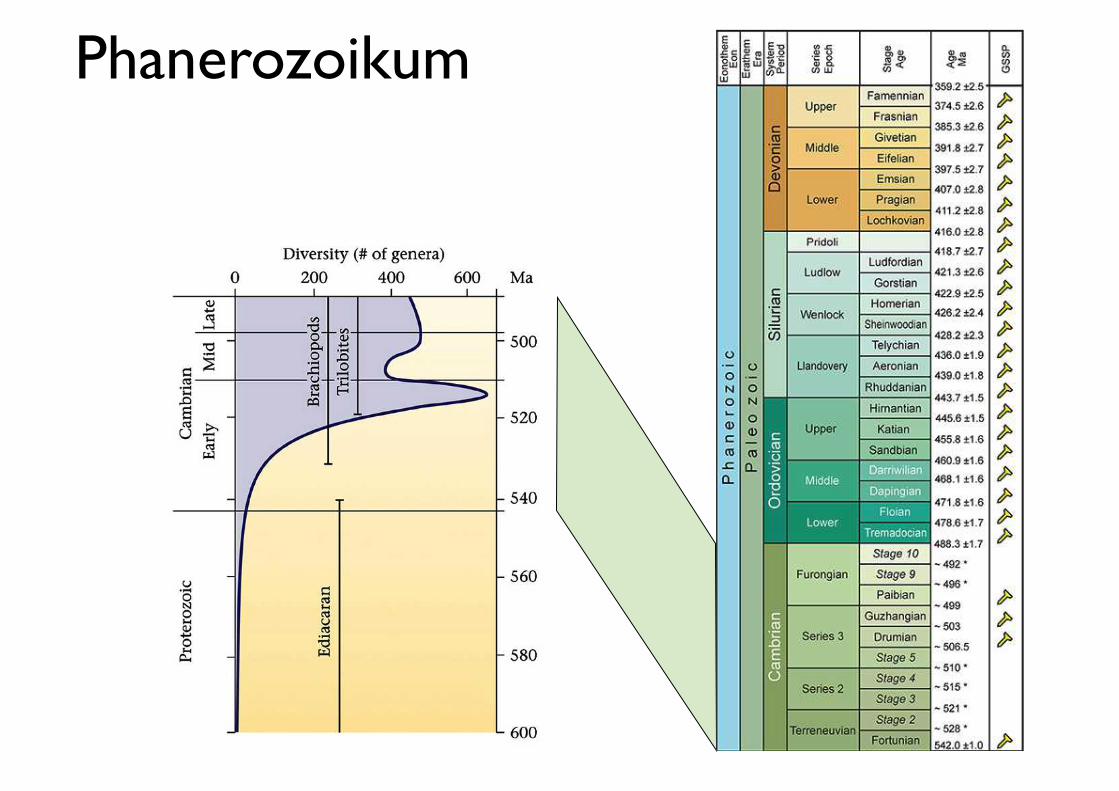
Phanerozoikum
PeriodeÄon Ära
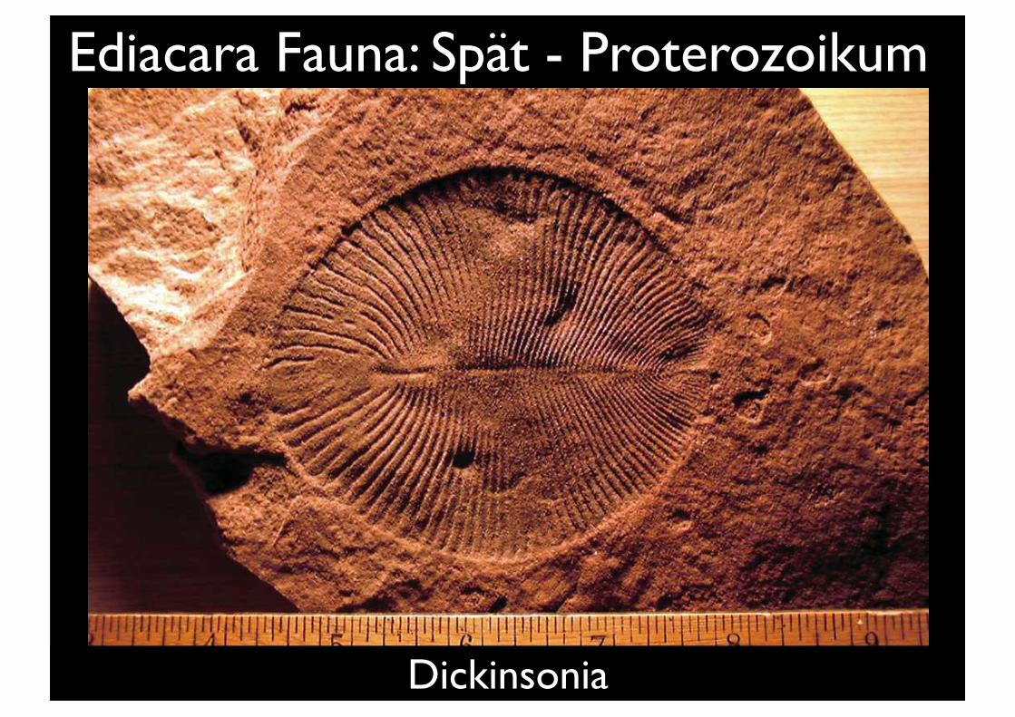
Ediacara Fauna: Spät - Proterozoikum
Dickinsonia
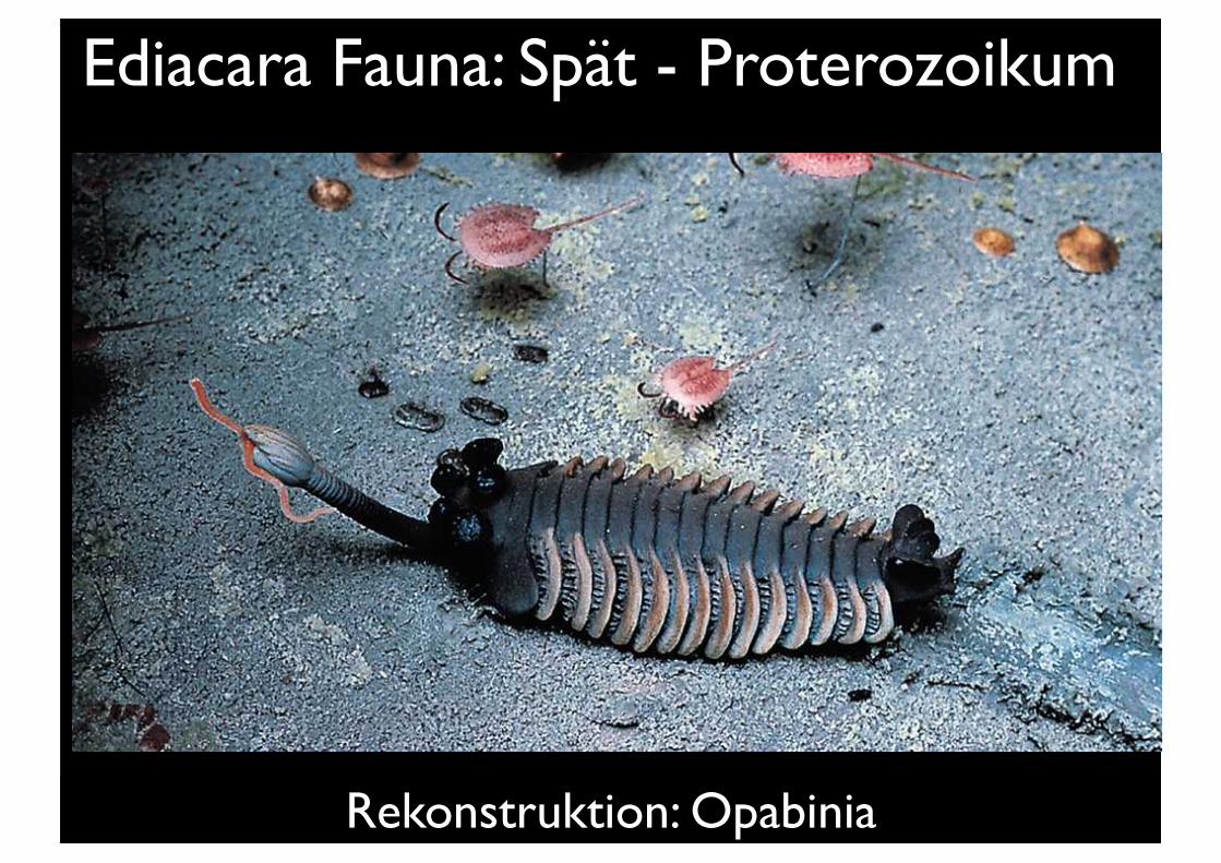
Ediacara Fauna: Spät - Proterozoikum
Rekonstruktion: Opabinia
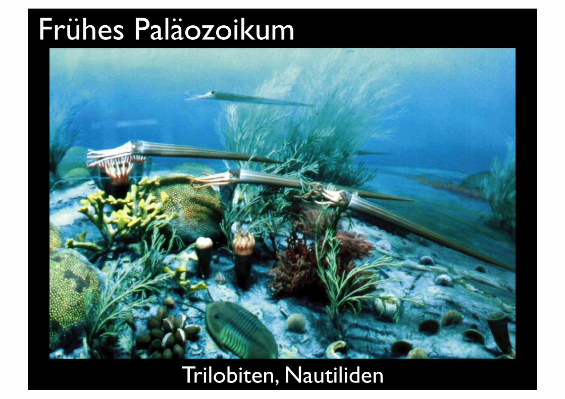
Frühes Paläozoikum
Trilobiten, Nautiliden
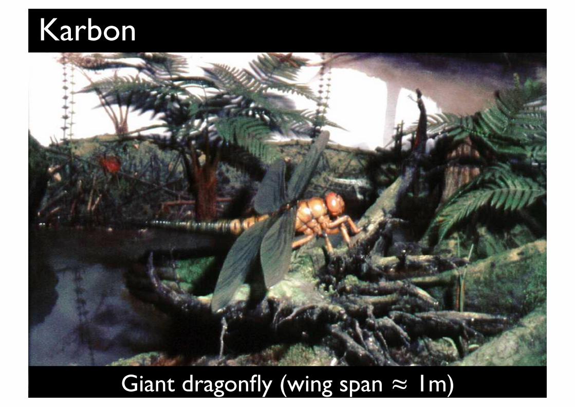
Karbon
Giant dragonfly (wing span ≈ 1m)
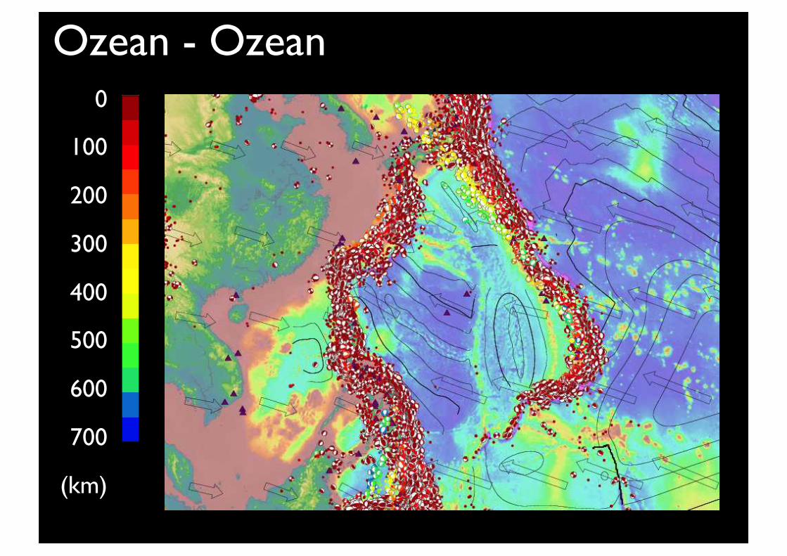
Ozean - Ozean0
100
200
300
400
500
600
700
(km)
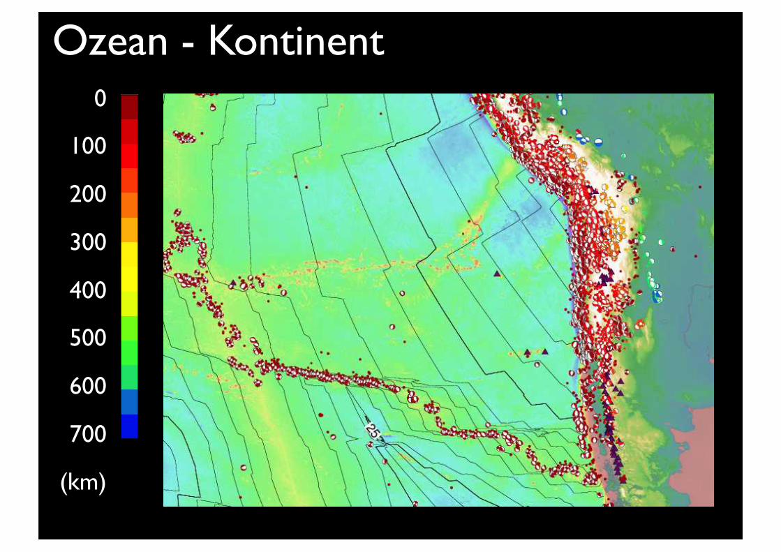
Ozean - Kontinent0
100
200
300
400
500
600
700
(km)
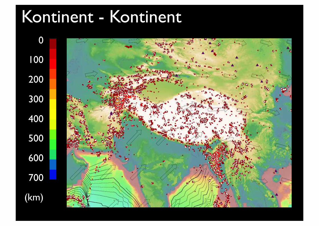
Kontinent - Kontinent0
100
200
300
400
500
600
700
(km)
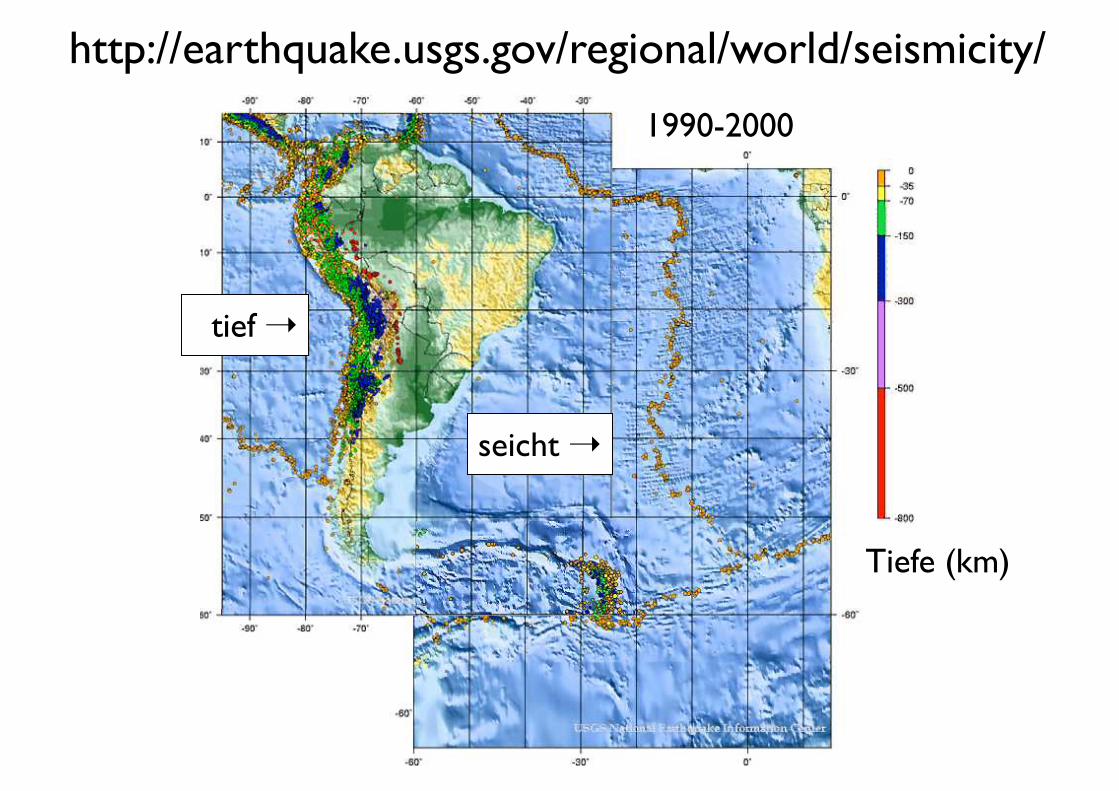
http://earthquake.usgs.gov/regional/world/seismicity/
1990-2000
Tiefe (km)
tief !
seicht !
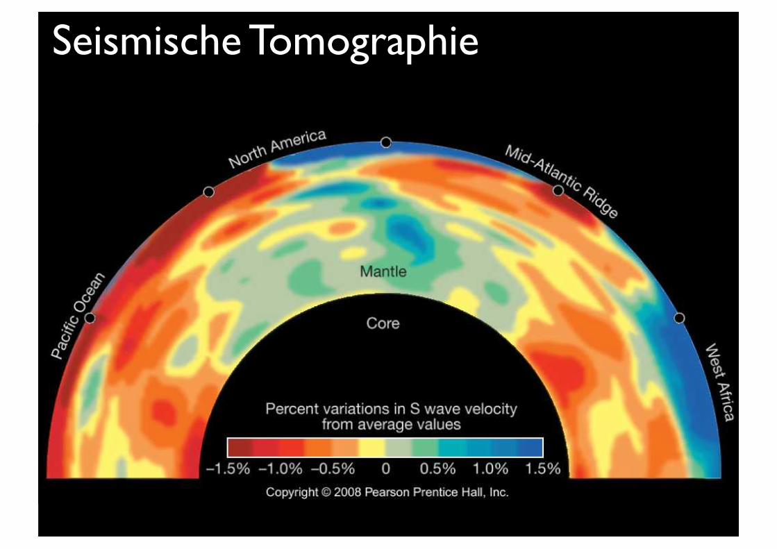
Seismische Tomographie
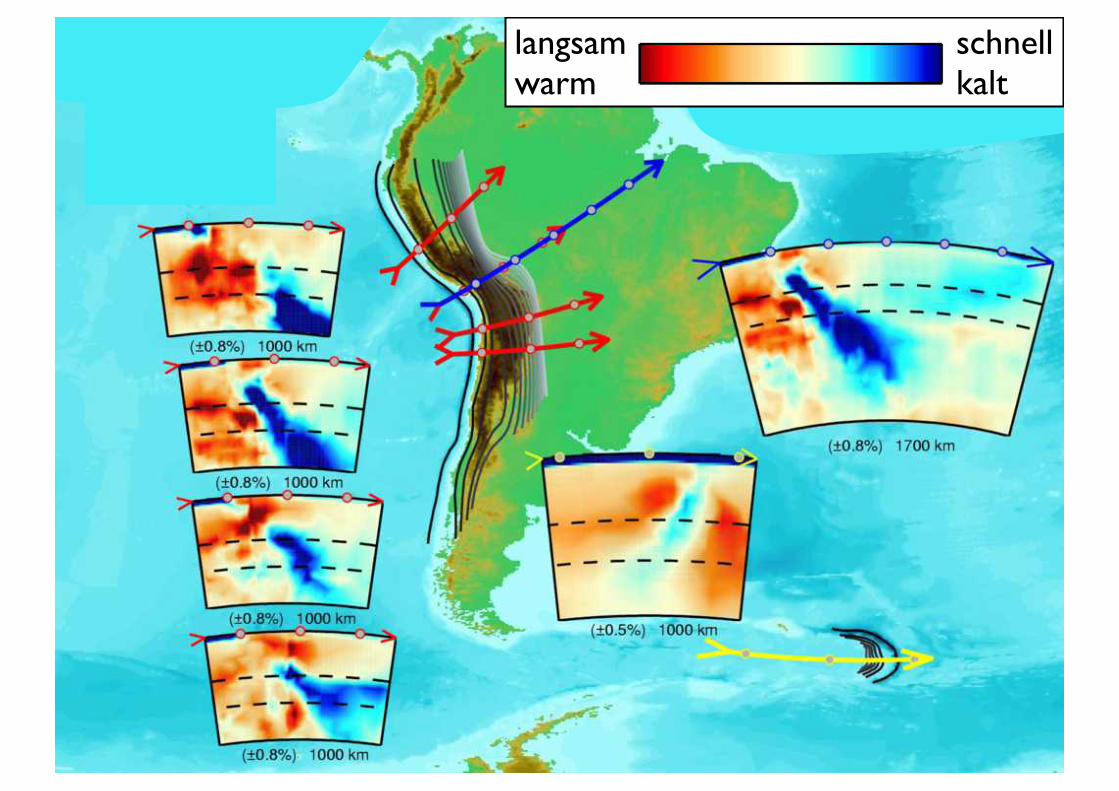
langsamwarm
schnellkalt
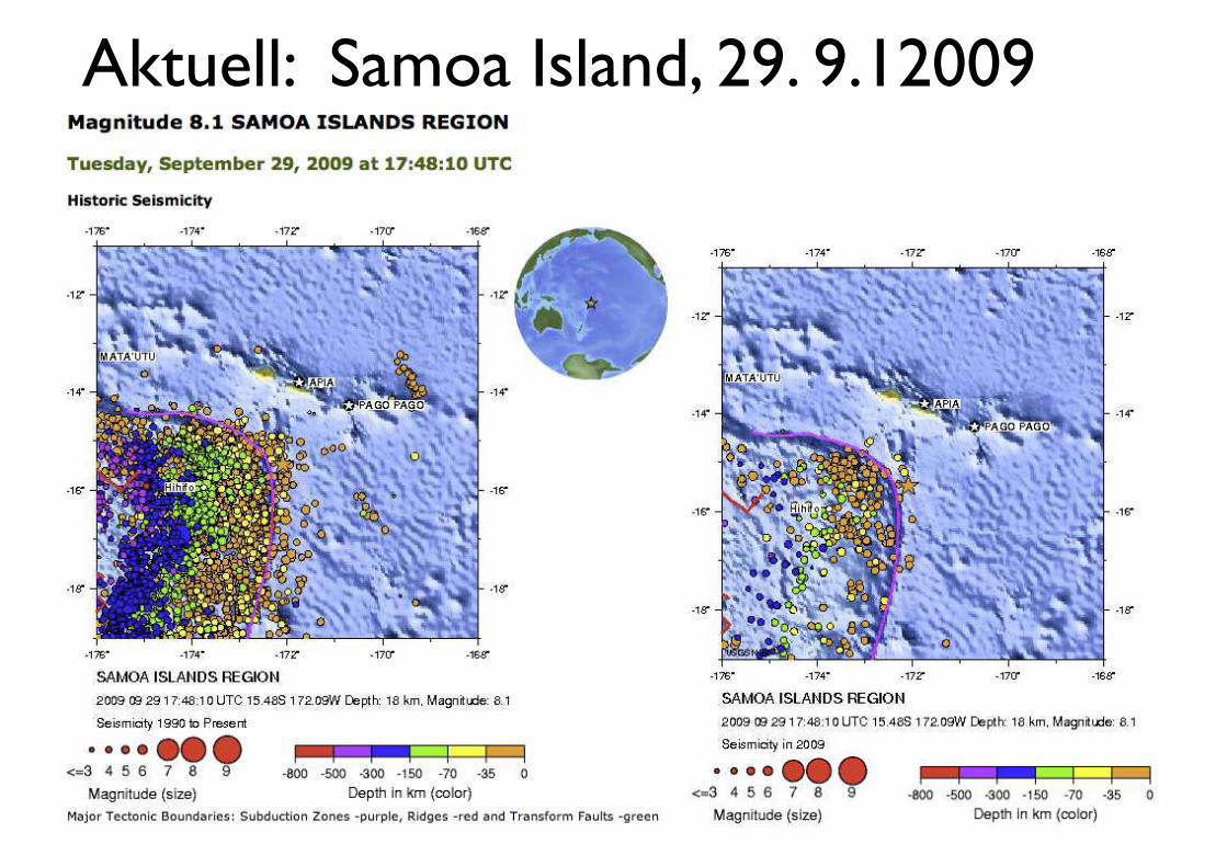
Aktuell: Samoa Island, 29. 9.12009
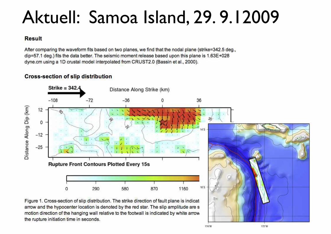
Aktuell: Samoa Island, 29. 9.12009
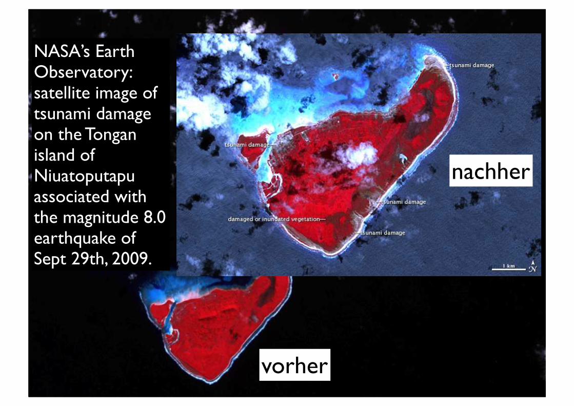
NASA’s Earth Observatory: satellite image of tsunami damage on the Tongan island of Niuatoputapu associated with the magnitude 8.0 earthquake of Sept 29th, 2009.
vorher
nachher
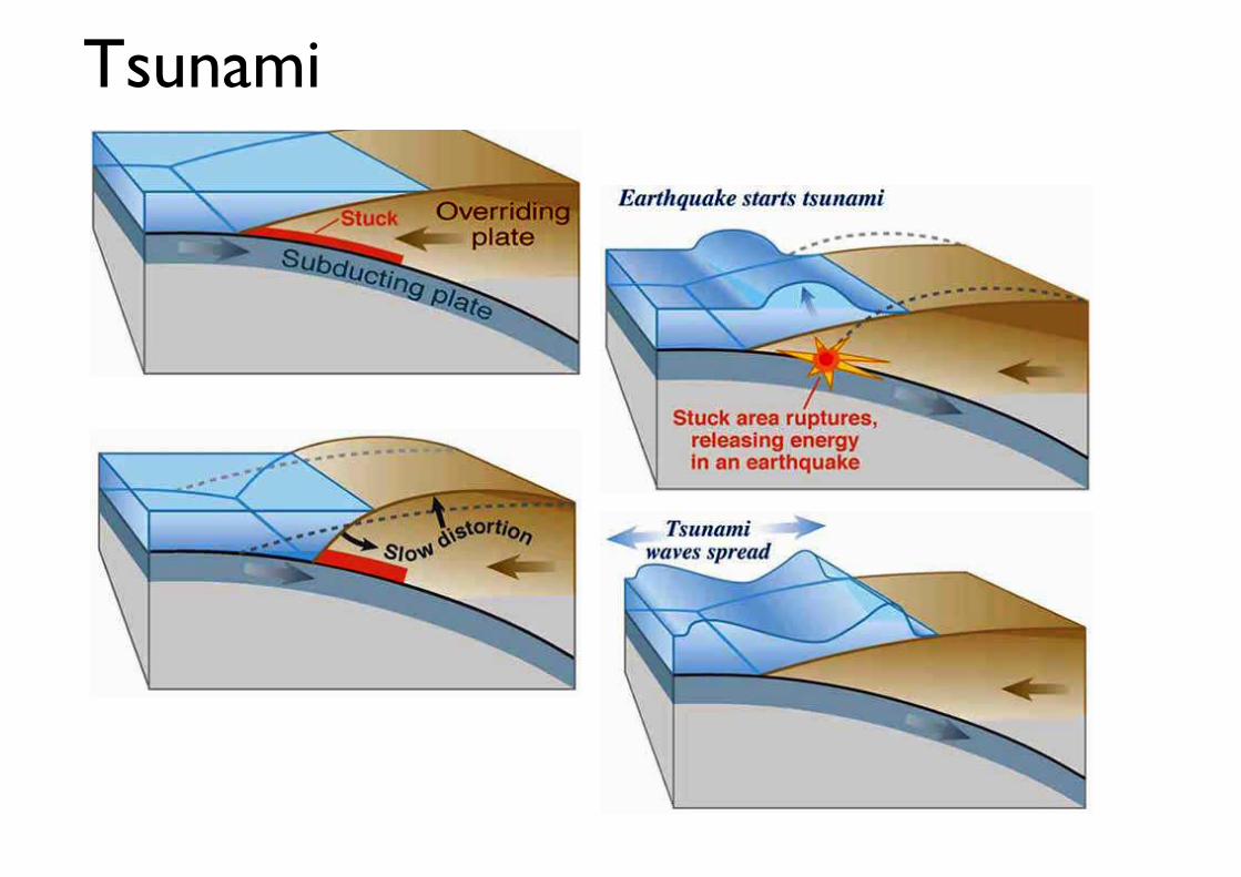
Tsunami
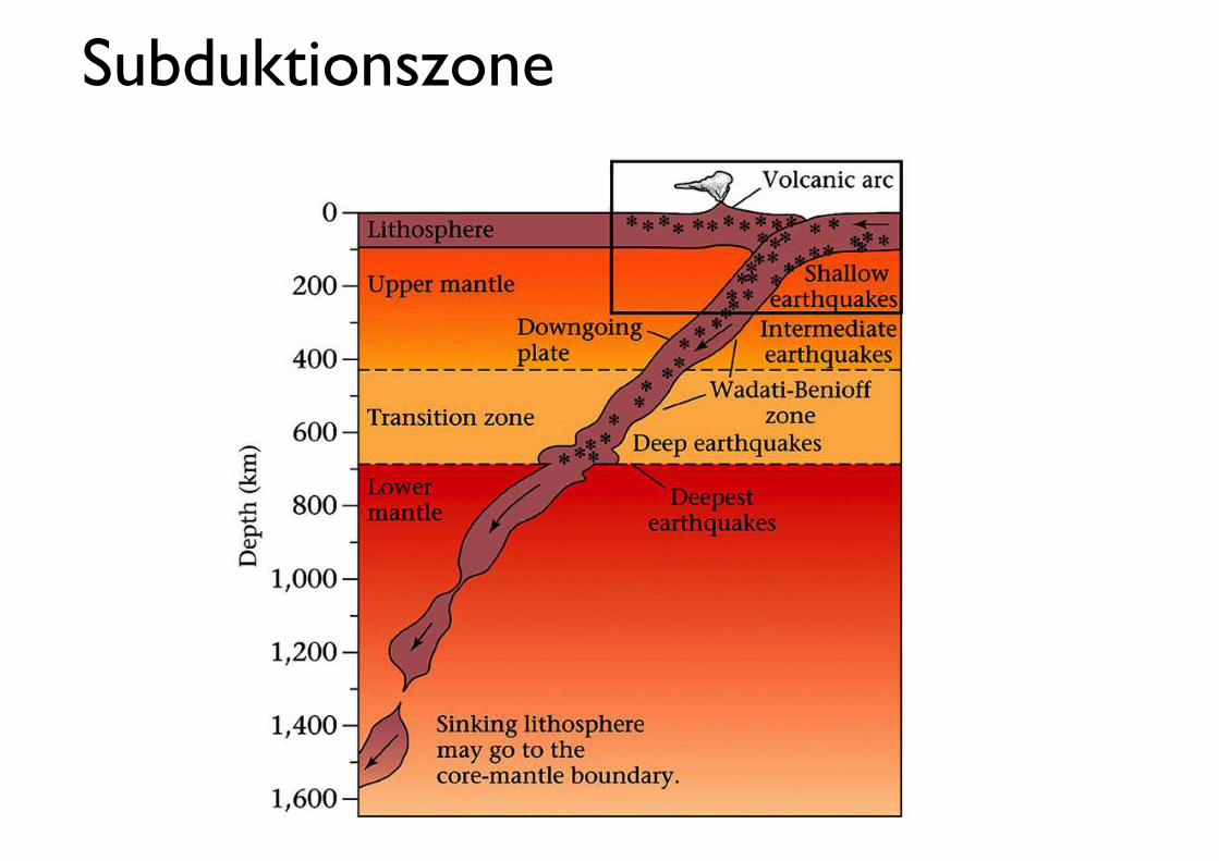
Subduktionszone
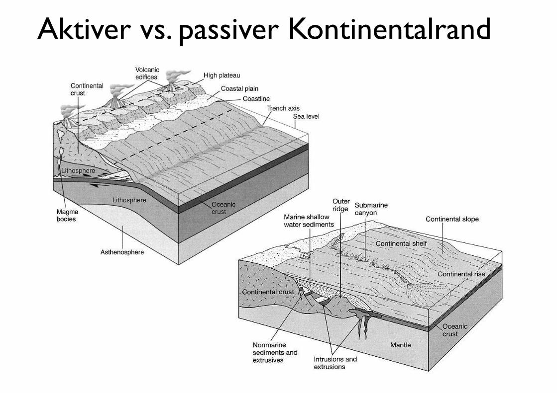
Aktiver vs. passiver Kontinentalrand
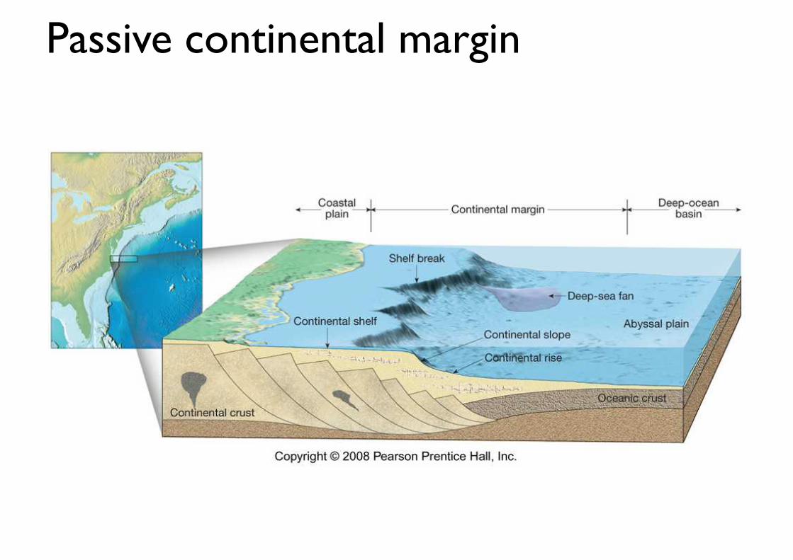
Passive continental margin
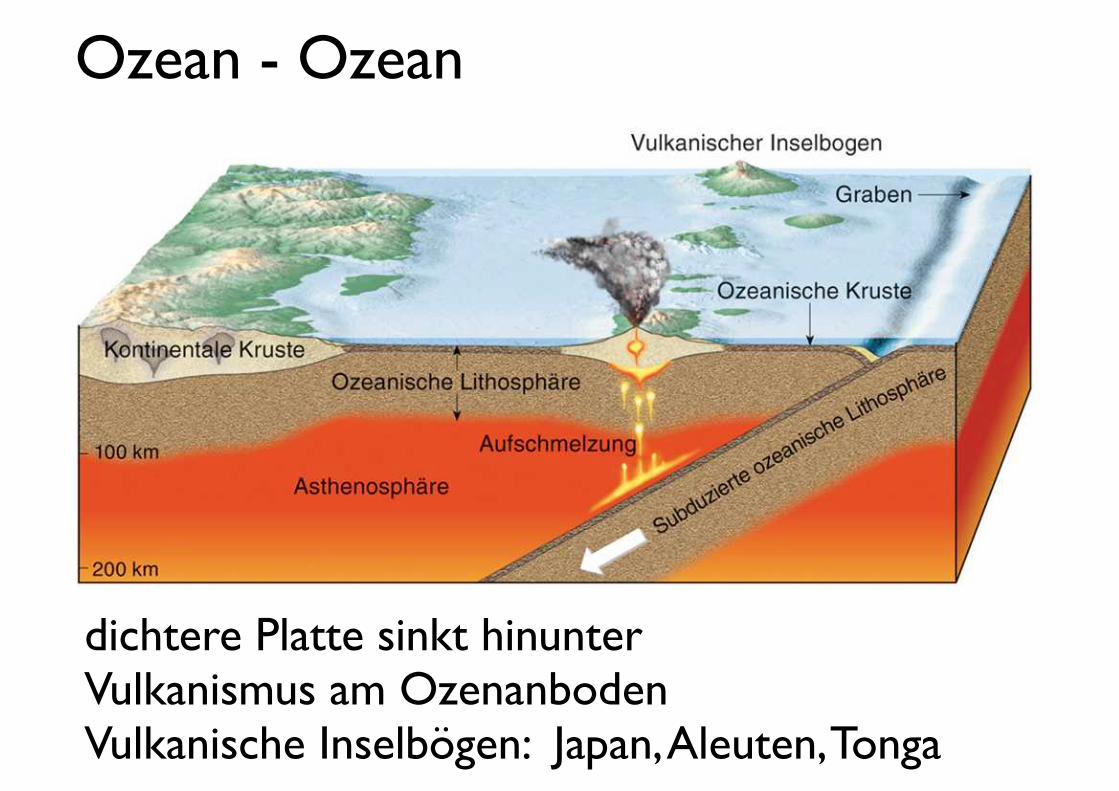
Ozean - Ozean
dichtere Platte sinkt hinunterVulkanismus am OzenanbodenVulkanische Inselbögen: Japan, Aleuten, Tonga
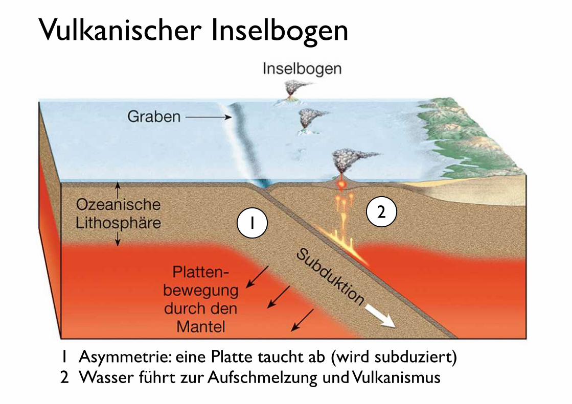
Vulkanischer Inselbogen
1! Asymmetrie: eine Platte taucht ab (wird subduziert)2!Wasser führt zur Aufschmelzung und Vulkanismus
12

Vulkanischer Inselbogen
1! Subduzierte Platte sinkt ab: roll-back2! Leichtes (heisses) Magma steigt auf, Kruste dehnt sich
12
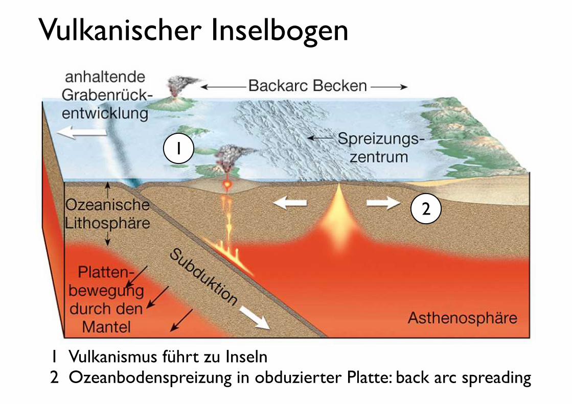
Vulkanischer Inselbogen
1! Vulkanismus führt zu Inseln2! Ozeanbodenspreizung in obduzierter Platte: back arc spreading
1
2

Beispiel: Aleutian
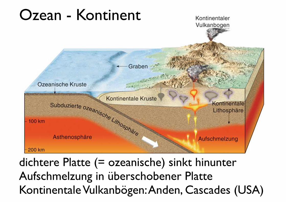
Ozean - Kontinent
dichtere Platte (= ozeanische) sinkt hinunterAufschmelzung in überschobener Platte Kontinentale Vulkanbögen: Anden, Cascades (USA)
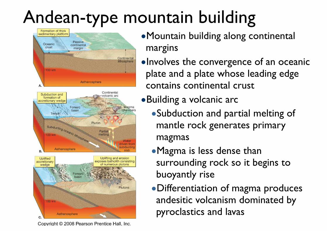
Andean-type mountain building•Mountain building along continental margins •Involves the convergence of an oceanic plate and a plate whose leading edge contains continental crust •Building a volcanic arc •Subduction and partial melting of mantle rock generates primary magmas •Magma is less dense than surrounding rock so it begins to buoyantly rise •Differentiation of magma produces andesitic volcanism dominated by pyroclastics and lavas
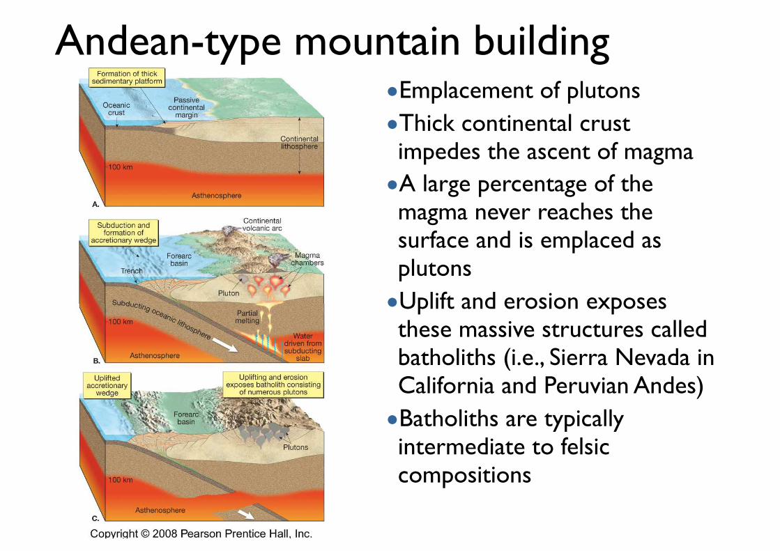
Andean-type mountain building•Emplacement of plutons •Thick continental crust impedes the ascent of magma •A large percentage of the magma never reaches the surface and is emplaced as plutons •Uplift and erosion exposes these massive structures called batholiths (i.e., Sierra Nevada in California and Peruvian Andes) •Batholiths are typically intermediate to felsic compositions
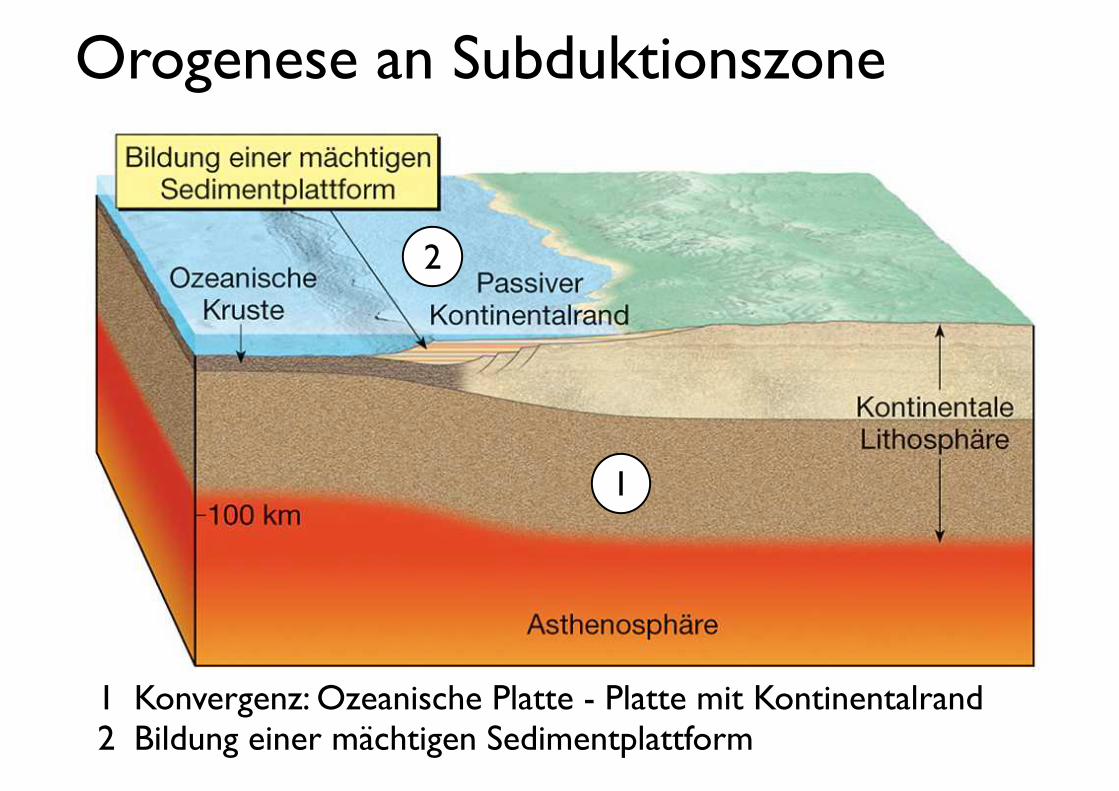
Orogenese an Subduktionszone
1! Konvergenz: Ozeanische Platte - Platte mit Kontinentalrand2! Bildung einer mächtigen Sedimentplattform
1
2
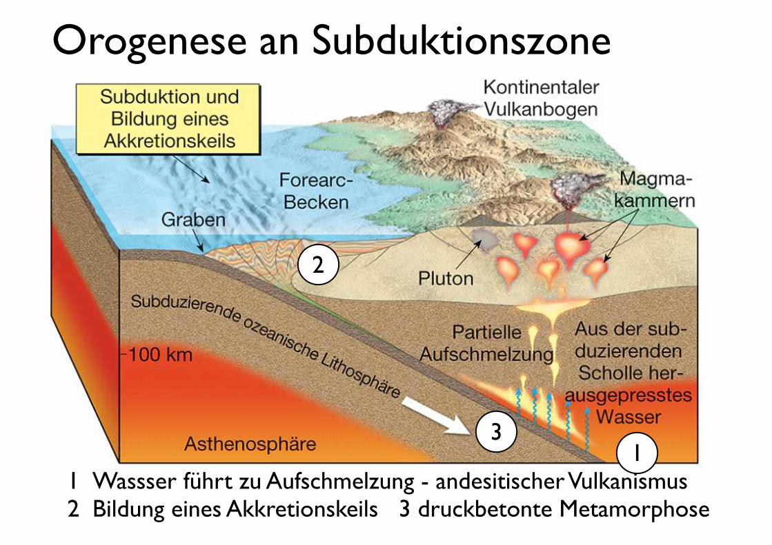
Orogenese an Subduktionszone
1!Wassser führt zu Aufschmelzung - andesitischer Vulkanismus2! Bildung eines Akkretionskeils 3 druckbetonte Metamorphose
1
2
3
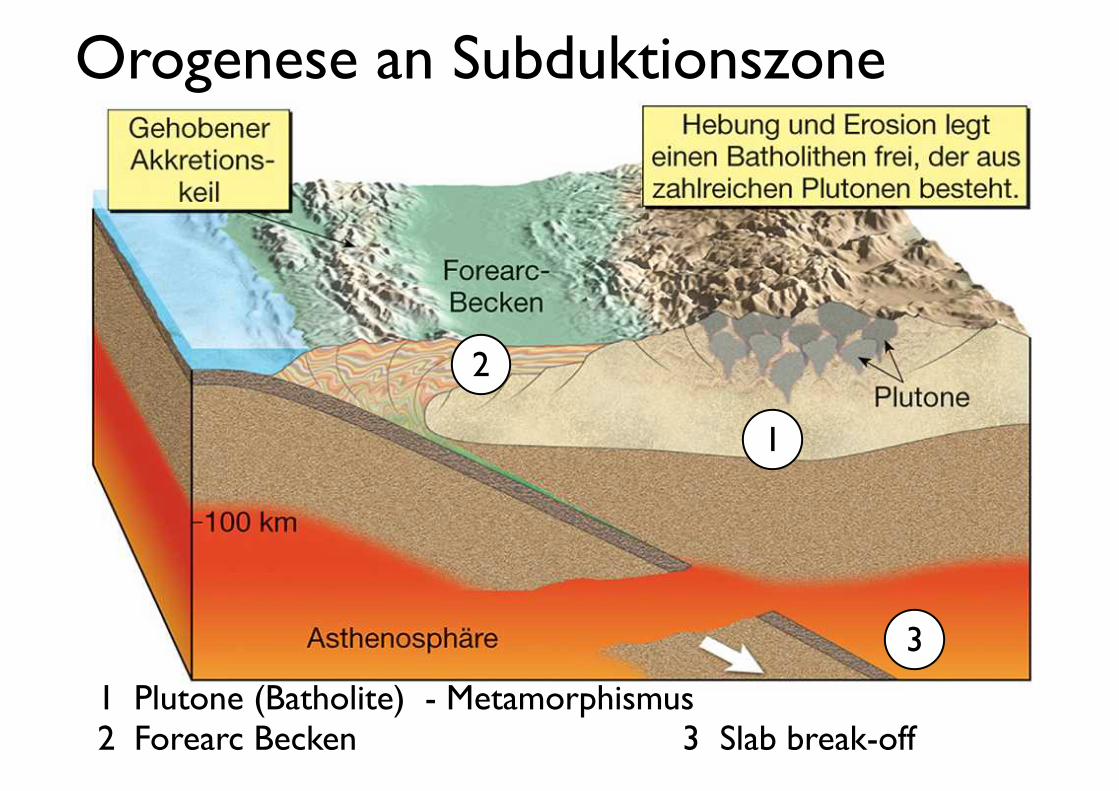
Orogenese an Subduktionszone
1! Plutone (Batholite) - Metamorphismus2! Forearc Becken 3 Slab break-off
1
2
3
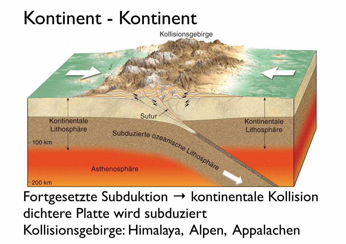
Kontinent - Kontinent
Fortgesetzte Subduktion → kontinentale Kollisiondichtere Platte wird subduziert Kollisionsgebirge: Himalaya, Alpen, Appalachen
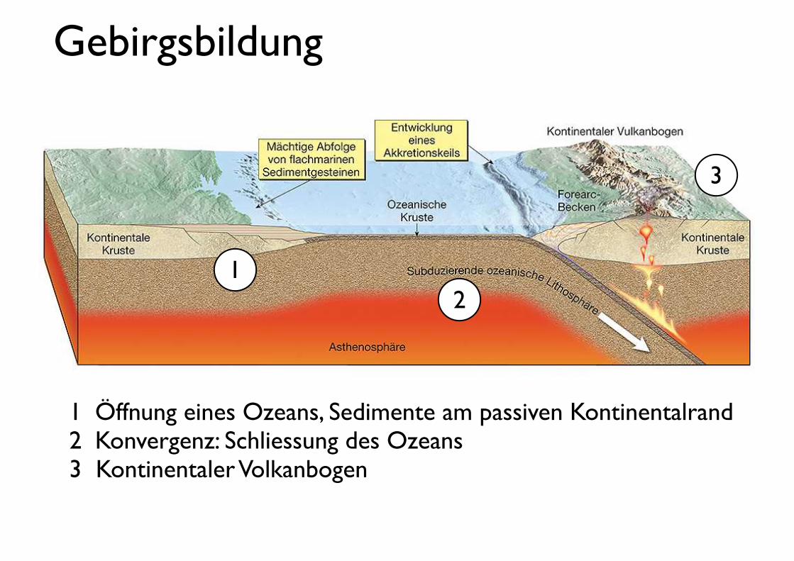
Gebirgsbildung
2
1! Öffnung eines Ozeans, Sedimente am passiven Kontinentalrand2! Konvergenz: Schliessung des Ozeans 3 Kontinentaler Volkanbogen
1
3
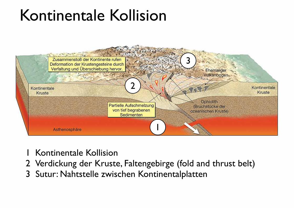
Kontinentale Kollision
2
1! Kontinentale Kollision2! Verdickung der Kruste, Faltengebirge (fold and thrust belt)3 Sutur: Nahtstelle zwischen Kontinentalplatten
1
3
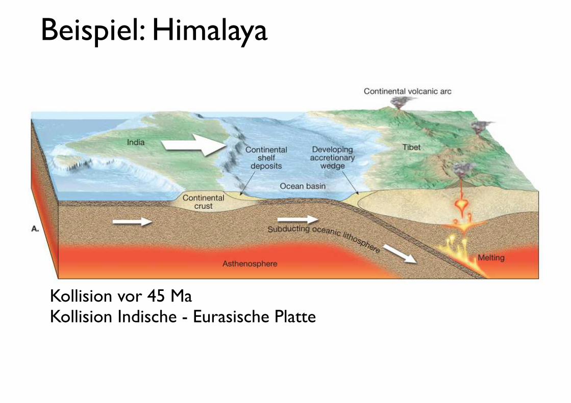
Beispiel: Himalaya
Kollision vor 45 MaKollision Indische - Eurasische Platte
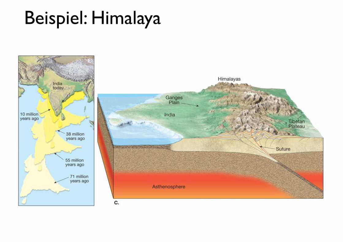
Beispiel: Himalaya
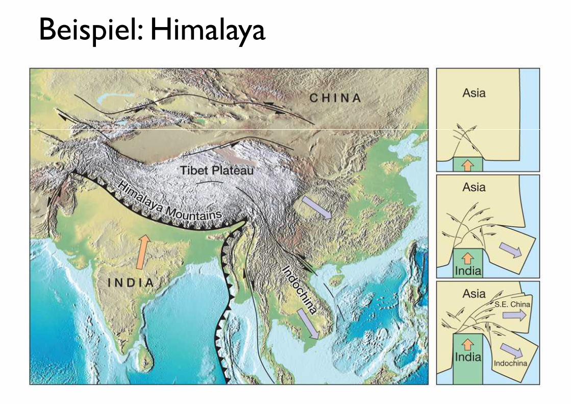
Beispiel: Himalaya

Beispiel: Appalachen
600 Ma
450 - 500 Ma
400 Ma
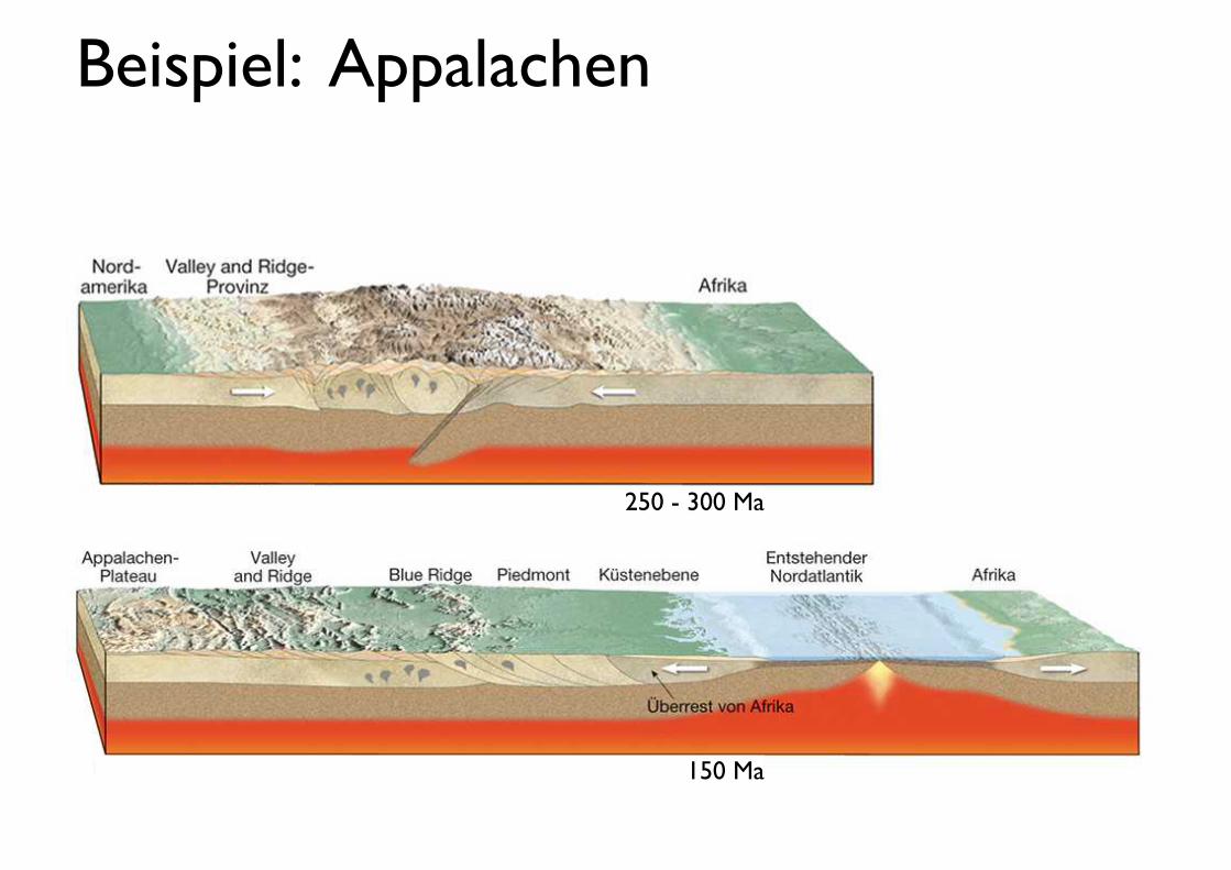
Beispiel: Appalachen
250 - 300 Ma
150 Ma
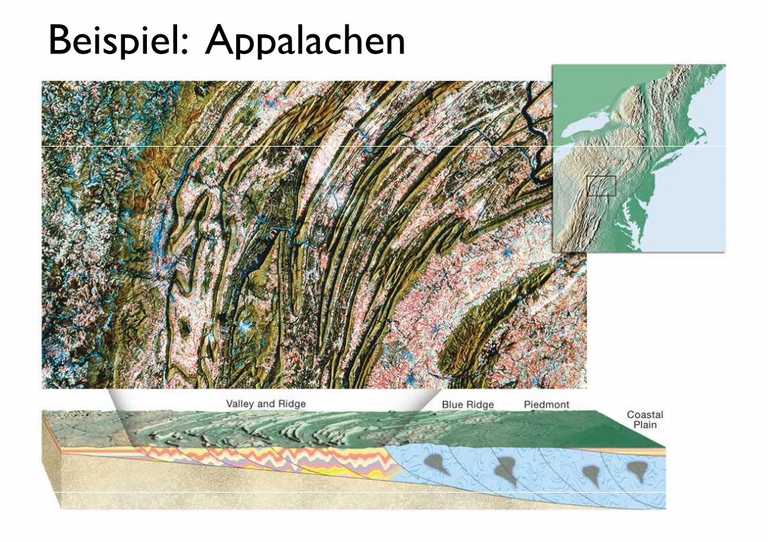
Beispiel: Appalachen
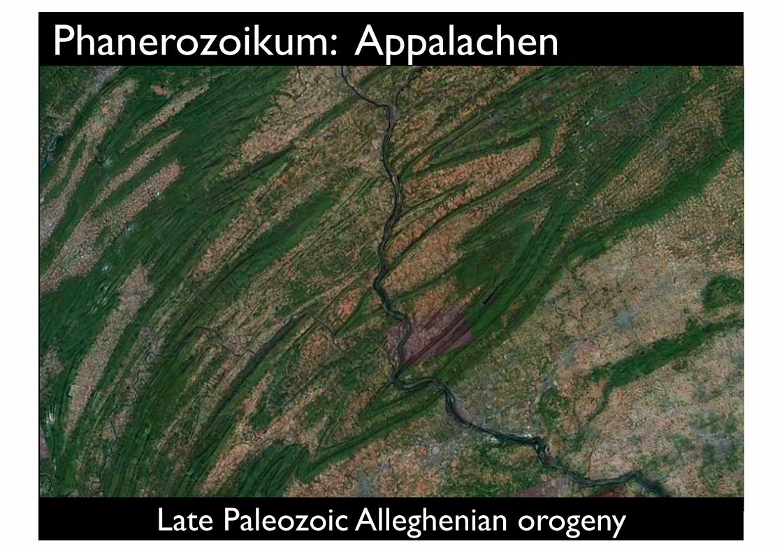
Phanerozoikum: Appalachen
Pennsylvania
Late Paleozoic Alleghenian orogeny
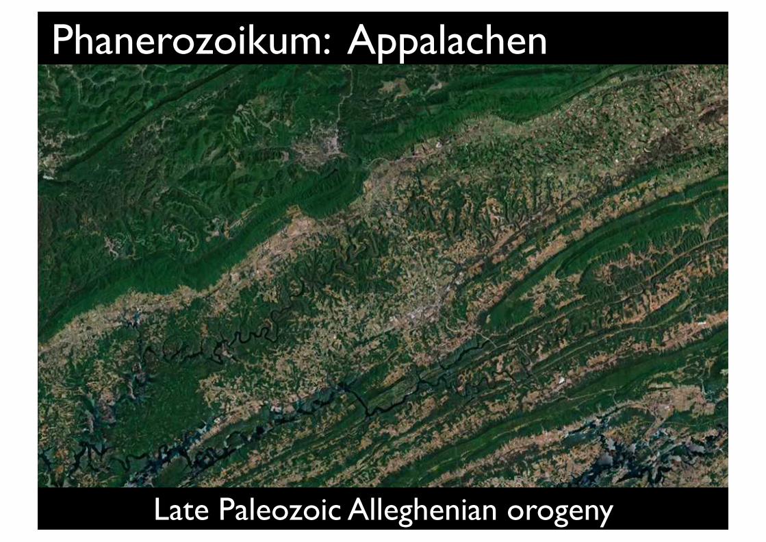
Tennessee
Phanerozoikum: Appalachen
Late Paleozoic Alleghenian orogeny
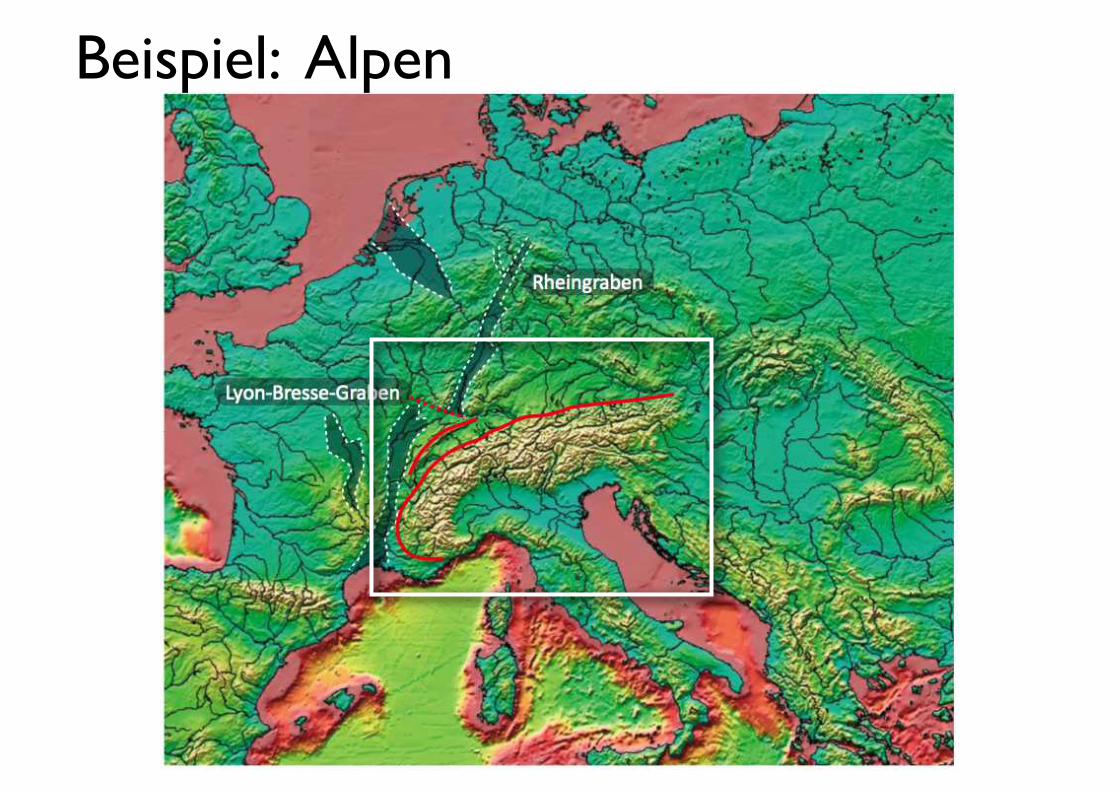
Beispiel: Alpen

Phase 1: Neuer Raum wird geschaffen ("Rifting Phase")
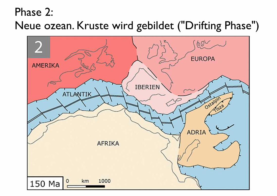
Phase 2: Neue ozean. Kruste wird gebildet ("Drifting Phase")
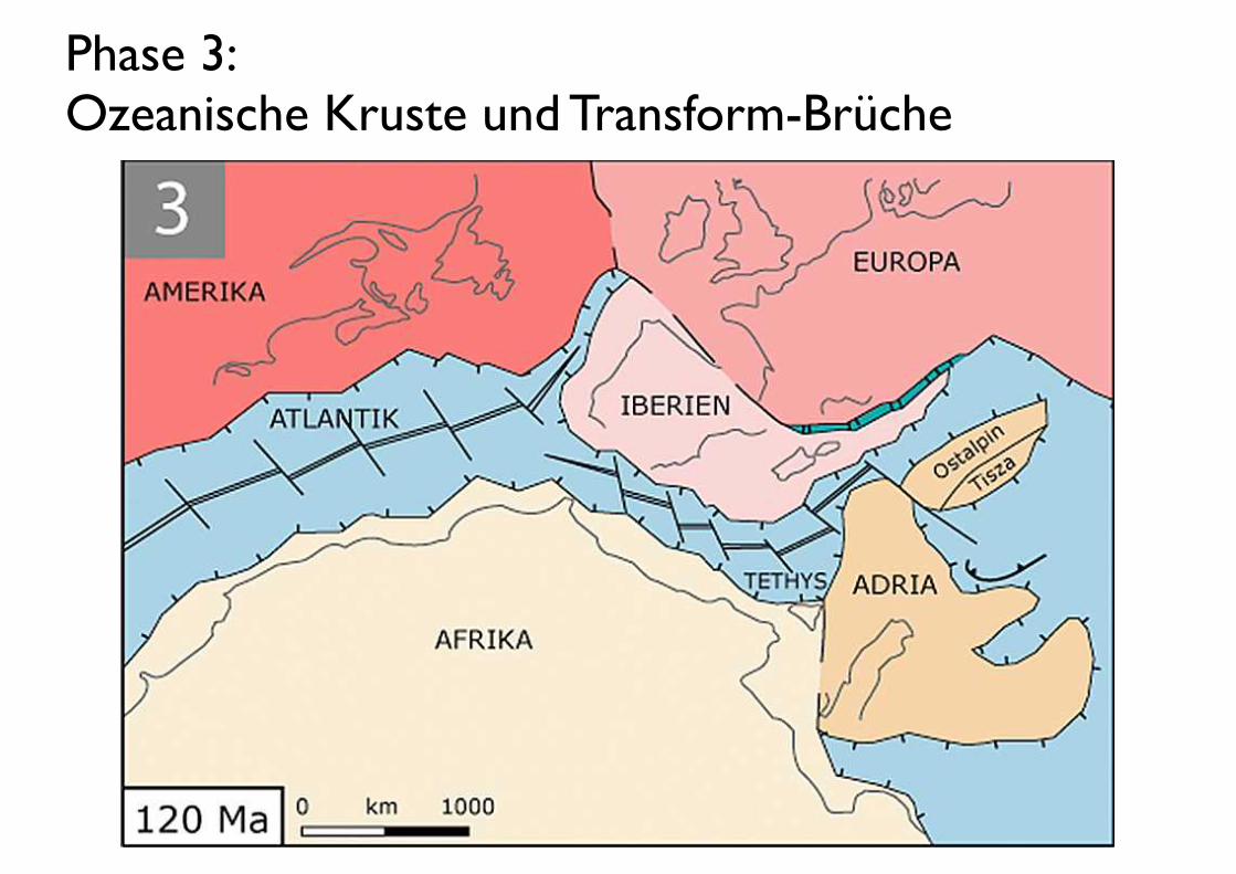
Phase 3: Ozeanische Kruste und Transform-Brüche
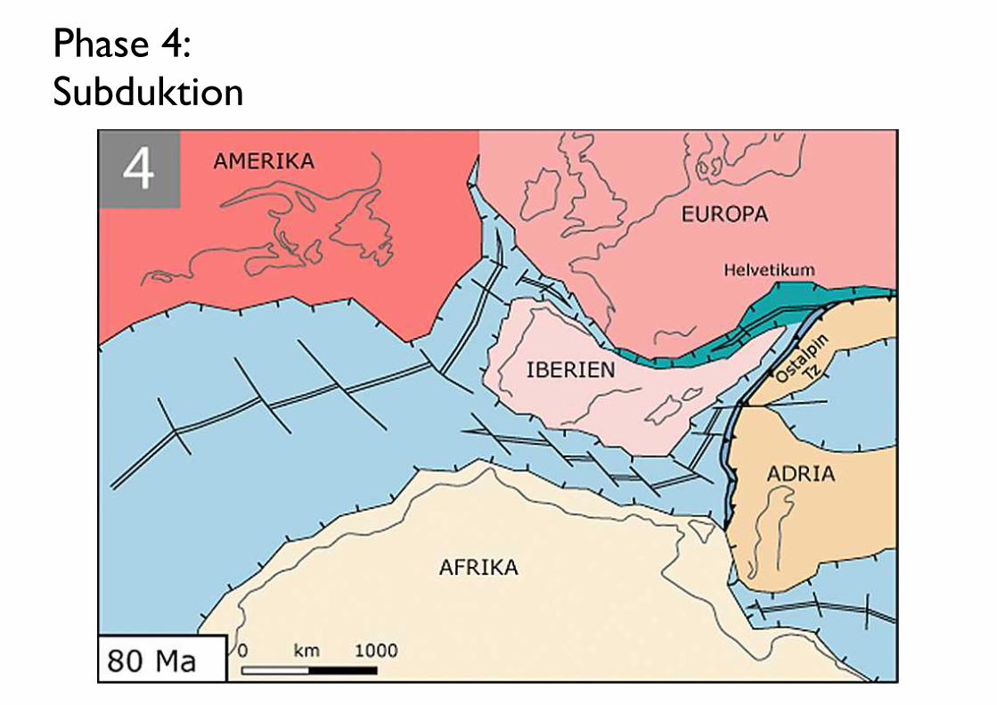
Phase 4: Subduktion
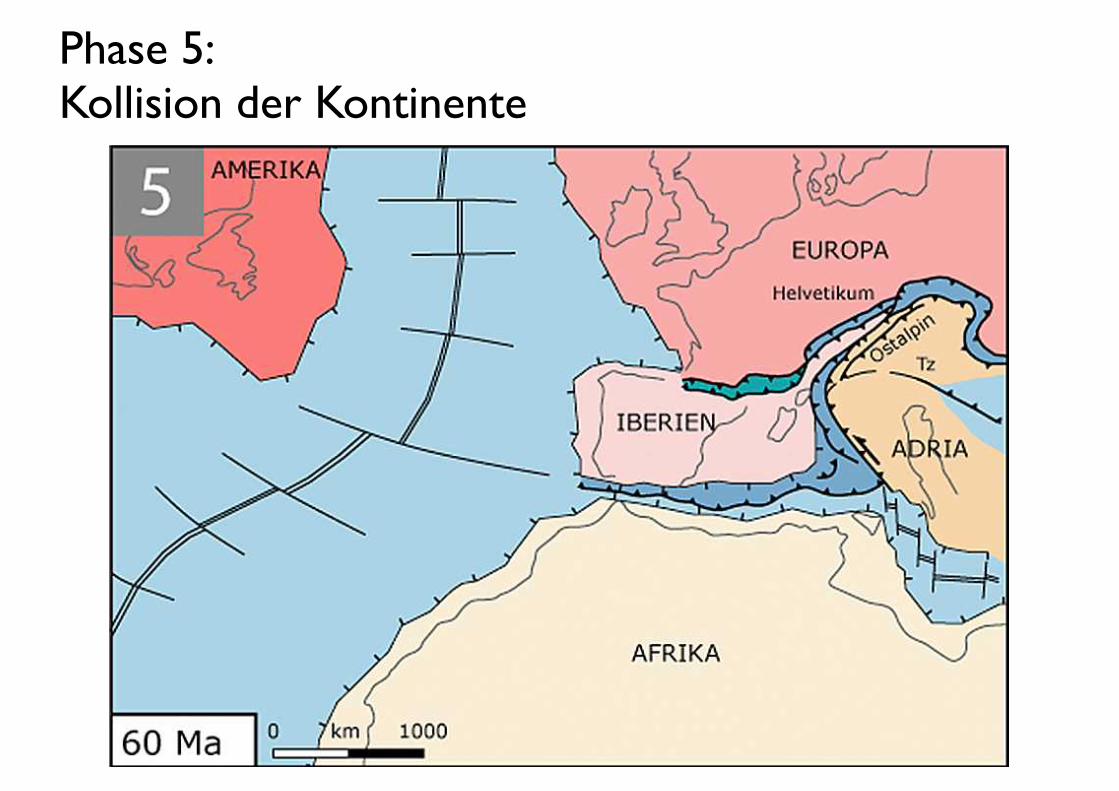
Phase 5: Kollision der Kontinente
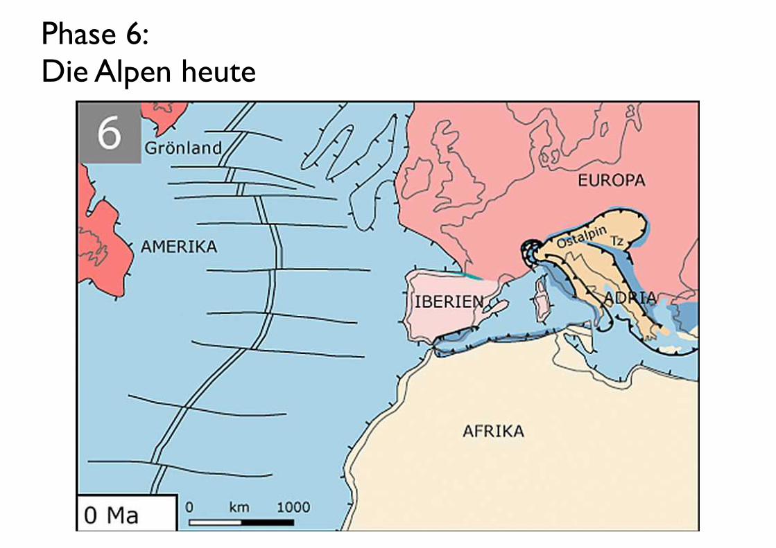
Phase 6: Die Alpen heute
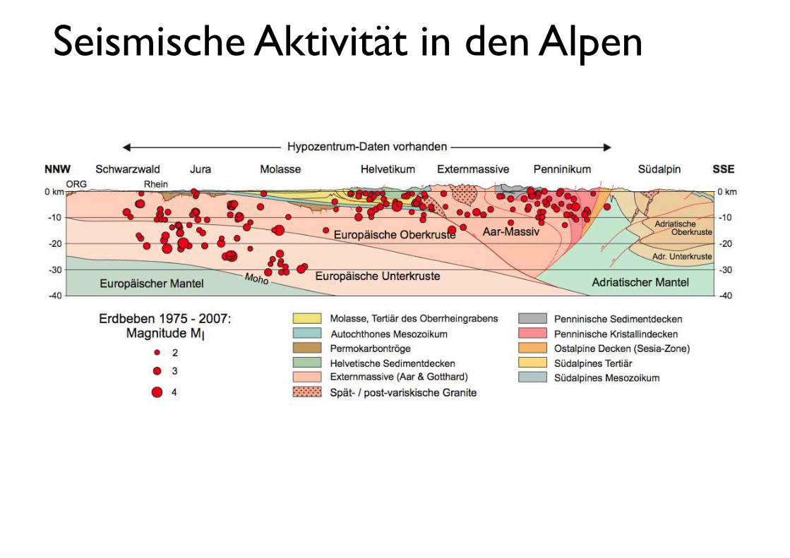
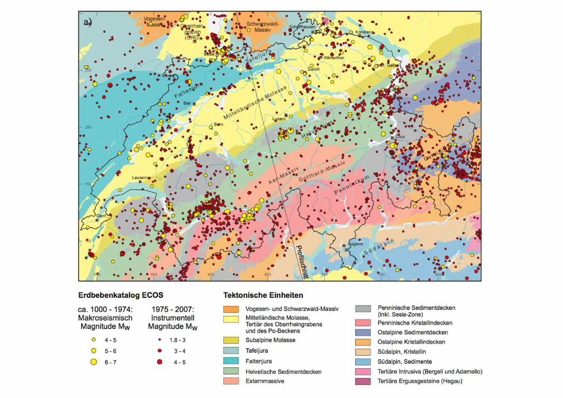
Seismische Aktivität in den Alpen
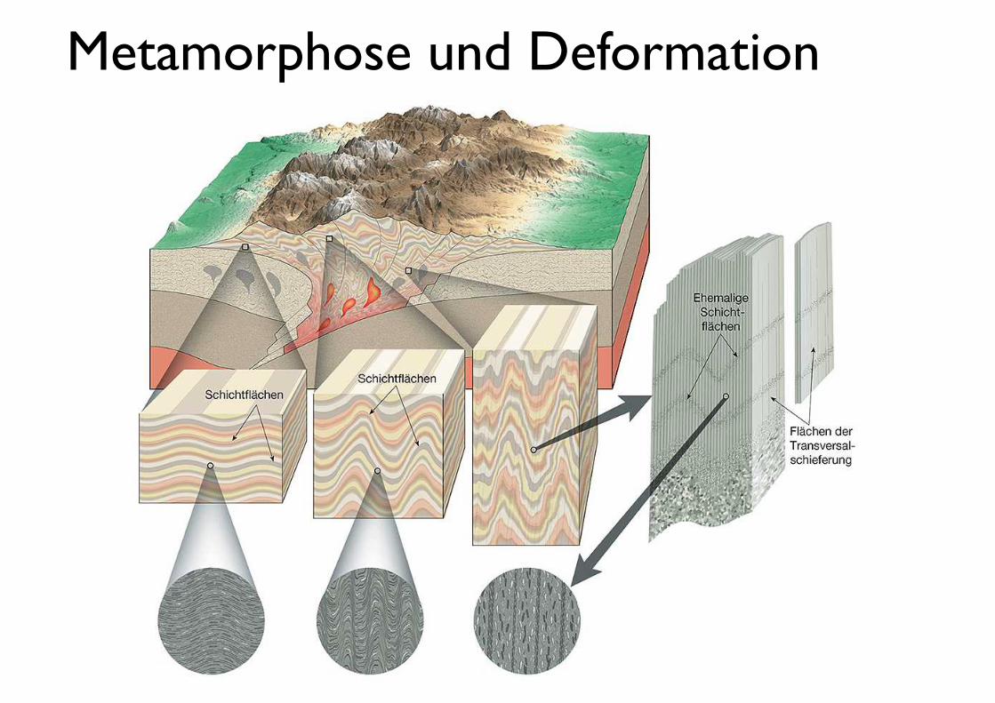
Metamorphose und Deformation
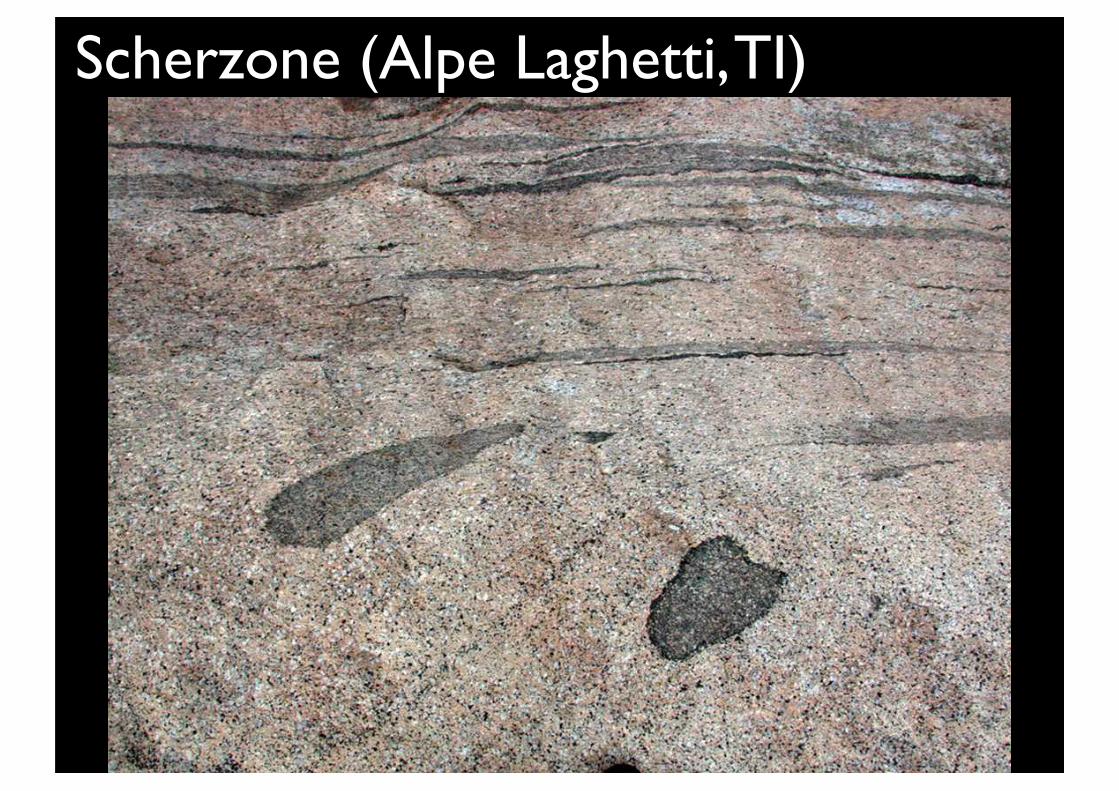
Scherzone (Alpe Laghetti, TI)
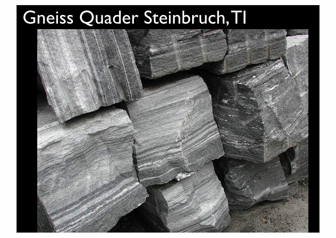
Gneiss Quader Steinbruch, TI
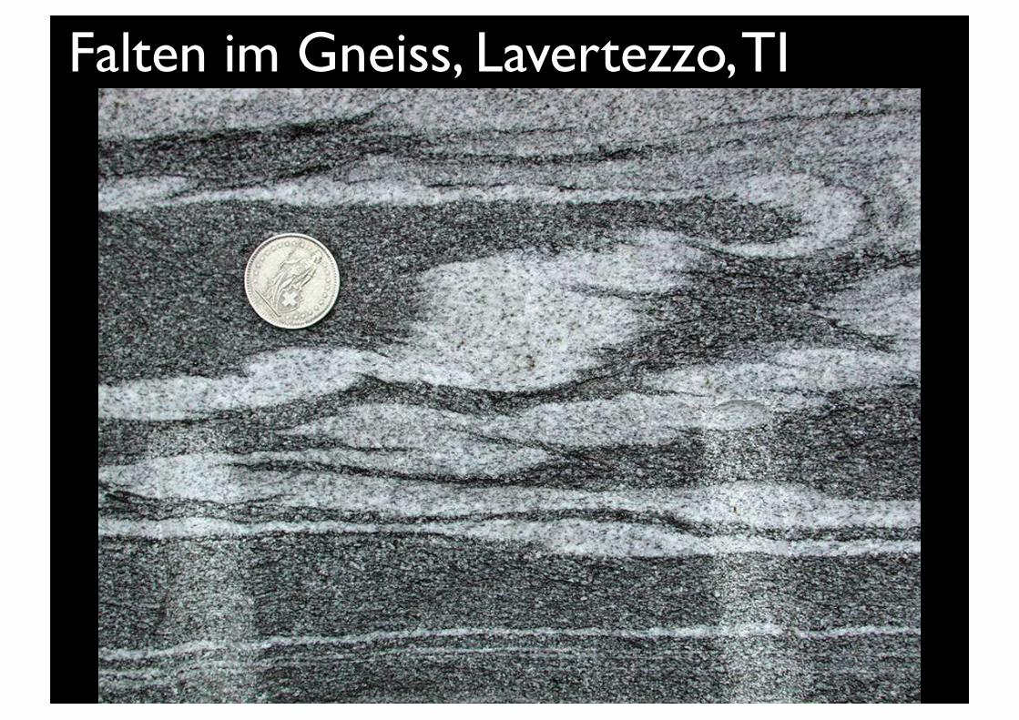
Falten im Gneiss, Lavertezzo, TI
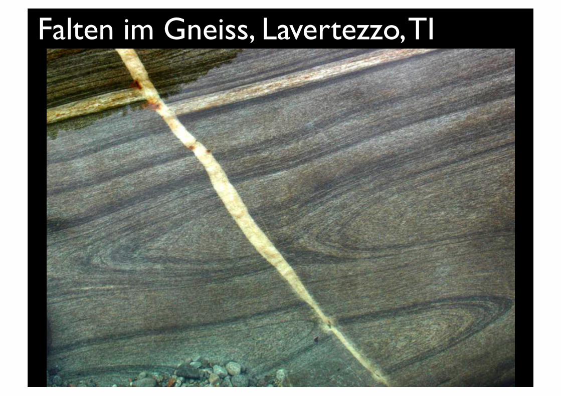
Falten im Gneiss, Lavertezzo, TI
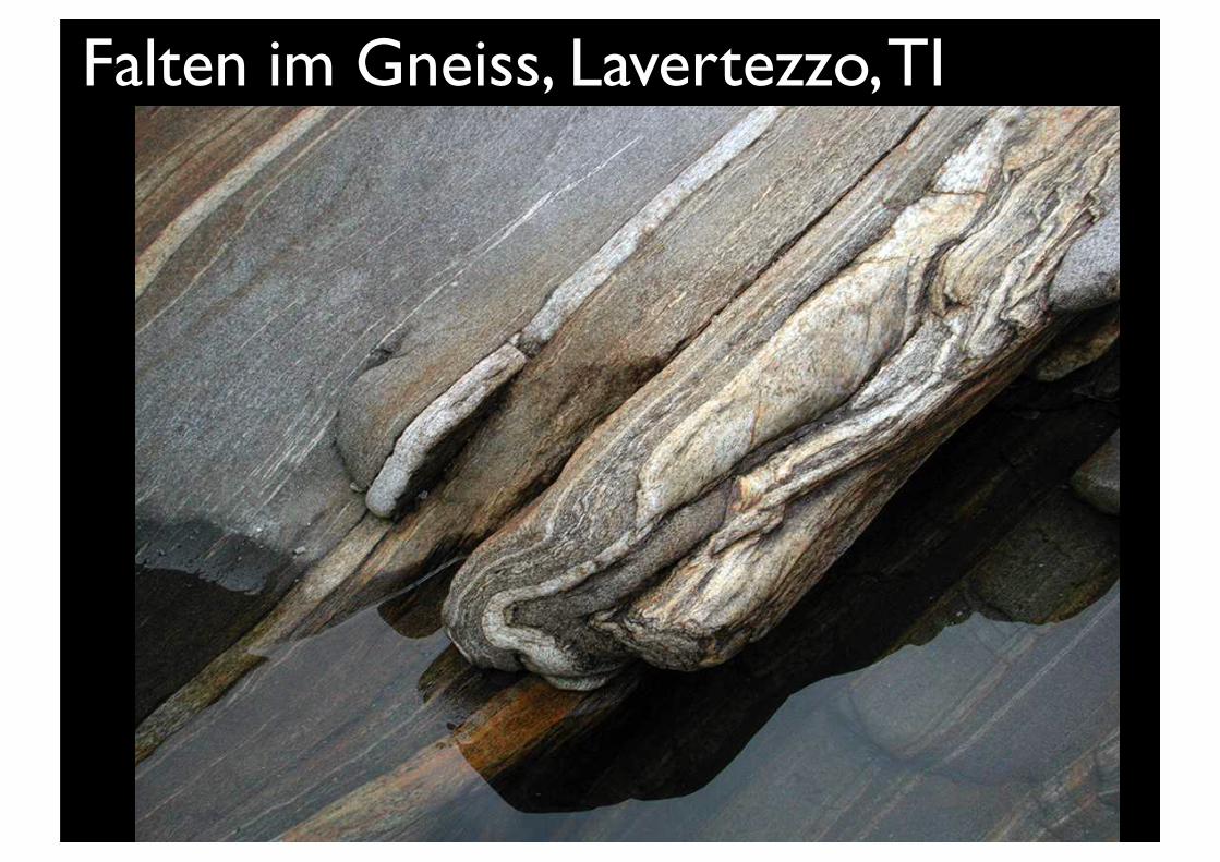
Falten im Gneiss, Lavertezzo, TI